

During my trip to Europe (Czech republic and Germany) in May 2022, I biked about 240 Km from Prague to Dresden. I’ll describe that experience in this post
First the key takeaways:
- I absolutely loved the experience and highly recommend it to anyone. This is sure to be the first of many such trips in the future
- Biking 50-60 km (~35 miles) a day may sound like a lot, but it is within easy reach of anyone of moderate or above physical fitness and some biking experience
- Use a bike tour company to take care of the logistics. That way, you can travel light and won’t need to bring anything special (except for personal use items such as biking shorts, jacket and gloves if you need them). The bike tour company takes care of providing a well-equipped bike, biking gear, maps, making hotel reservations and most importantly, luggage transfer.
- Make sure you are provided with a phone mount and digital maps that you can use on your phone (read below for details). Pedal toe clips are good to have as well, though not required. Also ask if the recommended activities/sights for each day are marked on the digital maps.
- If you are biking solo, you are free to bike at your own pace, stop at restaurants, as you please, do day hikes..
- You can also ride with a group – your own friends or other people. Read below for more info.
- Biking long distances can get a bit arduous when it is hot and the sun is out in full force, so ideal time to do multi-city bike trips is spring, early summer and fall.
- Cities visited: Prague, Melnik, Litomerice, Decin, Bad Schandau and Dresden. Sights to see: Radobýl hill, Strekov castle, Shepherd’s wall Lookout Tower, Terezin, Pravčická brána, Konigstein, Bastei bridge, Pillnitz castle.
The details..
I love biking and bike 17-20 miles along the Capital Crescent trail from Georgetown to Bethesda and back or the Mount Vernon trail from Rosslyn to Alexandria and back nearly every evening after work. For me, biking is a great way to end the work day and reset the mind, specially in the post-covid new normal of regular working from home. During the weekends, I do longer bike rides– ~ 40 miles to mount Vernon and back, averaging ~15 miles/hr. The idea of biking in Europe was first planted in my mind when I went to Budapest in 2018 and met an American girl who had biked from Paris to Budapest, a distance of ~1560 Km over 30 days. At first, biking such a long distance seems crazy, but you are only averaging 50 Km/Day, which is actually easily doable for anyone in moderate or better physical condition. An ex-gf last year had also done a few bike trips in France and Italy both alone and with family and enjoyed those experiences.
What makes these bike trips possible and popular in Europe, but not so in America are three factors. First, population density in Europe is higher (110/Sq km for the EU) and the population is more evenly distributed across the landmass, compared with America where the population density is lower (36/Sq km) and the population is concentrated along the coasts with a sparsely populated interior. This means that Europe is full of small cities separated by few dozens of kilometres, which is a comfortable intra-day biking distance. Secondly, intercity biking is much more popular in Europe, with a dense network of biking trails throughout the European Union. Finally, there are several companies that facilitate the logistics of multi-day biking trips by booking hotels along the way, taking care of luggage transfers and providing well-annotated maps with detailed directions and sightseeing ideas.
On this trip, I was planning on spending three weeks in Europe, with the first week in Prague. I didn’t have any concrete plans for what to do thereafter. On my third or fourth day, I began to explore the idea of finally realizing my long-held desire to do a multi-city bike trip. Google search for companies that organized such trips revealed several options such as these – 1, 2 and 3. I wrote to all three and picked europe-bike-tours because they were the first to respond to my email. Having picked the tour company, there were several decisions to be made – the destination, difficulty level, whether to ride solo or go with a group and what type of bike to rent.
There are several biking destinations from Prague that take different number of days, depending on distance and difficulty of terrain. For example, Prague to Vienna takes 7 days, Prague to Budapest 14 days, Prague to Dresden 5 days. Some of these can be customized to cover part of the distance by train/boat or shorten the number of days by covering more distance each day. I decided to do Prague to Dresden, because it is a popular route and this was my first time doing a multi-city bike trip.
The second decision is whether to do a self-guided tour (individually or with a partner/friends) or go with a group of other bikers (including an English speaking guide). The self-guided tours can start whenever your schedule permits, whereas the group tours leave on specific days of the month. See this for more info. I decided to do the self-guided tour, since the group tour schedule didn’t work for me.
Finally, you get to pick the type of bike to ride. The base option is a standard hybrid bike. You can also choose a road bike or e-bike. I went with the base option.
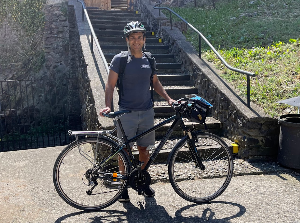
The day before the trip started, the tour operator met up with me in my hotel and delivered the bike, maps, detailed itinerary, hotel addresses, things to see along the way, information about restaurants etc. The bike came with a bag in the front (below the handle) which could be used to store the lock, pump, tools etc.
This is how page 1 of the map for Day 1 (Prague to Melnik) looked like.
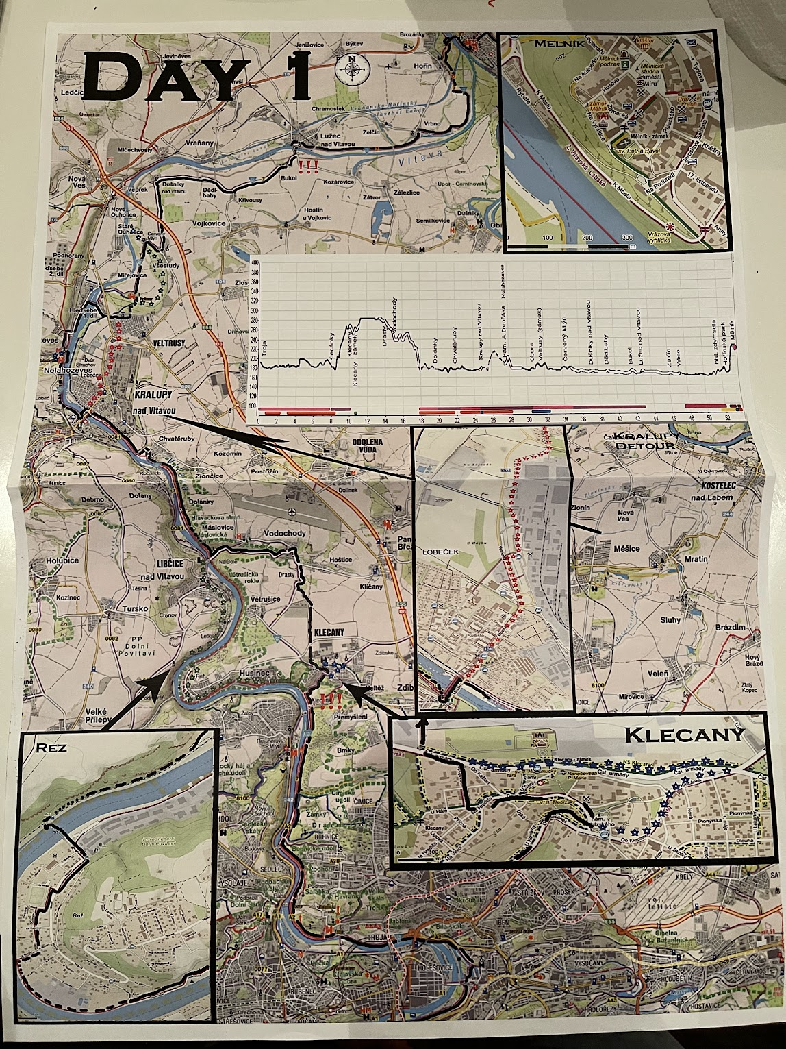
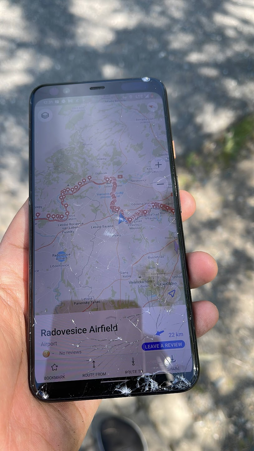
The map is quite detailed, however it is difficult to follow because you don’t know where you are on the map when you are biking. Upon expressing this concern, the operator emailed me the kml (Keyhole Markup Language) files for each day. These files can be used to display geographical data such as placemarks, descriptions, ground overlays, paths etc., on a digital map. The operator recommended using an app “mapi” to visualize these files. I downloaded the app on my iPhone, but wasn’t able to open the kml files after following the instructions to the letter several times. Fortunately, the kml file worked on the mapi app on my Android phone (Google Pixel).
You may be wondering what to do about your luggage, because clearly you can’t carry heavy luggage on a bike. The tour operator takes care of the luggage transfer for you, all you need to do is to tag the luggage with a tag provided by the operator and leave it with the hotel concierge.
Next, I’ll provide a brief description of each day of my trip, information about activities and excursions and a lot of pictures.
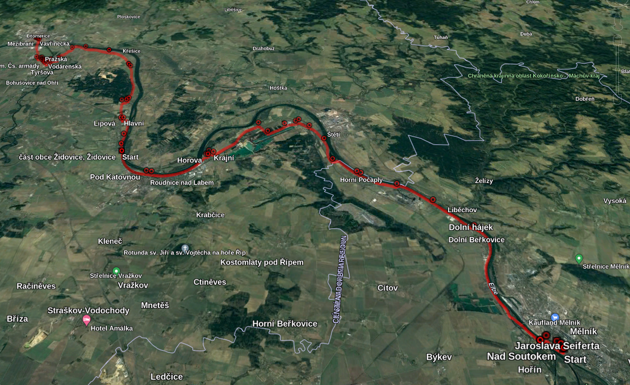
Day 1 – Prague – Mělník (52 km)
I started the bike ride around 10AM. To avoid having to bike through downtown Prague, I carried the bike on the subway to the Nádraží Holešovice station and got on the bike trail from there.
Right away, I realized the paper maps were useless, because I had no idea where I was on the map. Trying to find your position by correlating what I was seeing around me to some landmark on the map is nearly impossible when you are biking. I pulled out the Android phone to use the mapi app, only to realize that the bike was lacking a phone mount! I texted the tour operator who sympathized with the situation but said there was little he could do now that I was on my way and advised me to buy a mount on my own.
Another thing I missed right away were pedal toe clips cage (see pic below). They make pedaling more efficient by allowing you to pull up as well as down, and also help to keep the pedal right under the ball of your foot.
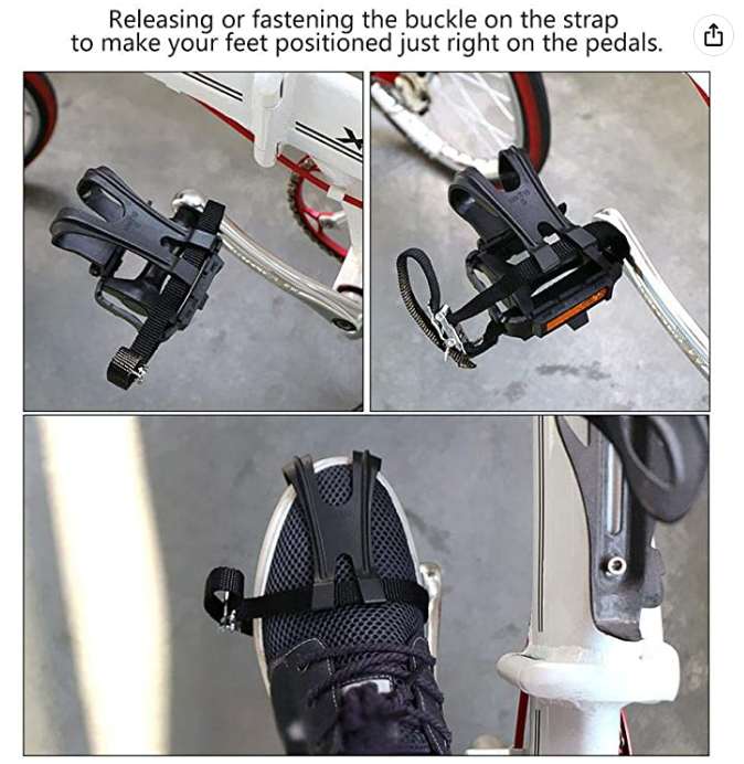
I use pedal toe clip cage regularly on my bike in Washington and love them. The operator again advised going to a bike shop and having the clips installed.
Lacking a phone mount, I slipped the phone into the plastic sleeve on top of the bike bag. It wasn’t ideal, but it worked for a while.
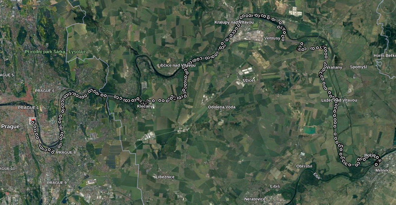
The trail followed the Elbe river for a few Km but deviated near the town of Klecánky where it goes up and down a hill. The activity description of the day also mentioned a couple of sightseeing options – Renaissance chateau and Antonín Dvořák Museum near the town of Nelahozeves, but I missed both of those. I really wish the sightseeing options were included as landmarks in the kml file, because that really serves as the source of truth when you are on the bike.
About half-way to Melnik, a small disaster struck. The sleeve into which I had slipped the phone had an opening and the phone slipped out and fell on the pavement, shattering the screen 🙁 . It soured my mood for a bit, but I resolved to stop at a bike shop in Melnik and get a phone mount and tried to put the incident out of mind.
After another few Km, I stopped by a local Czech restaurant for lunch and to recharge my phone.
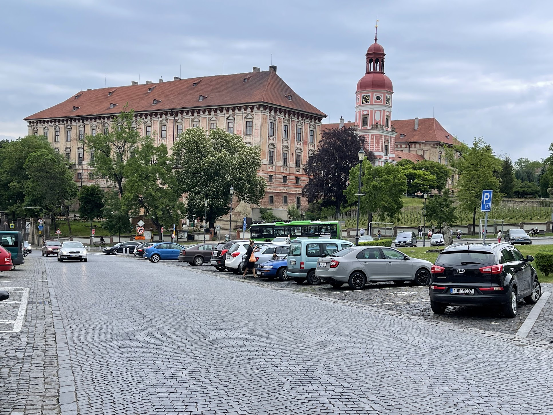
I arrived in Melnik around 3 PM. My hotel was located up a hill, about 2 km from the bridge to Melnik. My luggage had already been delivered. I was feeling pretty good and the work day in the US was just starting so I attended some work meetings and then went for a walk to explore the town. I got coffee at cafe Melnik, a cute cafe close to the town center. Melnik is a town of 19000 at the confluence of the Elbe and Vltava rivers. It is the center of the wine growing region of the Czech republic and an important transportation hub. It is known for the historic center (called Miru square), Melnik castle and the church of Peter and Paul. I got dinner at a nice restaurant in the town center and tried some of the local wine. Nothing to write home about, but not too bad either!
Day 2: Mělník – Litoměřice (51 Km)
On day 2, I commenced biking around 10 AM. First thing I did was to find a bike shop to get a phone mount installed. I stopped by a couple of bike shops in Melnik, but to my surprise, none had a phone mount! I located a big bike shop across the river, not far from the bike trail and decided to stop by that one. Fortunately, they had several phone mounts and I got a medium range one installed. I considered getting pedal toe clips as well, but the bike shop didn’t have any in store.
The trail mostly followed the Elbe river. I stopped by for lunch in the town of Roudnice nad Labem (English translation – Roudnice over Elbe), a town of ~13,000 and one of the oldest in the Czech republic. It suffered extensive damage during the Hussite wars of the 15th century and the 30 year war in the 17th century. In 1603, it was acquired by the Lobkowicz family and remained so until 1945. The most important landmark is the Roudnice Castle built in the 12th century.
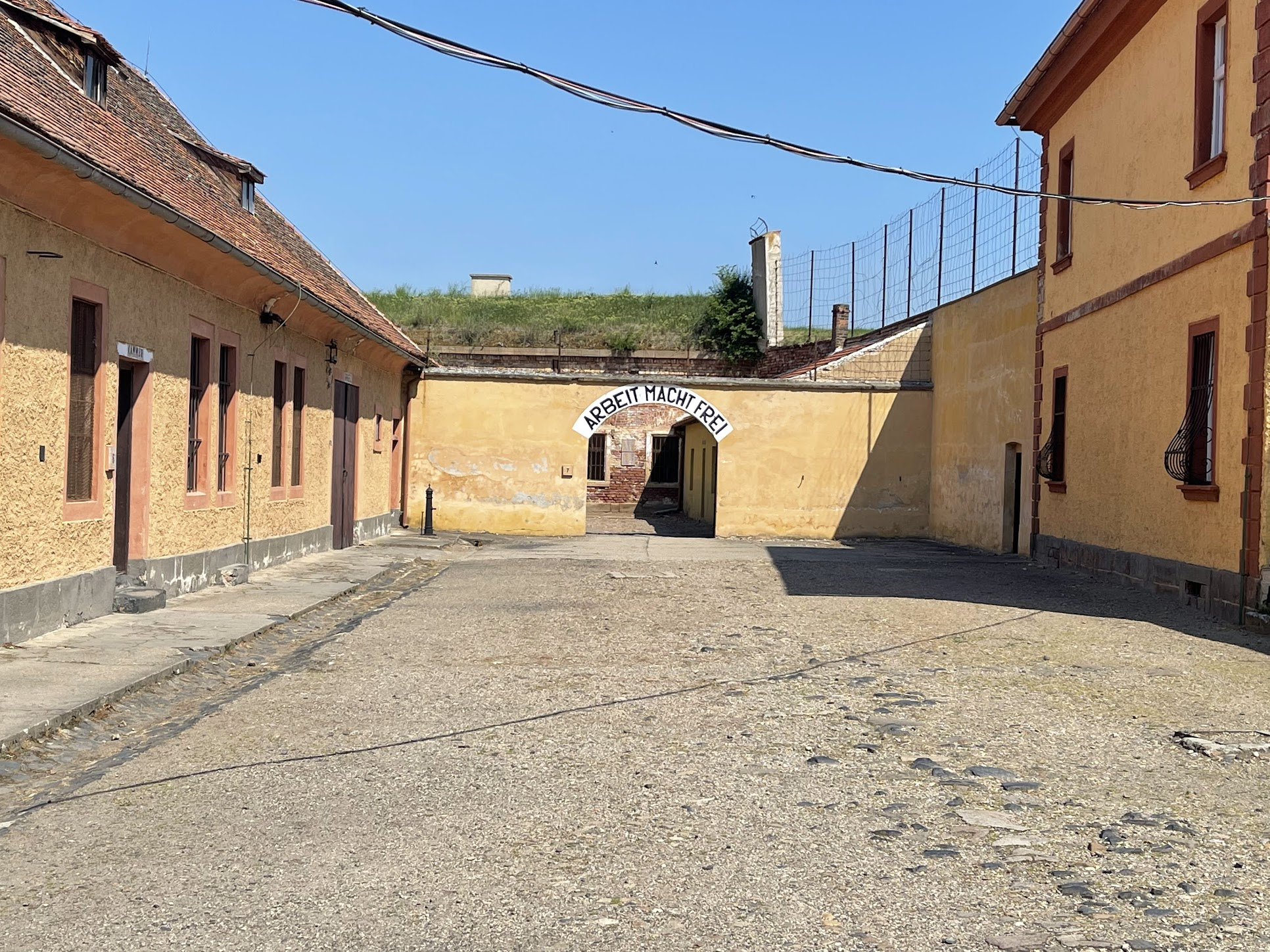
After lunch, I continued along to Litoměřice. Shortly before crossing the bridge to Litoměřice, I passed by the town of Terezin (Theresienstadt in German), created by Emperor Joseph II of Austria in the late 18th century and named in honor of his mother, Empress Maria Theresa. Terezin was a Jewish ghetto and concentration camp during WW2. It held primarily Jews from Czechoslovakia, as well as tens of thousands of Jews deported chiefly from Germany and Austria, as well as hundreds from the Netherlands and Denmark. More than 150,000 Jews were sent there, including 15,000 children, and held there for months or years, before being sent by rail transports to their deaths at Treblinka and Auschwitz extermination camps in occupied Poland, and to smaller camps elsewhere.
I had lost my way a bit on the way to Terezin, which added an extra half an hour to my journey. It was nearly 4 by the time I arrived in Terezin and there wasn’t enough time to visit the town. I decided to visit Terezin in next morning.
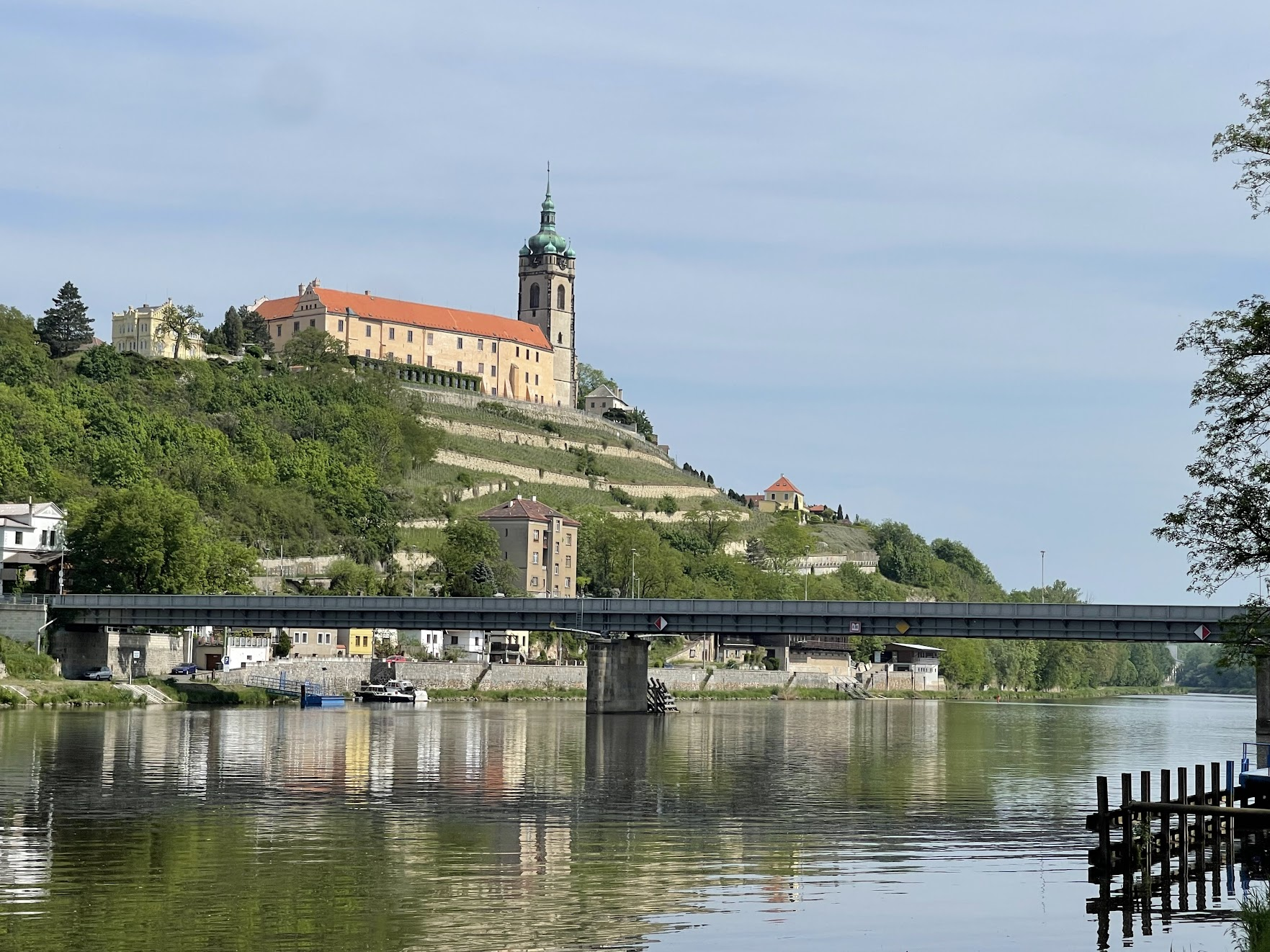
Litoměřice has about 24,000 inhabitants and also suffered during the 15th century Hussite wars. After the 30 year war, the town became dominated by Catholic Germans and the native Czech population was pushed out. Protecting the rights of this German population, who lived in Sudetenland (historical name for the northern, southern, and western areas of former Czechoslovakia which were inhabited primarily by Germans) was one of Hitler’s demands that paved the way to WW2. After the war, much of the German population was forcibly expelled and the town repopulated with Czechs.
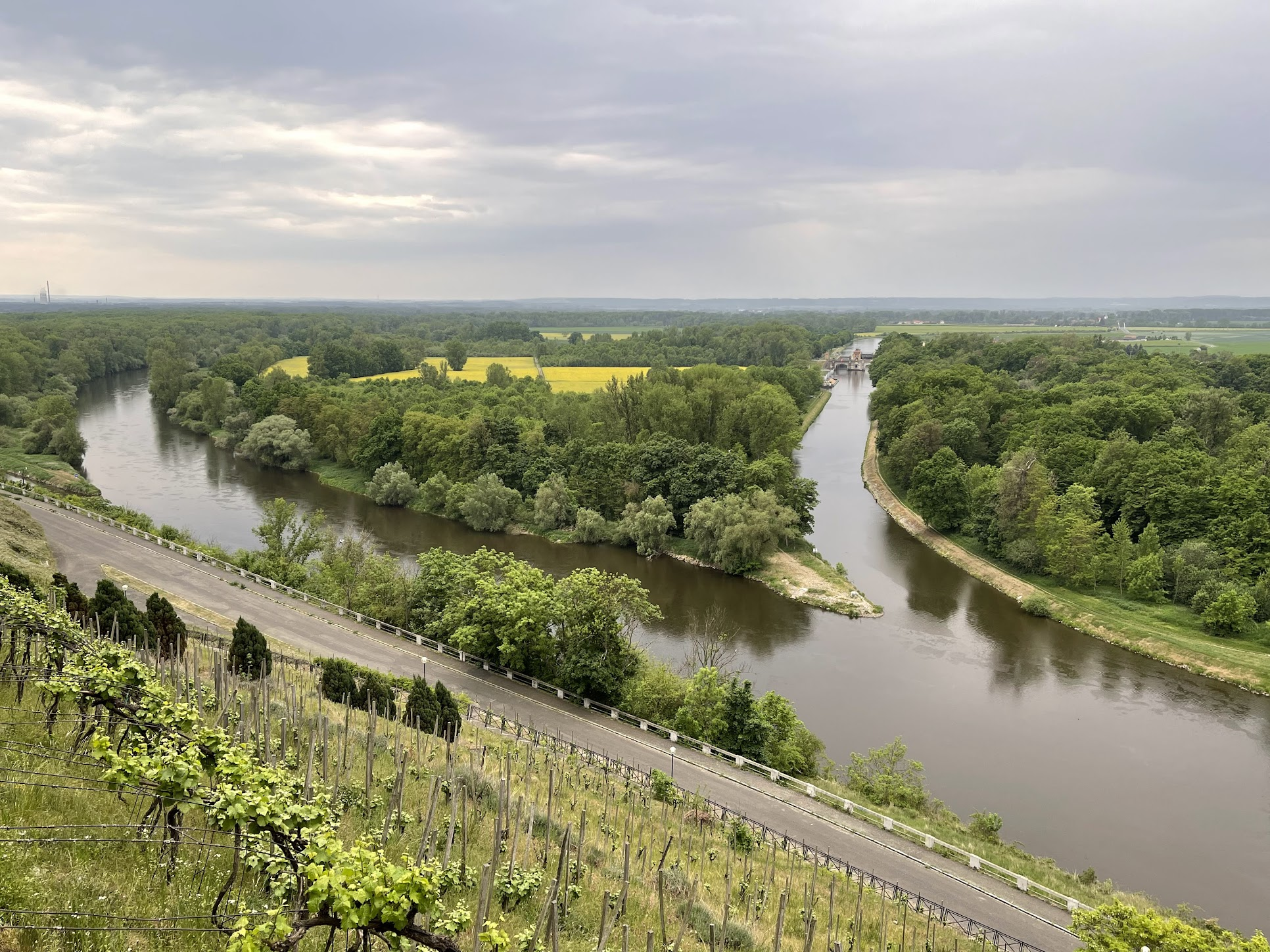
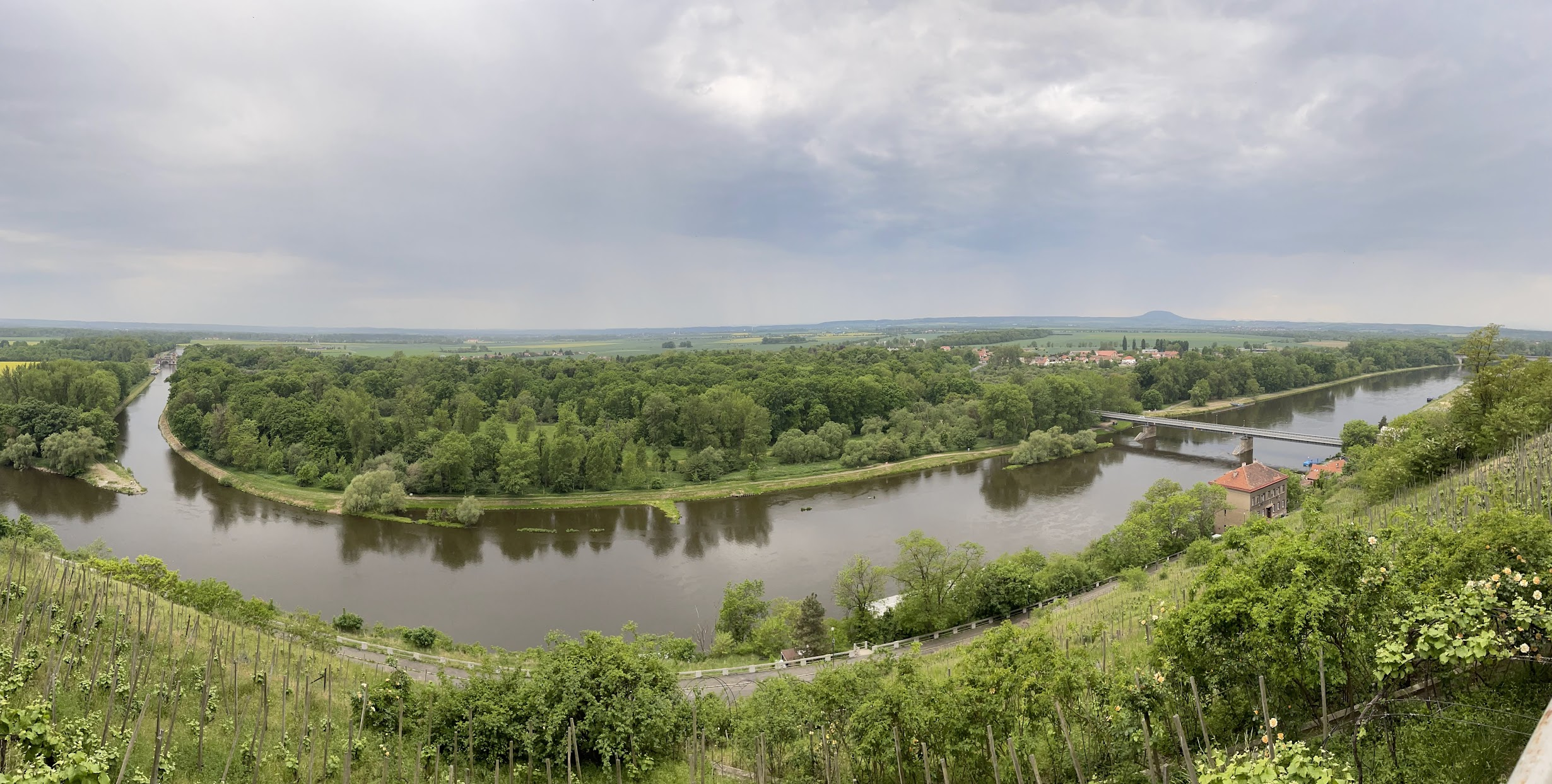
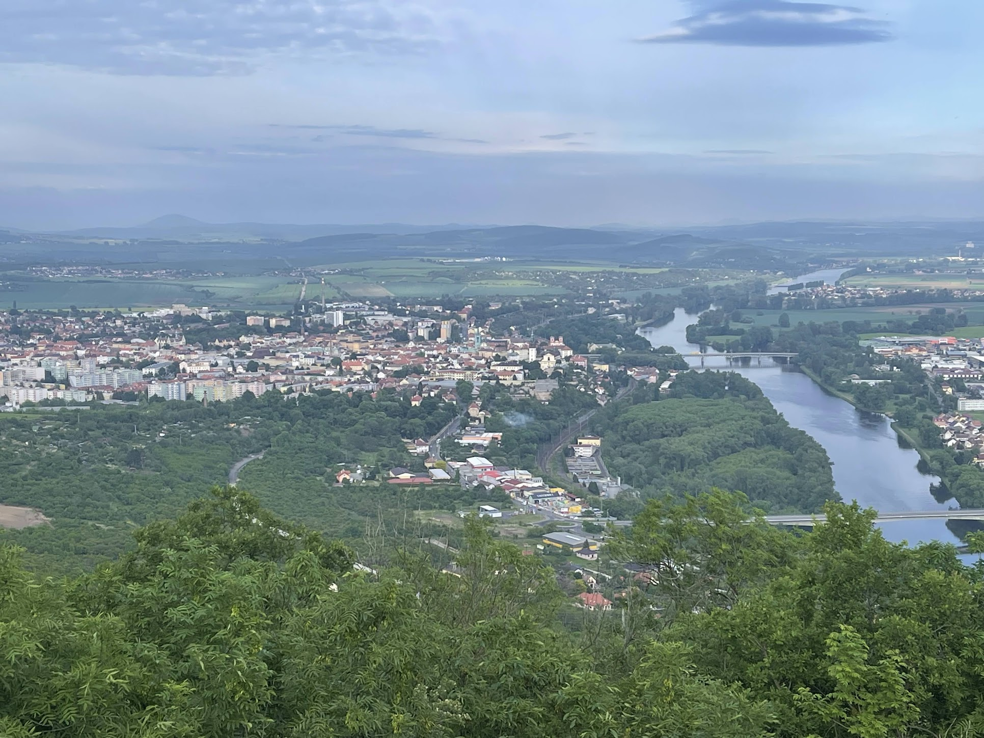
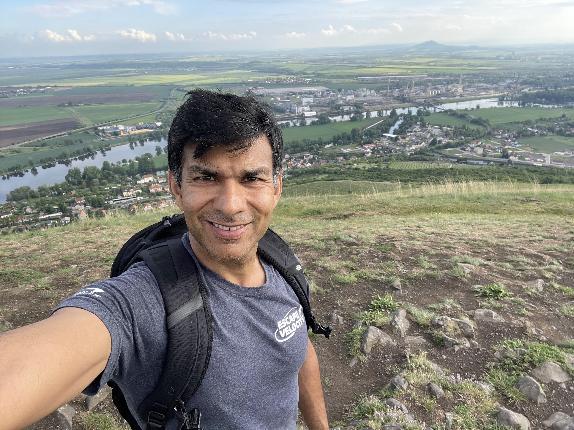
After checking into my hotel, I decided to do a popular hike to the Radobýl hill about 3 Km from Litoměřice. There is a fairly steep climb leading to the beginning of the hike. From the top of the hill, you get to enjoy gorgeous, panoramic views of Litoměřice, Elbe river and neighboring towns!
After the hike, I got a nice, big dinner at a local restaurant and called it in for the day.
Day 3: Litoměřice – Děčín (53 Km)
I set out around 9 AM the next day for Decin, the 3’rd stop on the way.
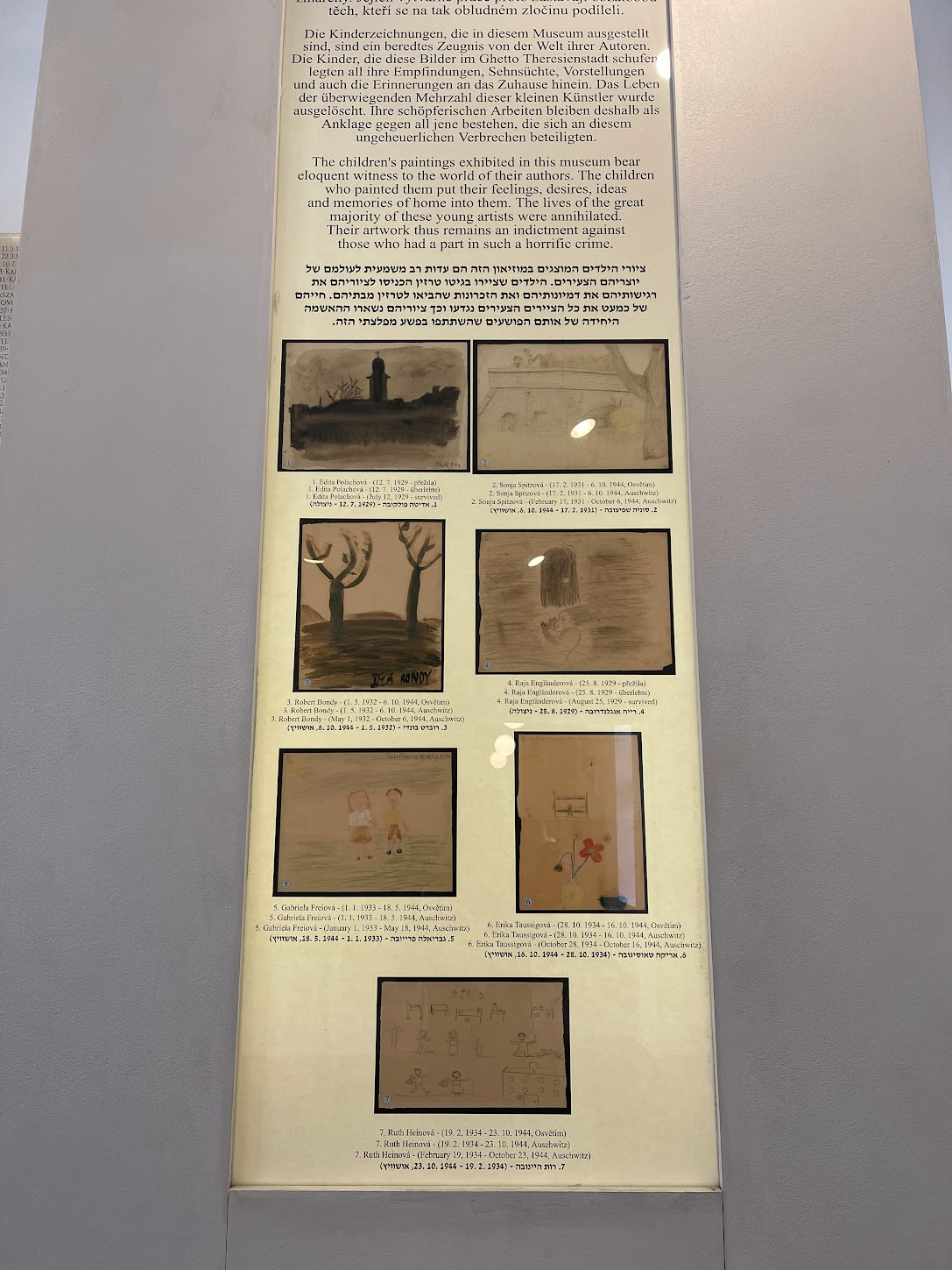
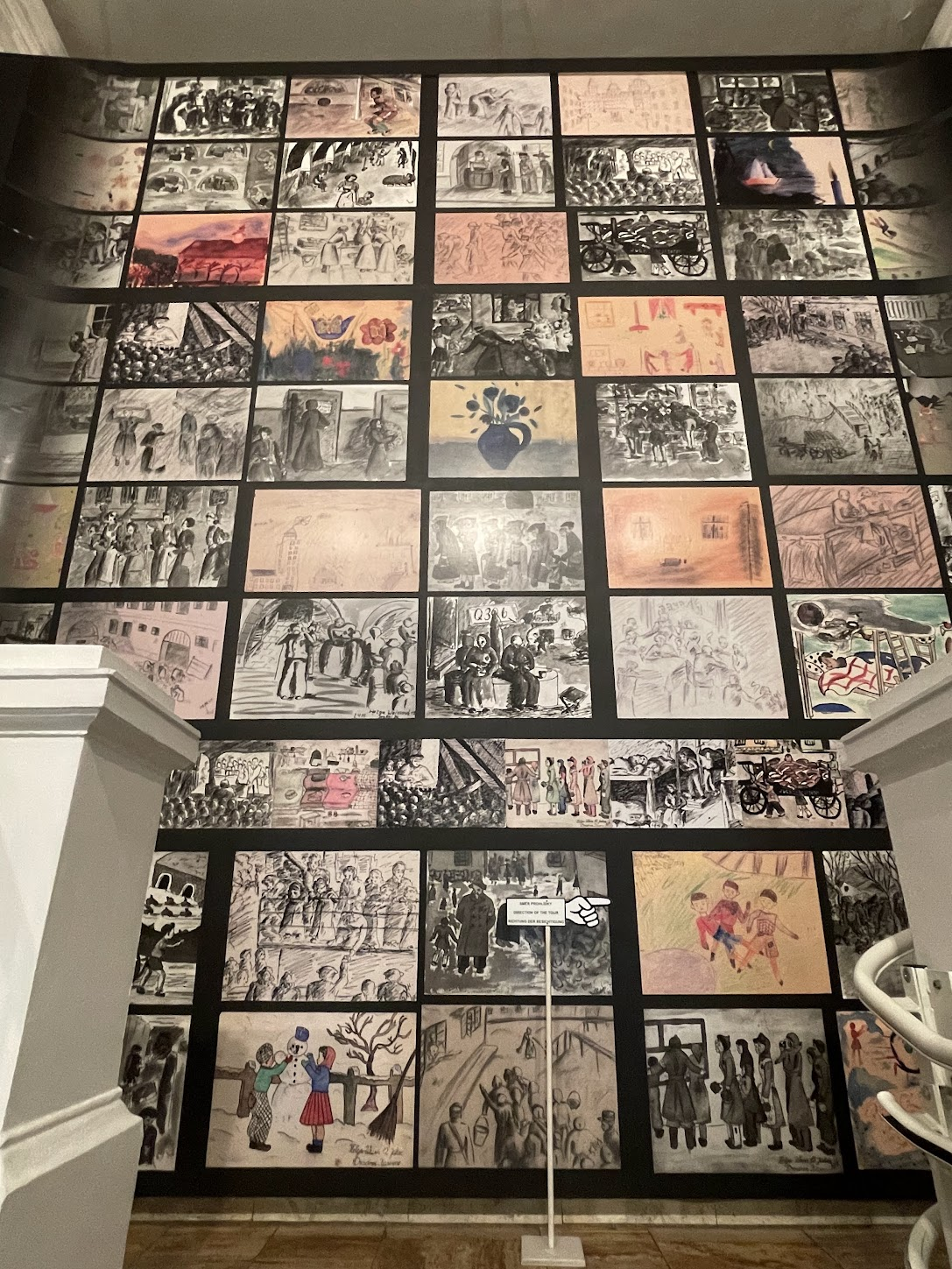
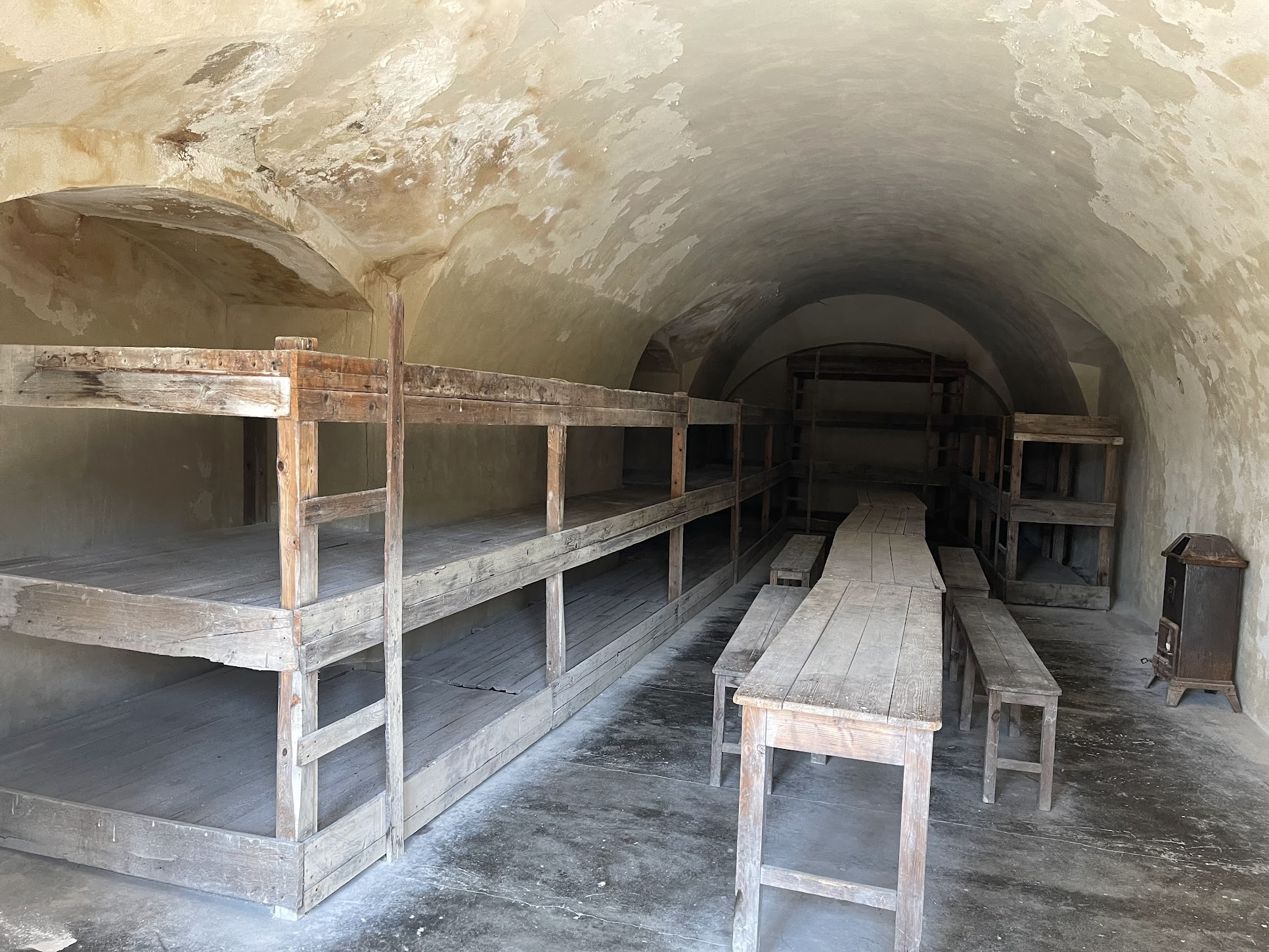
Before turning North towards Decin, I visited the Terezin concentration camp, used to house Jews, primarily from Czechoslovakia, as well as tens of thousands of Jews deported chiefly from Germany and Austria, Netherlands and Denmark. More than 150,000 Jews were sent there, including 15,000 children, and held there for months or years, before being sent by rail transports to their deaths at Treblinka and Auschwitz extermination camps in occupied Poland, and to smaller camps elsewhere. Although Terezin was not an extermination camp, about 33,000 died in the ghetto. This was mostly due to the appalling conditions arising out of extreme population density, malnutrition and disease.
I had never been to a concentration camp before and it was quite an emotional experience. I found the paintings made by the children who lived in the camp the most poignant and heartbreaking because they so eloquently expressed their desires and struggle to understand the cruelty of the world around them.
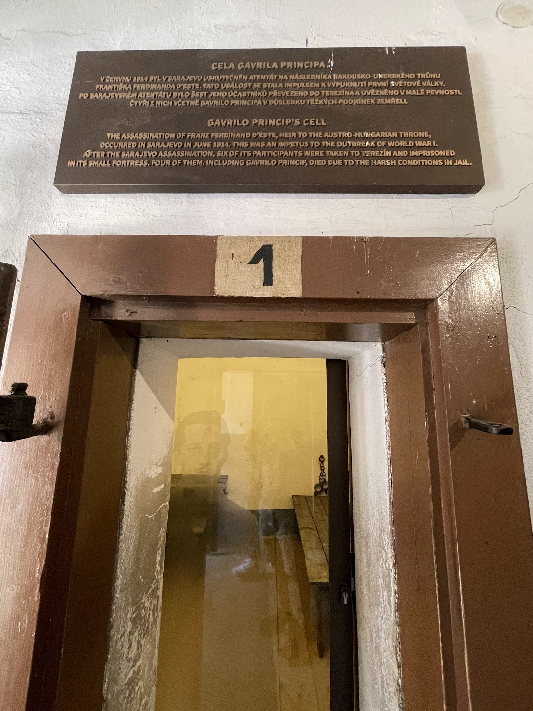
Aside from being a medieval prison and concentration camp, Terezin also contains the cell where Garilo Princip, the guy who assassinated Franz Ferdinand, the heir to the Austro-Hungarian throne was imprisoned. This assassination triggered the chain reaction of military mobilization that ultimately led to WW1.
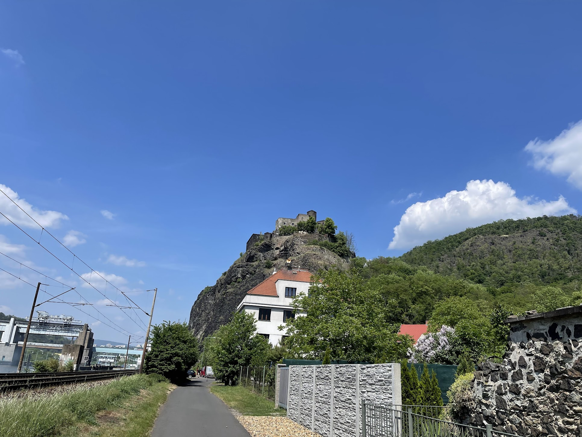
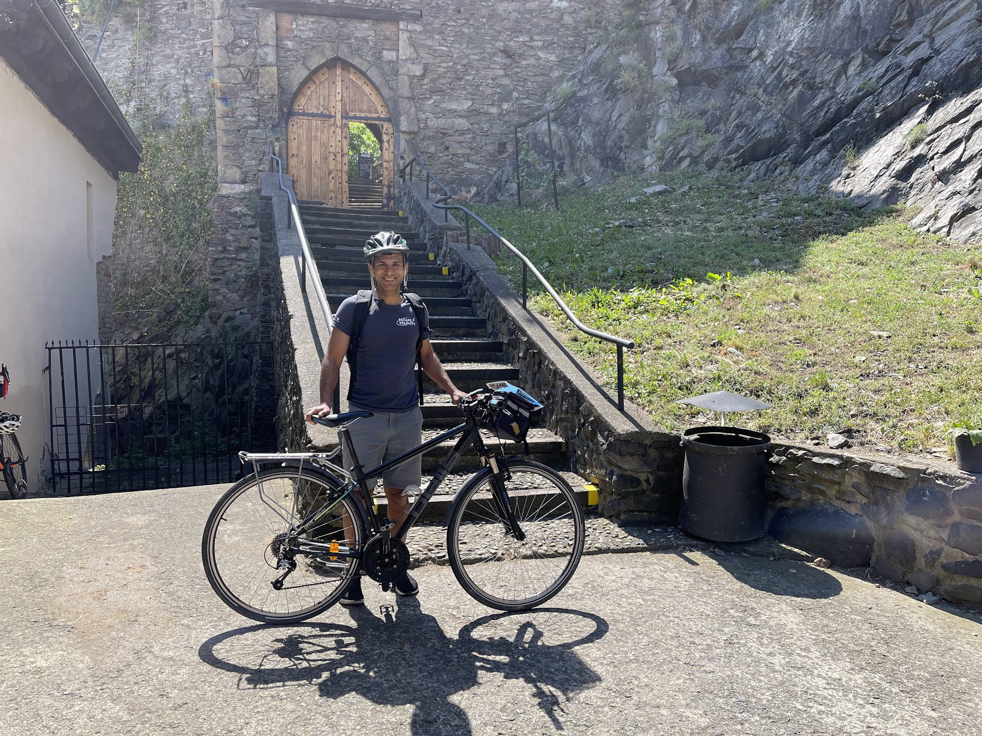
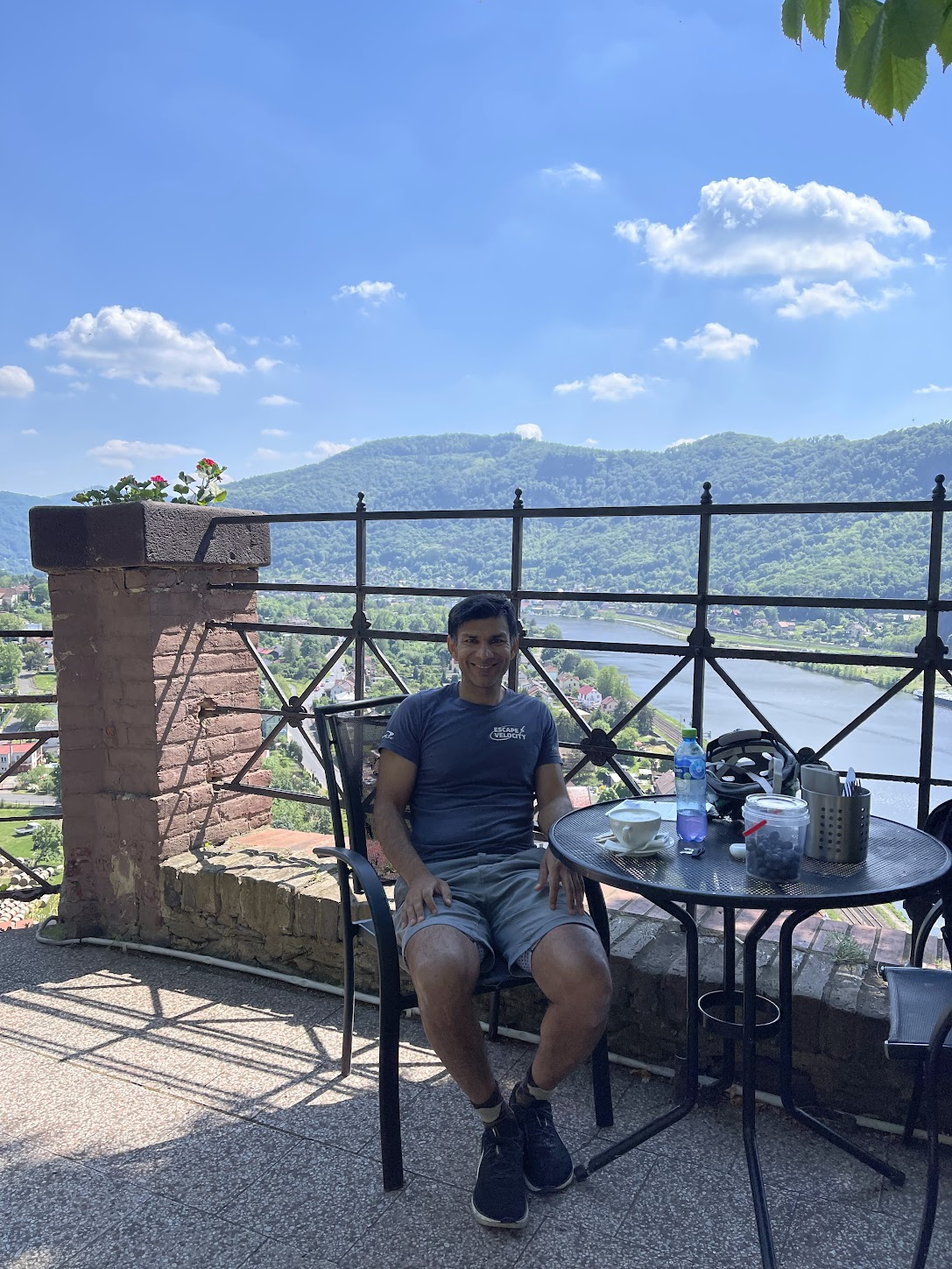
From Terezin, I commenced my bike ride to Decin, the next city on my itinerary. Along the way, I stopped by the Strekov castle, a well-preserved ruined castle perched atop a cliff above the River Elbe near the town of Ústí nad Labem The castle was built in the 14th century to protect the waterway and collect duties on transported goods
I biked up a fairly steep road up to the gate of the castle. Felt quite proud of myself for having made it to the gate on a bike!
I had lunch at a nice restaurant right outside the castle
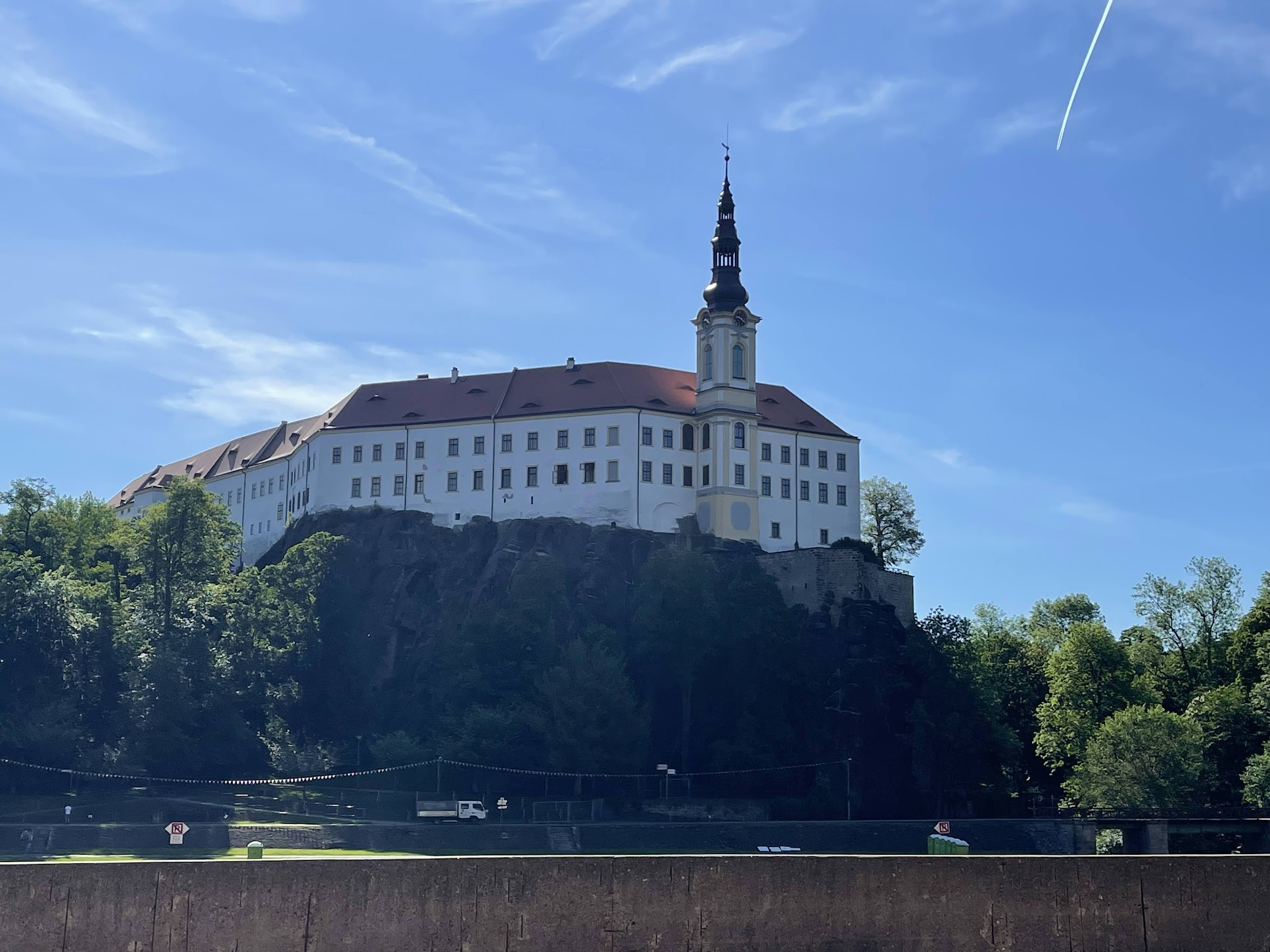
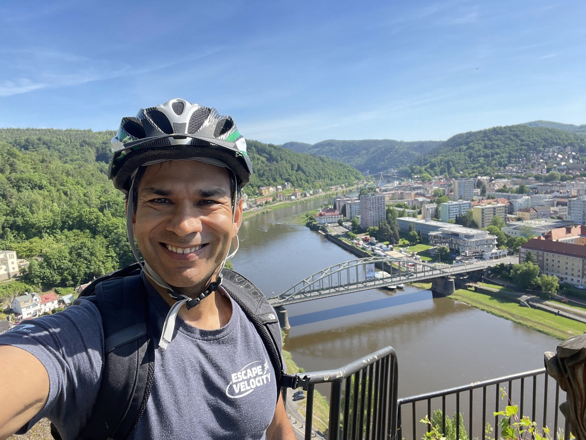
From Strekov, it was another 20 Km or so to Decin, a town of about 47,000 along the Elbe river and an important rail, road, and water transport hub.
The Decin castle was first built around 1128 as a wooden fortress. It was replaced by a royal stone castle in the 13th century. In the 16th century, a grand Renaissance palace was constructed on the site, to be renovated in the Baroque style from the 17th century onward. The castle was occupied by German troops during WW2 and then Soviet troops after the war. After the departure of Soviet troops in 1991, the castle was restored and now used as a museum and for hosting private events. After checking into my hotel, I locked my bike in a shed at the back of the hotel. All the hotels on the trip were well-equipped to store bikes. There must have been other bikers staying at these hotels also, because I saw several bikes in the storage rooms.
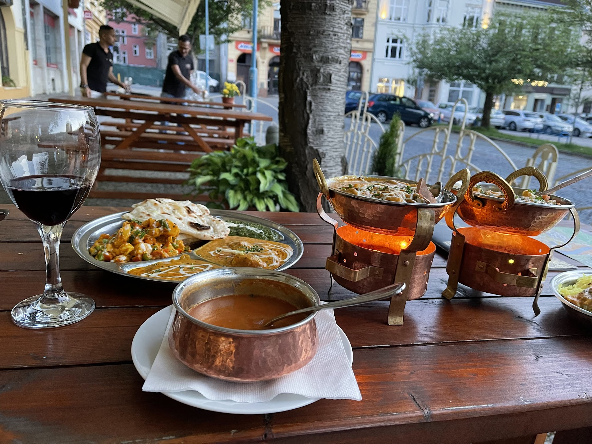
Afterwards, I had dinner at an Indian restaurant, right next door to the hotel. Wouldn’t have expected to find an Indian restaurant in a small Czech town, but the food was pretty decent!
Day 4: Děčín – Bad Schandau (25 Km)
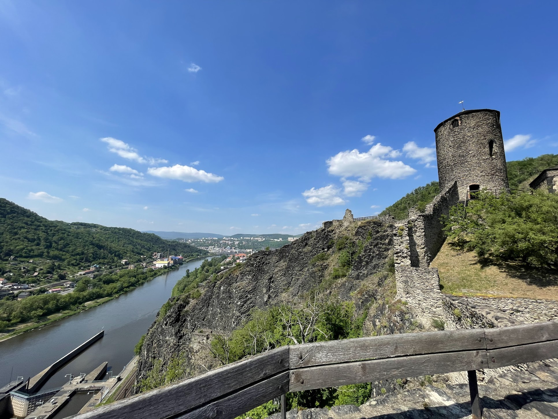
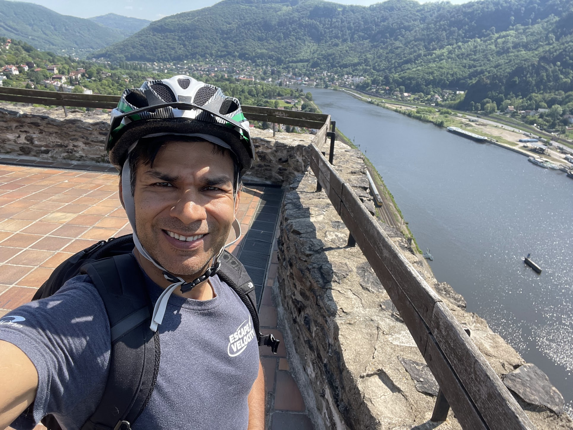
Before setting off for Bad Schandau, the next stop along the way, I biked + hiked over to the Shepherd’s wall Lookout Tower, on the other side of the Elbe river from Decin. The lookout has a restaurant (which was closed when I arrived) and offers amazing views of the river and Decin. I highly recommend going there.
From Decin, it was a only a few Km of biking to the German border.
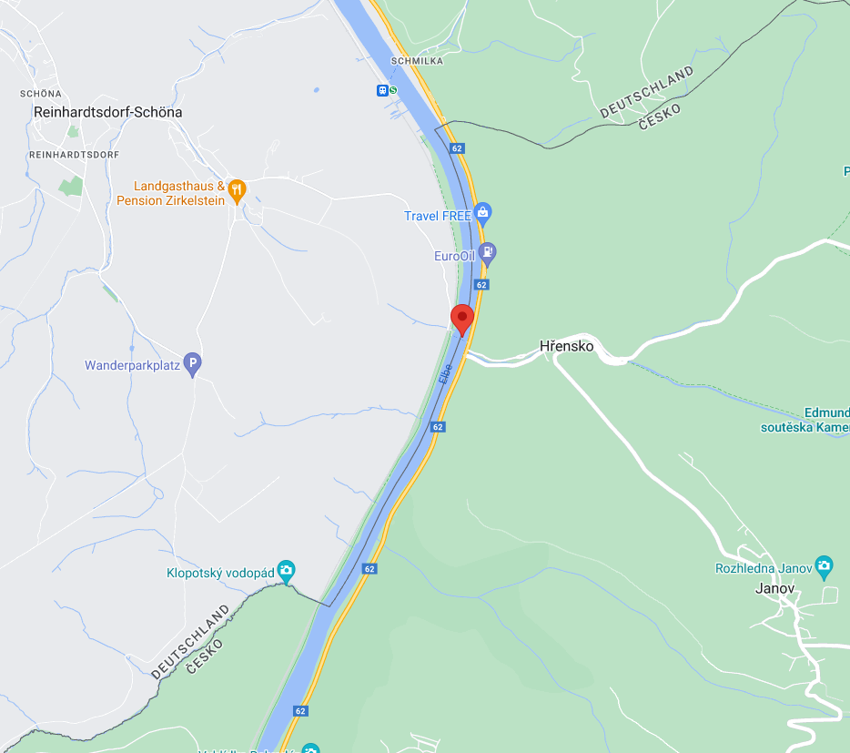
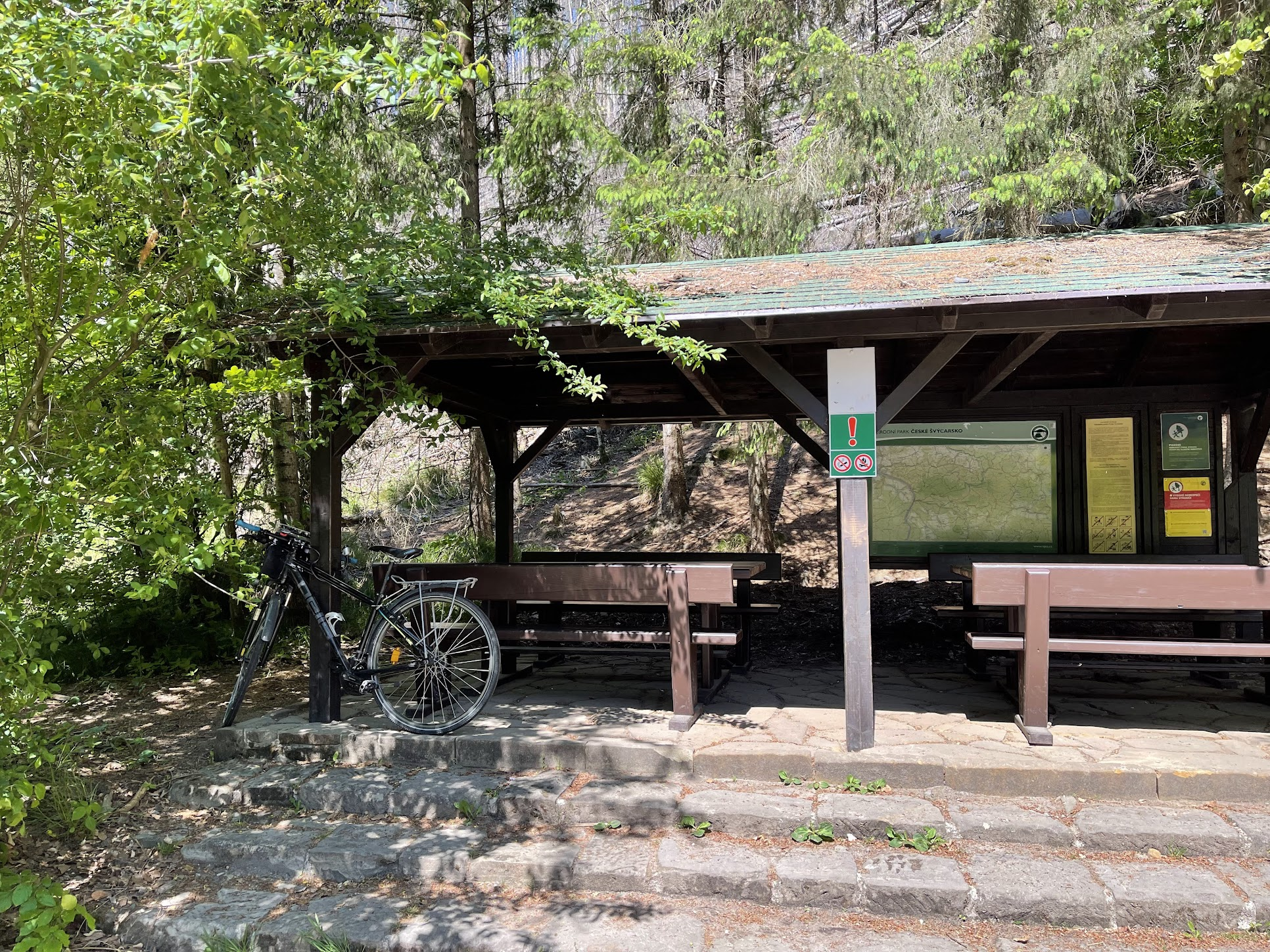
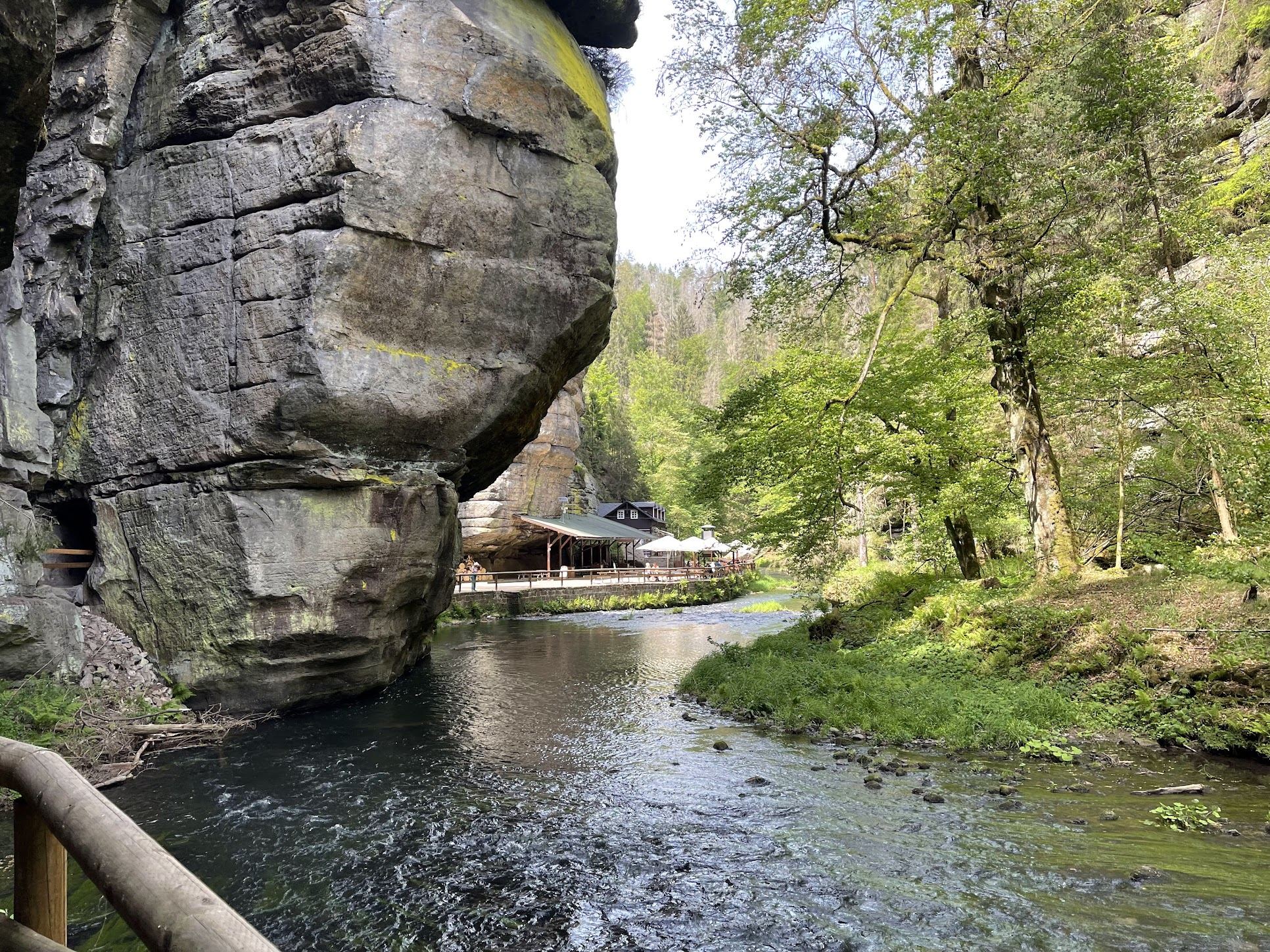
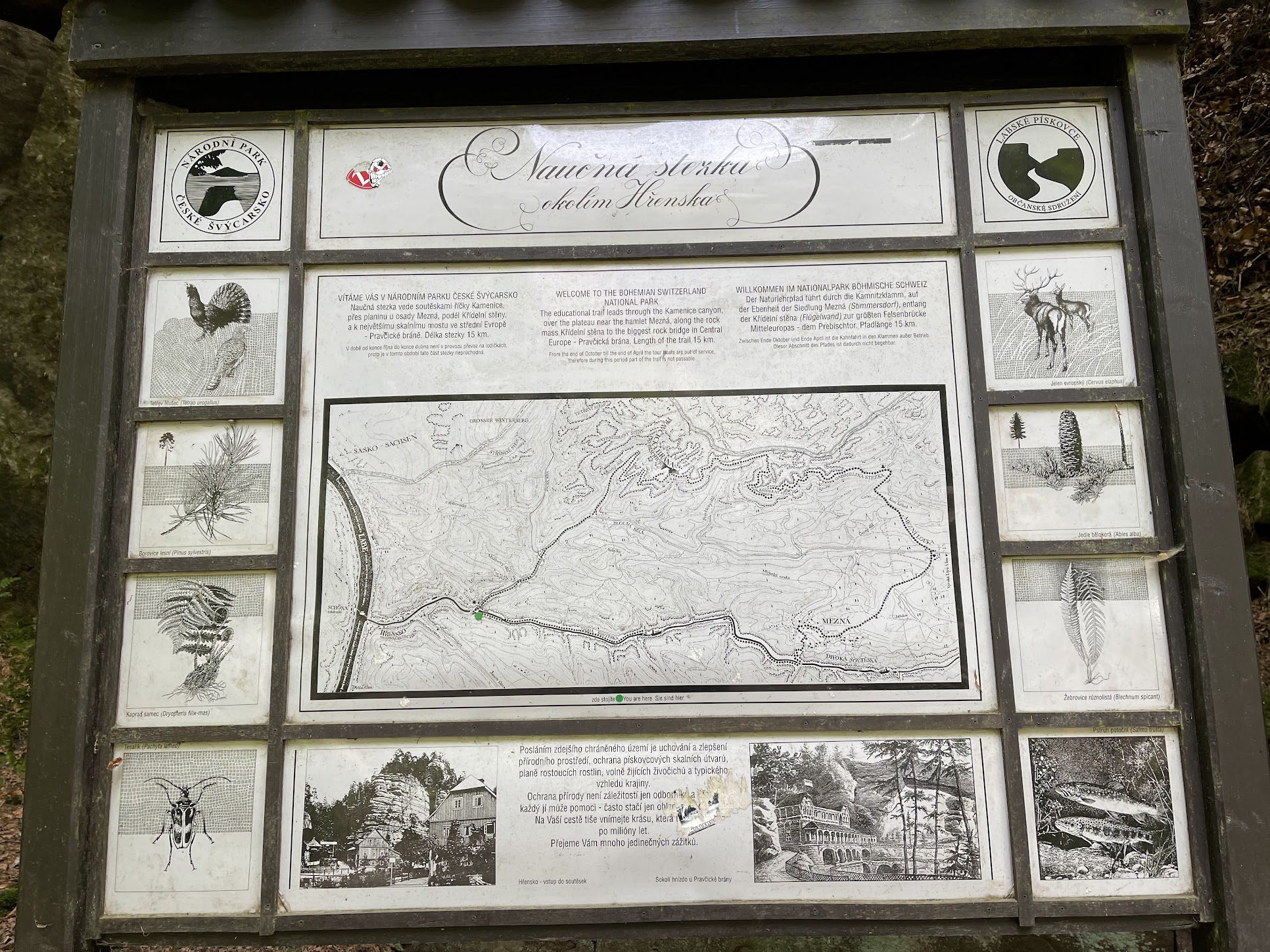
Shortly after crossing the German border, I crossed the river back to the Czech town of Hrensko to do a popular local hike in the “Czech Switzerland National Park”. There are very few bridges on the Elbe in that area, so to cross the river, you must take a ferry which costs a 1-2 Euros and run every 20-30 min. You can take a bike on the ferry.
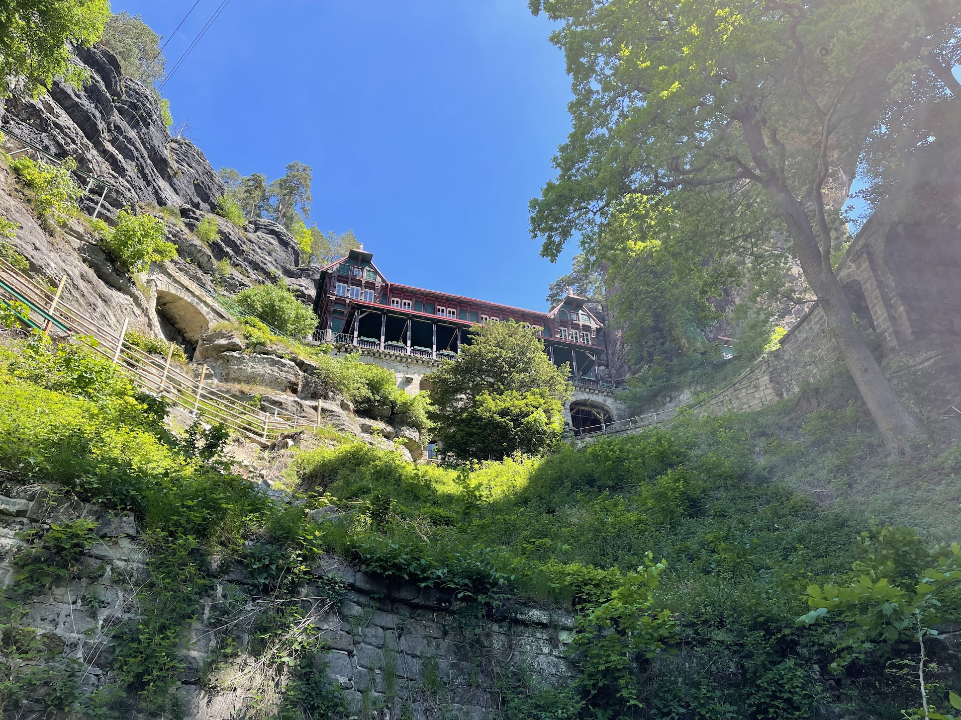
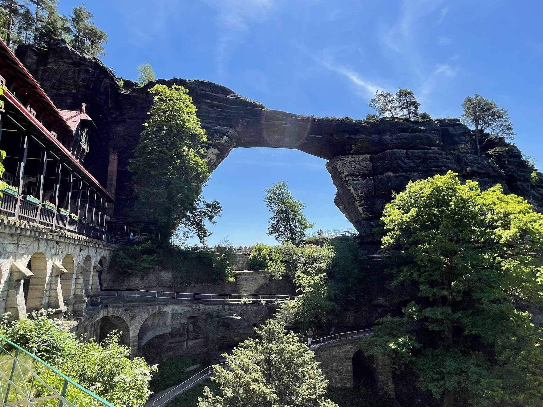
Hrensko is a town of 300 inhabitants situated at the confluence of the Kamenice and Elbe rivers in the heart of the Czech Switzerland National Park and offers many attractive activities, especially for hikers. Many trails lead through scenic rock formations, passes, deep gorges and hillsides. A highlight is the wonderful Pravčická brána (Pravčice Gate), the biggest sand stone natural bridge in Europe.
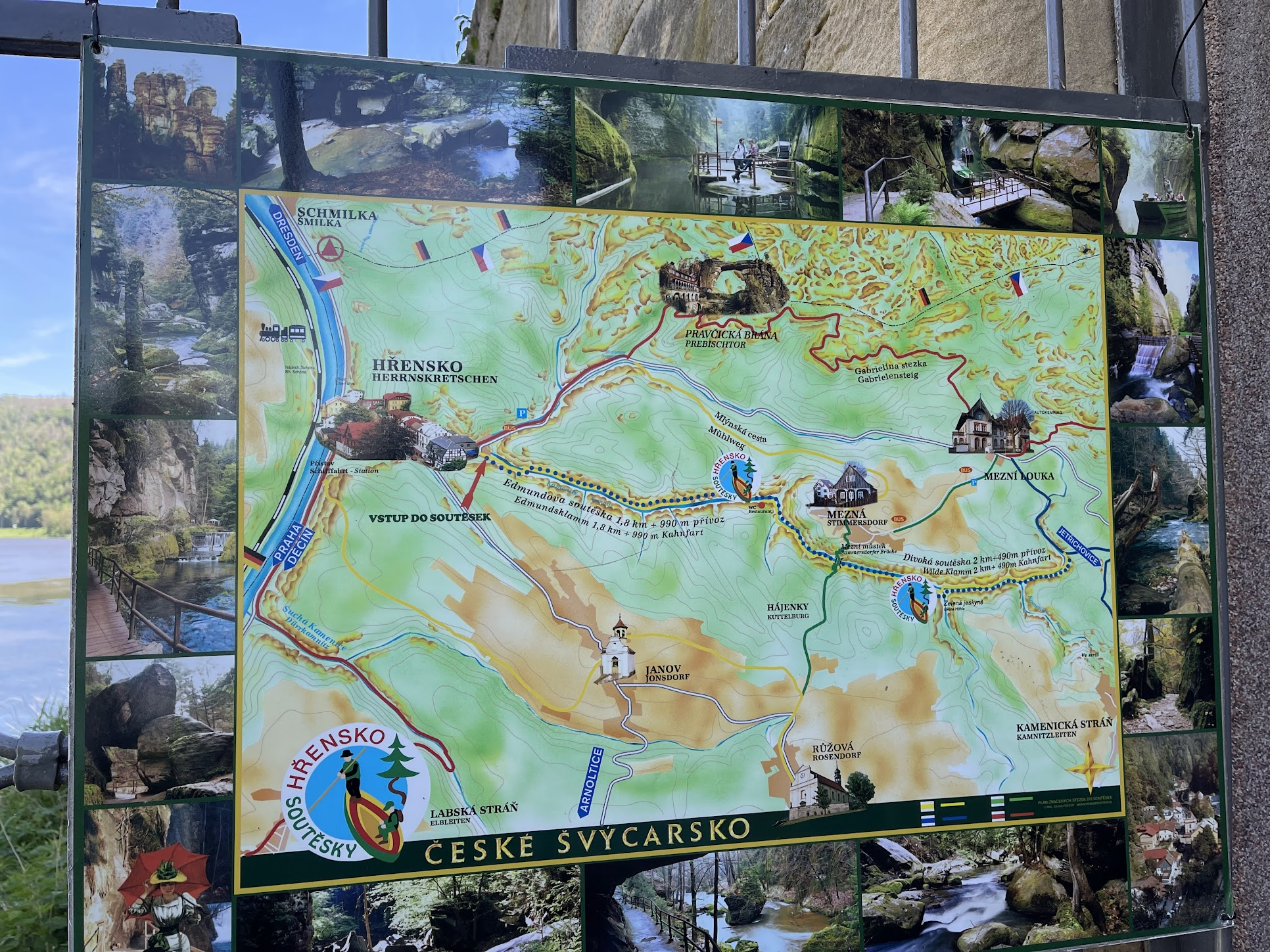
After crossing the river, I tried to figure out the best way to explore the area. I asked some local shops on what to do, but my complete lack of Czech and German language skills became an impediment. Seeing that the trail head to Pravčická brána was only about a 1.5 Km away (and after some advice from an English speaking hiker), I biked over to the trail head, which required going up a not-too-steep hill.
I locked my bike near the trail head and hiked up to Pravčická brána, ~2.5 Km, moderately challenging, but very nice hike.
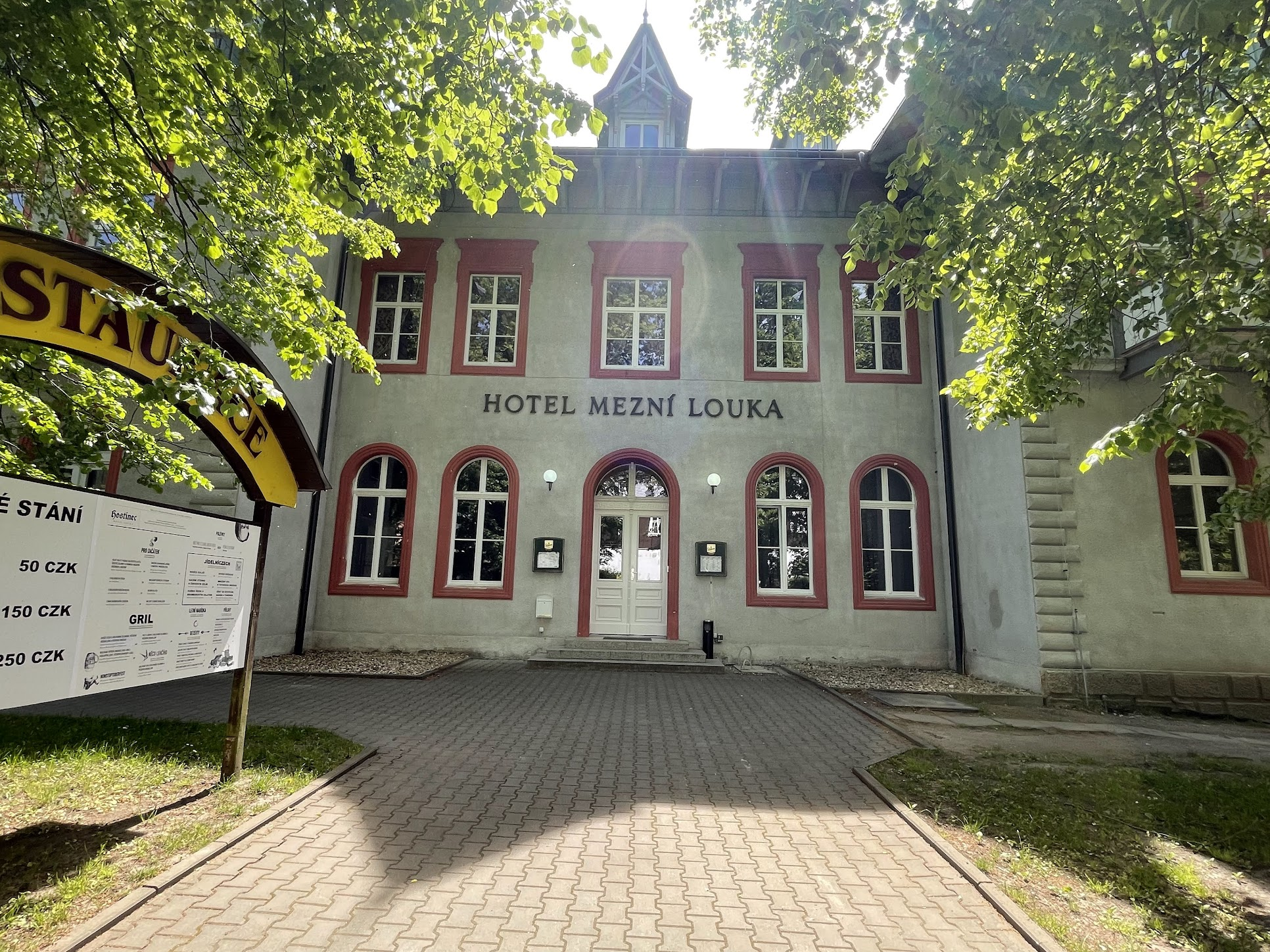
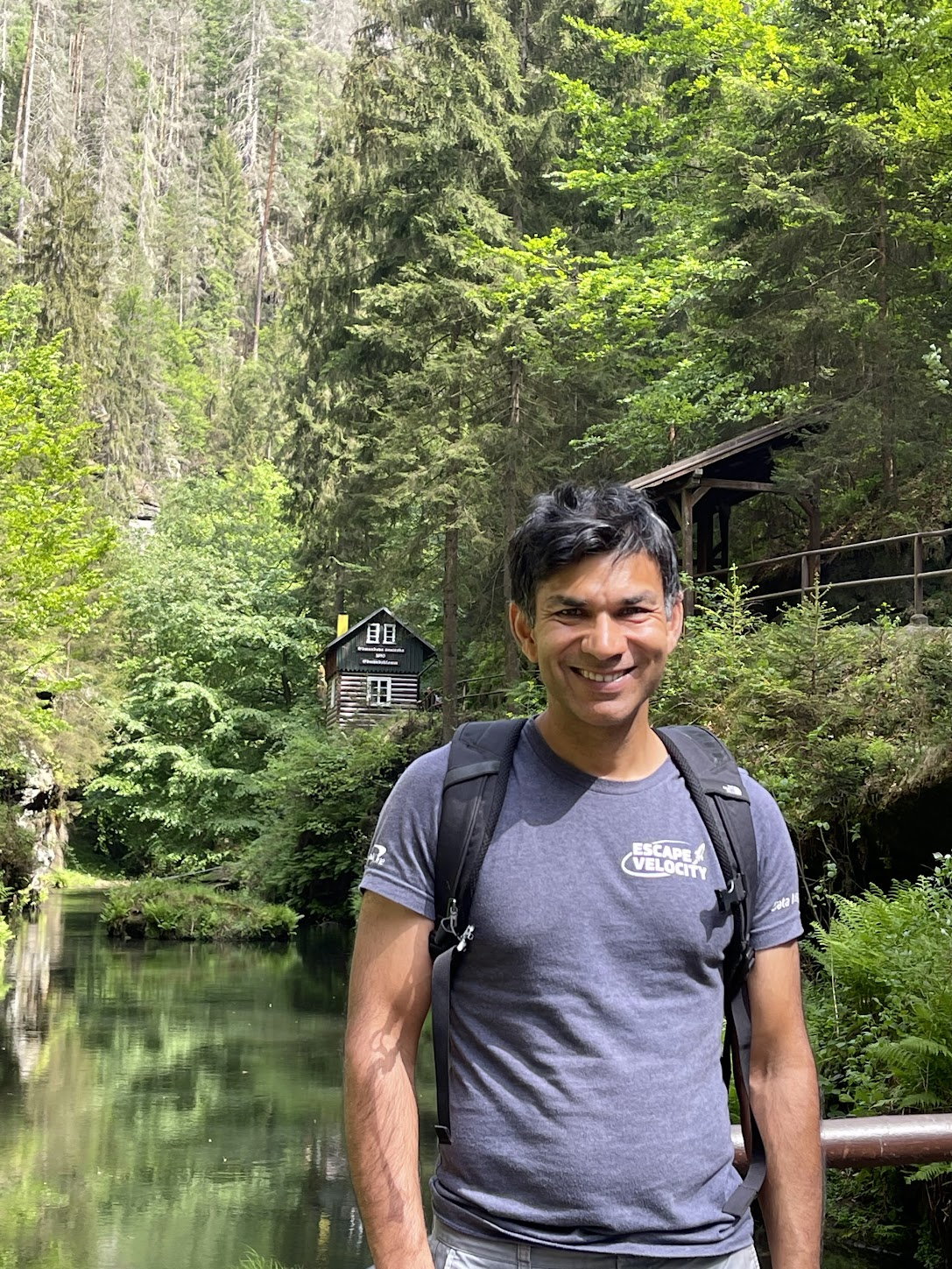
What to do after the hike was a little bit confusing. The activity list provided by the bike tour indicated a popular boat ride on the Kamenice river, that flows into the Elbe at Hrensko. I also saw buses carrying hikers up and down the road that I had biked along. Since I couldn’t take my bike on the boat, I decided to bike back to Hresnko, locked my bike near a restaurant and then took a bus to hotel Mezni Louka (about a 20 min ride), a way point along the way to the stream.
From Mezni Louka, I walked about 2 Km to resort Mezna. This walk was the most boring part of the day and I’d recommend avoiding it if you could take a bus or some other transport. From Mezna, I followed a steep trail down to the stream.
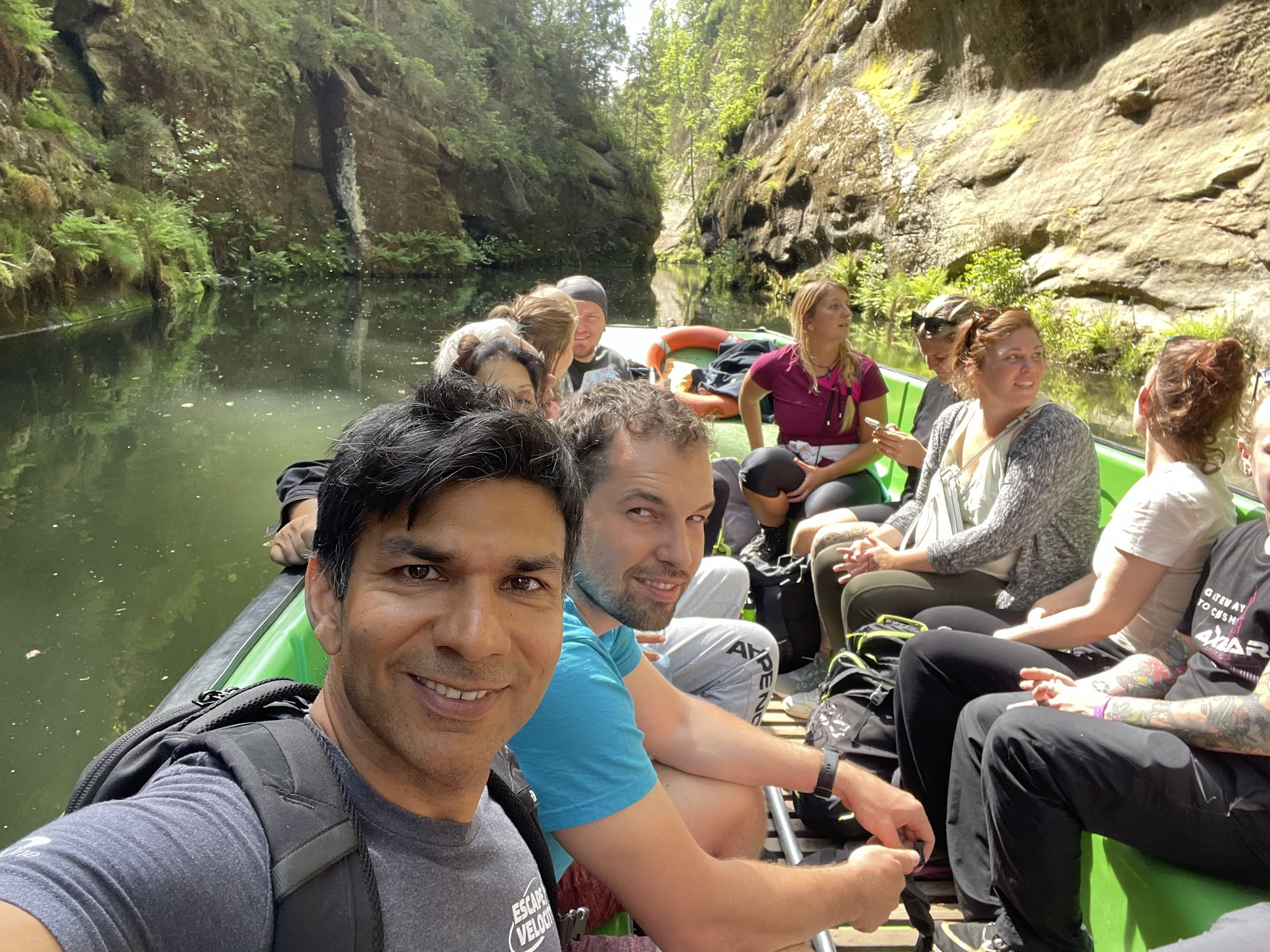
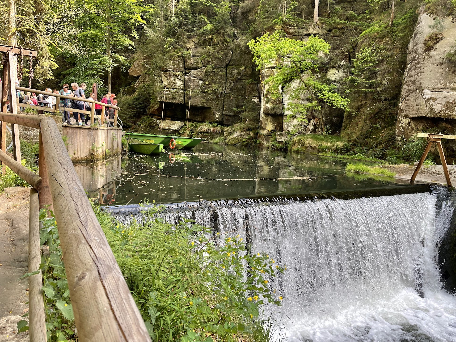
I walked along the stream a few kilometers, going through a couple of tunnels and passing by two restaurants before reaching the dock.
There were about 20 people on the boat. The boat was driven by muscle power from a big burly Czech/German guy who was telling various stories associated with the stream in Czech and German. I caught snippets of some of these stories being translated into English by a tour guide leading a small tour of English speaking tourists. One of the stories was about the area being a popular smuggling route for smugglers going back and forth between the Czech and German lands.. Other stories were about how the features on the cliffs lining the river resemble animal faces
After the boat ride, I walked back to my bike and got some food at a restaurant nearby. I requested the hostess (who didn’t speak any English) to plug-in my phone + charger to a wall outlet, but she seemed oddly reluctant to do it and said something like – “only for 10 minutes!”. I found the interaction a bit bizarre.
The entire Hresnsko excursion took about 5 hours and was very much worth it. I took the ferry back across the river and continued along to Bad Schandau, the next city on my itinerary and the first in Germany. The first two ferry crossings to Bad Schandau were closed so I had to bike for an extra couple of kilometres to find an open ferry crossing.
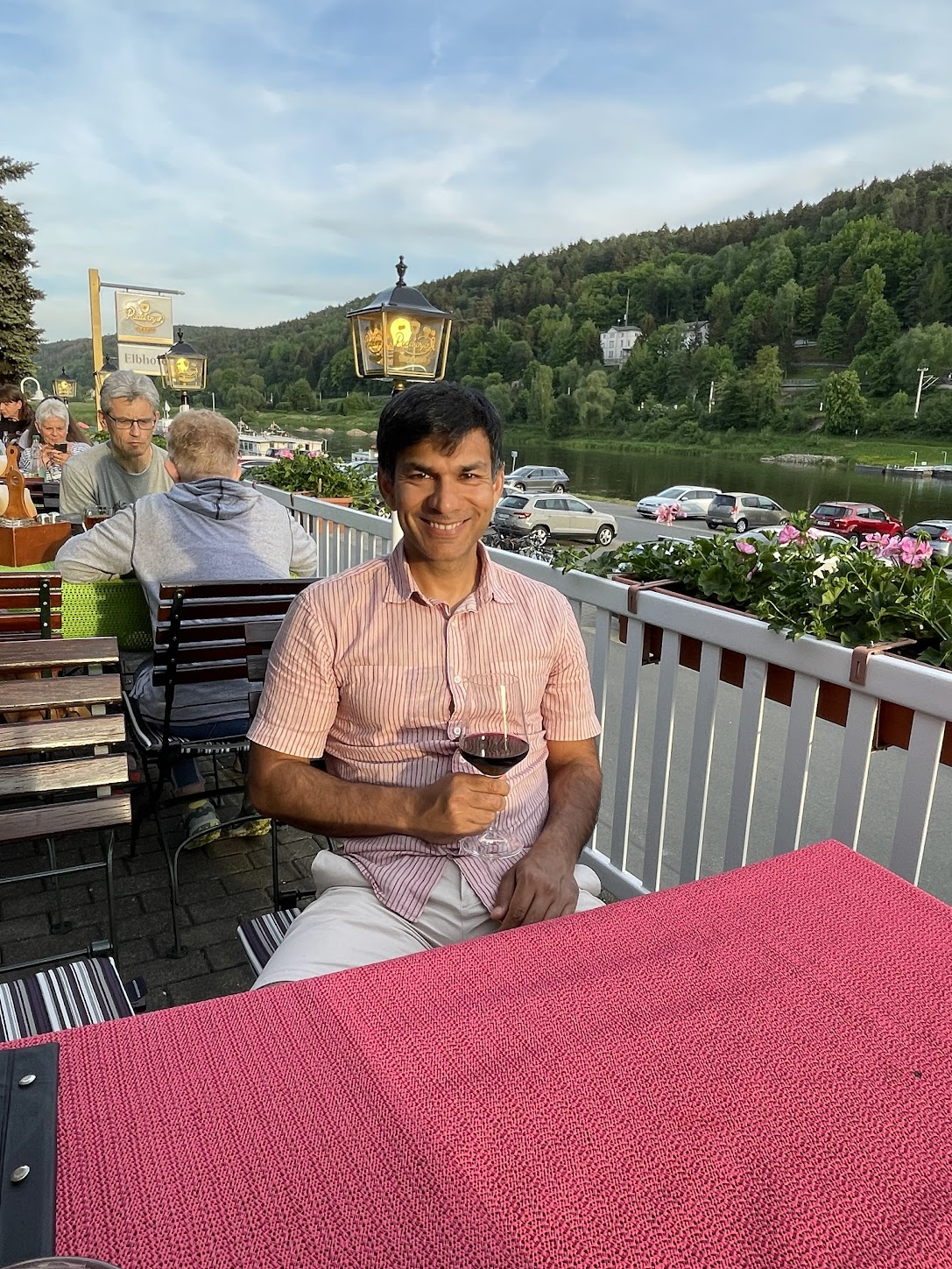
Bad Schandau is a spa (“bad” in German means spa) town and summer resort of roughly 3500 people. It is a picturesque border town, with a lots of charming houses and restaurants along the riverside. A river promenade and cycle path along the River Elbe stretches for 2.6 km from one end of Bad Schandau past the ferry stops and the town center and continues along the village of Postelwitz, which forms part of Bad Schandau.
The activity guide described several excursions in Bad Schandau – the Toskana Therme spa water world with 4 indoor pools, a whirlpool, a baby paddling pool, and an open air pool), botanical garden, Kirnitzschtal tram (a historic electrical tram, the shortest line in Germany, started its service back in 1898 and connects the Bad Schandau town centre, along a 7.4 km long stretch, to the Kirnitzsch Valley) and hike to Kuhstahl with a stunning view of the surrounding sandstone panorama. However, I was a bit tired after the day’s activities and just took a stroll along the waterfront and enjoyed a nice dinner by the river.
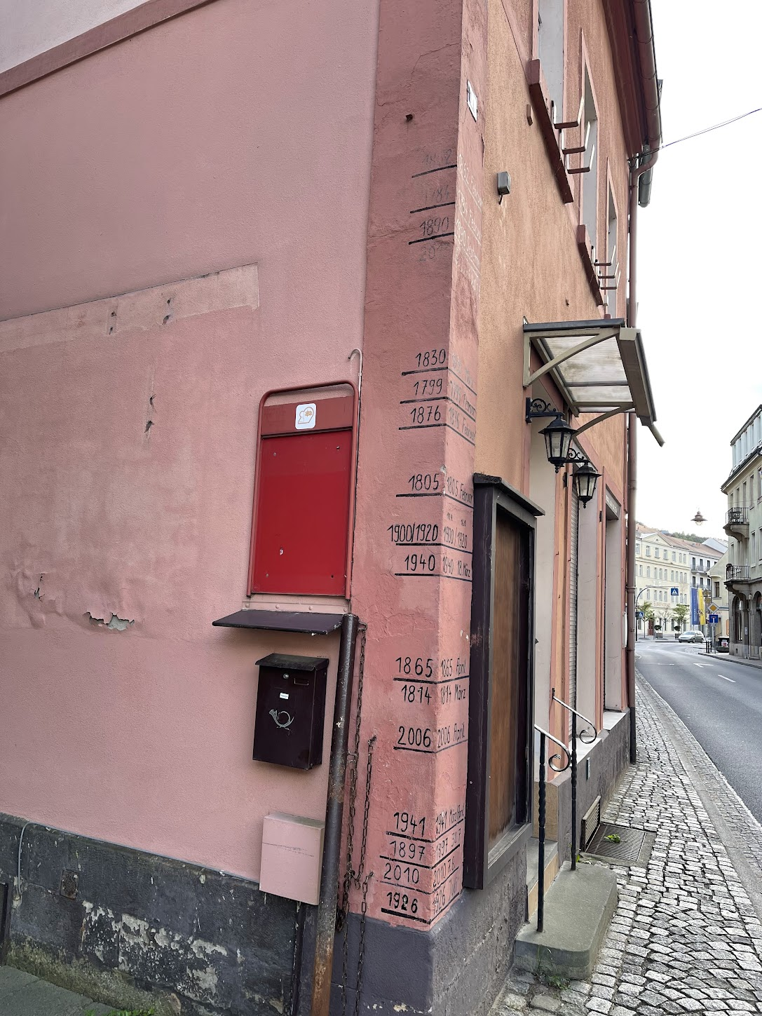
On the way to the restaurant, I passed by this sign showing the water level of the Elbe during flooding. Bad Schandau is quite vulnerable to flooding and was badly hit by the flooding of the Elbe in the years 1845, 2002 and 2006. The sign was a good reminder of the power of the forces of nature – how a gentle, placid, serene river that sustains life and serves as a beautiful backdrop for countless pictures can turn into a raging torrent threatening to devour everything in its way!
Day 5: Bad Schandau – Dresden (50 Km)
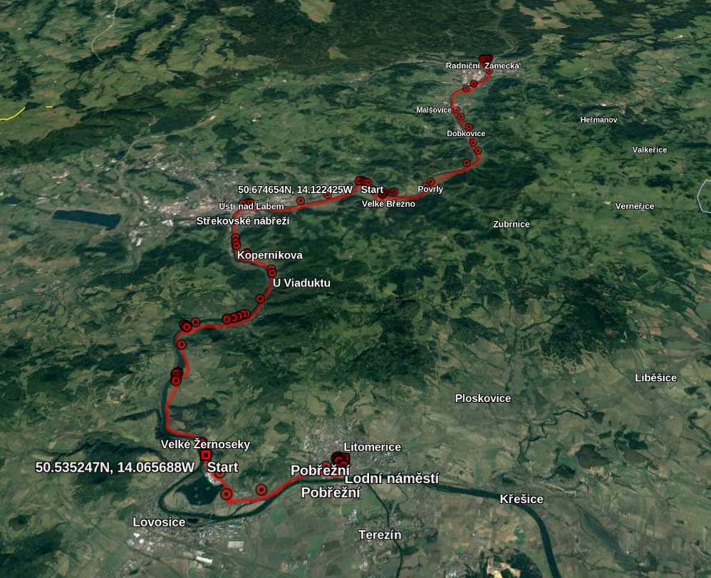
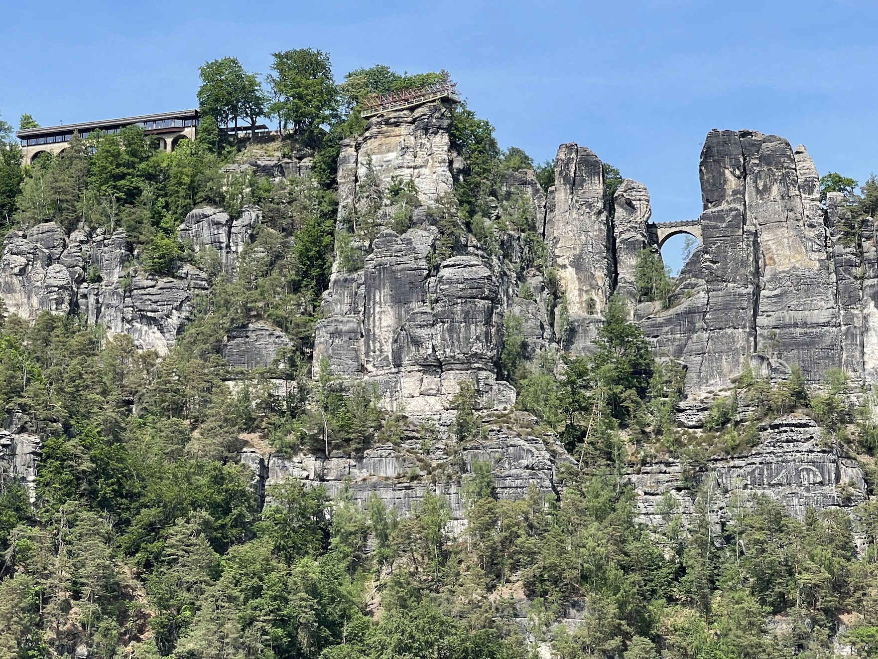
Day 5 was packed with historic delights. The highlights were Konigstein fortress, Bastei bridge and Pilnitz castle (see map).
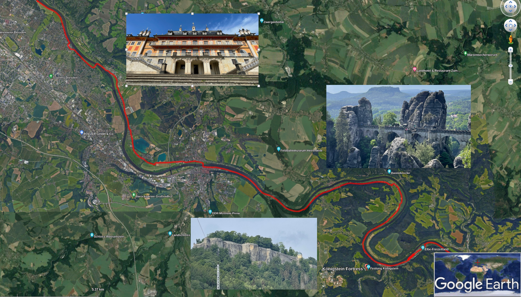
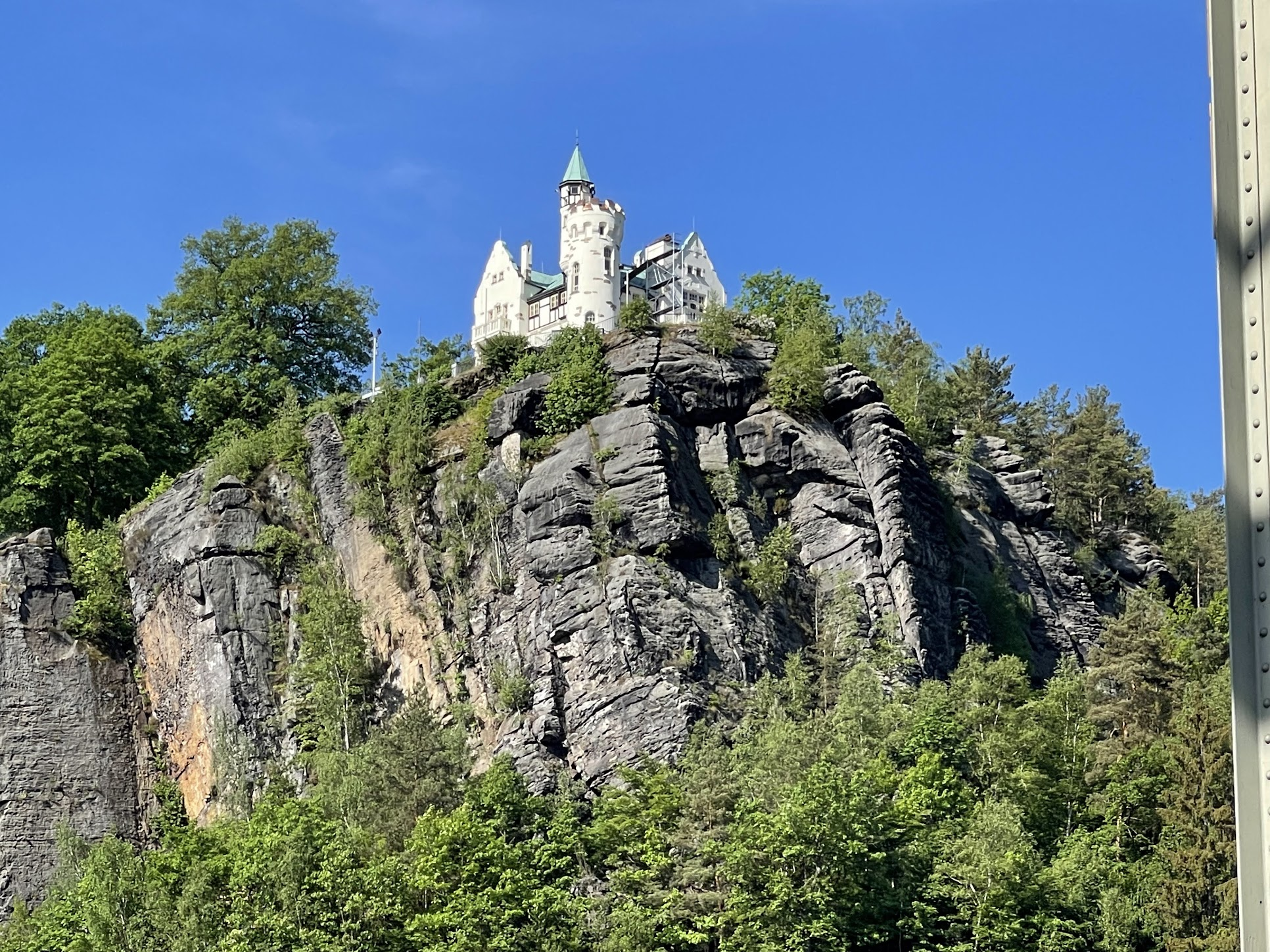
To cover all three in one day would have been quite difficult. Thankfully, I had already visited the Bastei bridge and nearby Neurathen castle on a previous trip, so I was able to spend more time at Konigstein and have a more relaxed day.
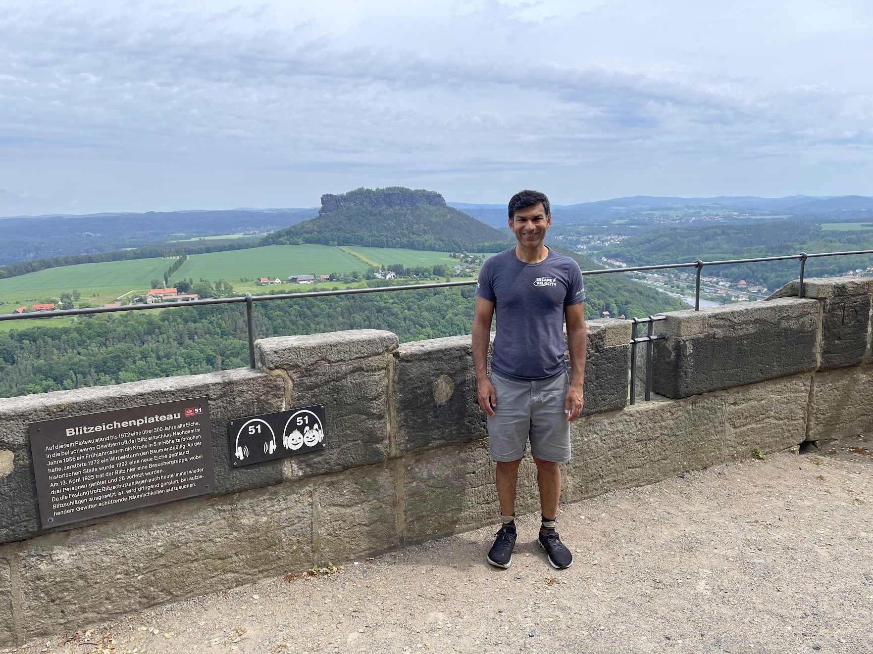
The Konigstein fortress (called the “Saxon Bastille”) is a historic mountaintop fortress about 40 Km from Dresden. The fortress was used as a state prison for centuries and is one of Saxony’s foremost tourist attractions, with 700,000 visitors per year.
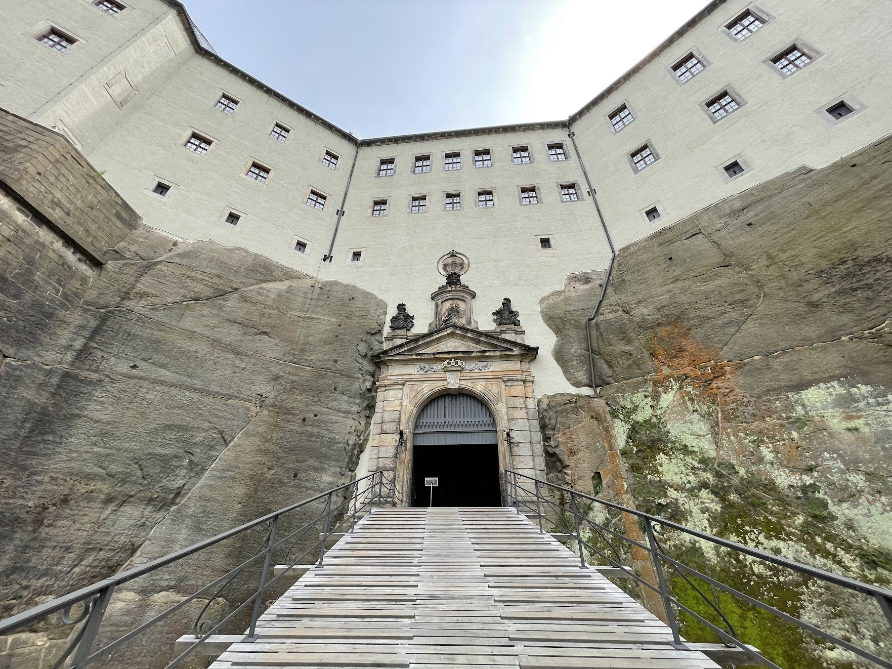
It is quite easy to see the fortress from the bike trail, however it wasn’t obvious to me how to bike up to it. I looked at the map and tried to follow a trail that seemed to be leading up to the fortress. However the trail was very steep and after a few hundred meters, I couldn’t bike up any longer. So I locked my bike to a sturdy looking tree nearby and hiked the rest of the way up. Upon arriving at the base of the fortress, I bought a ticket and took an elevator to the top of the fortress walls. You could also enter the fortress through the main gates, but I didn’t know that at the time.
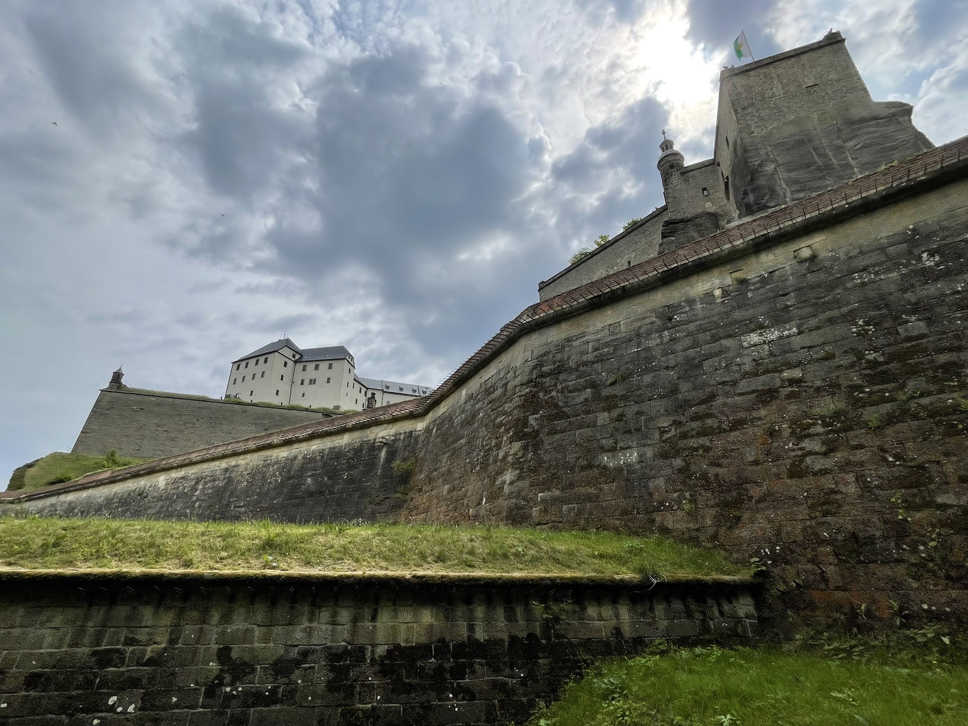
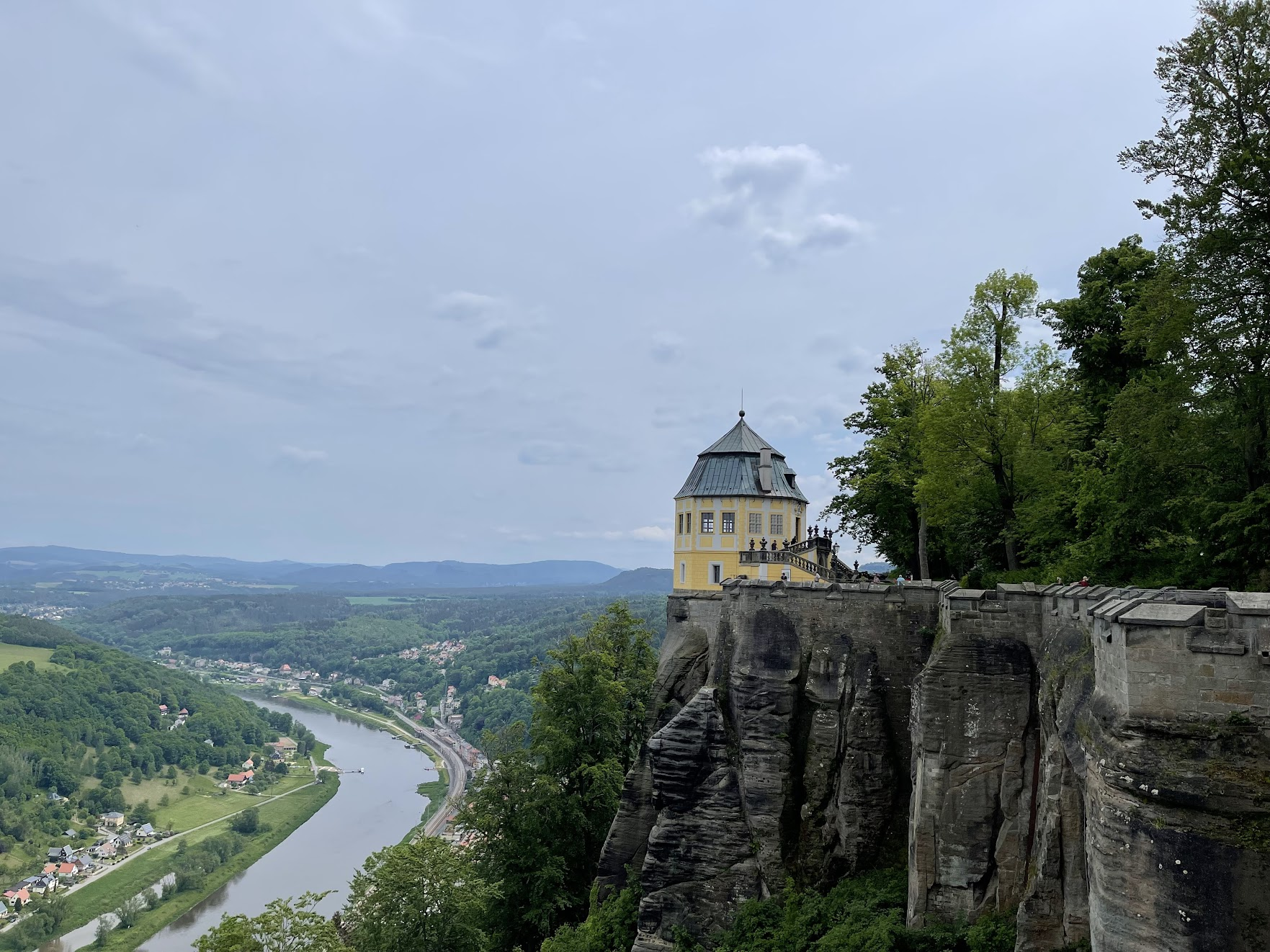
The oldest written record of a castle on the Königstein (“King’s Rock”) is found in a deed by King Wenceslaus I of Bohemia dating to the year 1233. The castle changed hands several times in the centuries that followed, ultimately landing firmly in the control of the kingdom of Saxony, one of the constituent kingdoms of the holy Roman empire, and later the country of Germany. Over the centuries, the fortress was used as a state prison, as a military fortress and even for religious purposes. Because Königstein Fortress was regarded as unconquerable, the Saxon monarchs retreated to it from Wittenberg (residence of the elector of Saxony from 1486 to 1525) and Dresden during times of crisis and also deposited the state treasure and many works of art from the famous Zwinger (art museum in Dresden) here. It was also used as a country retreat due to its lovely surroundings.
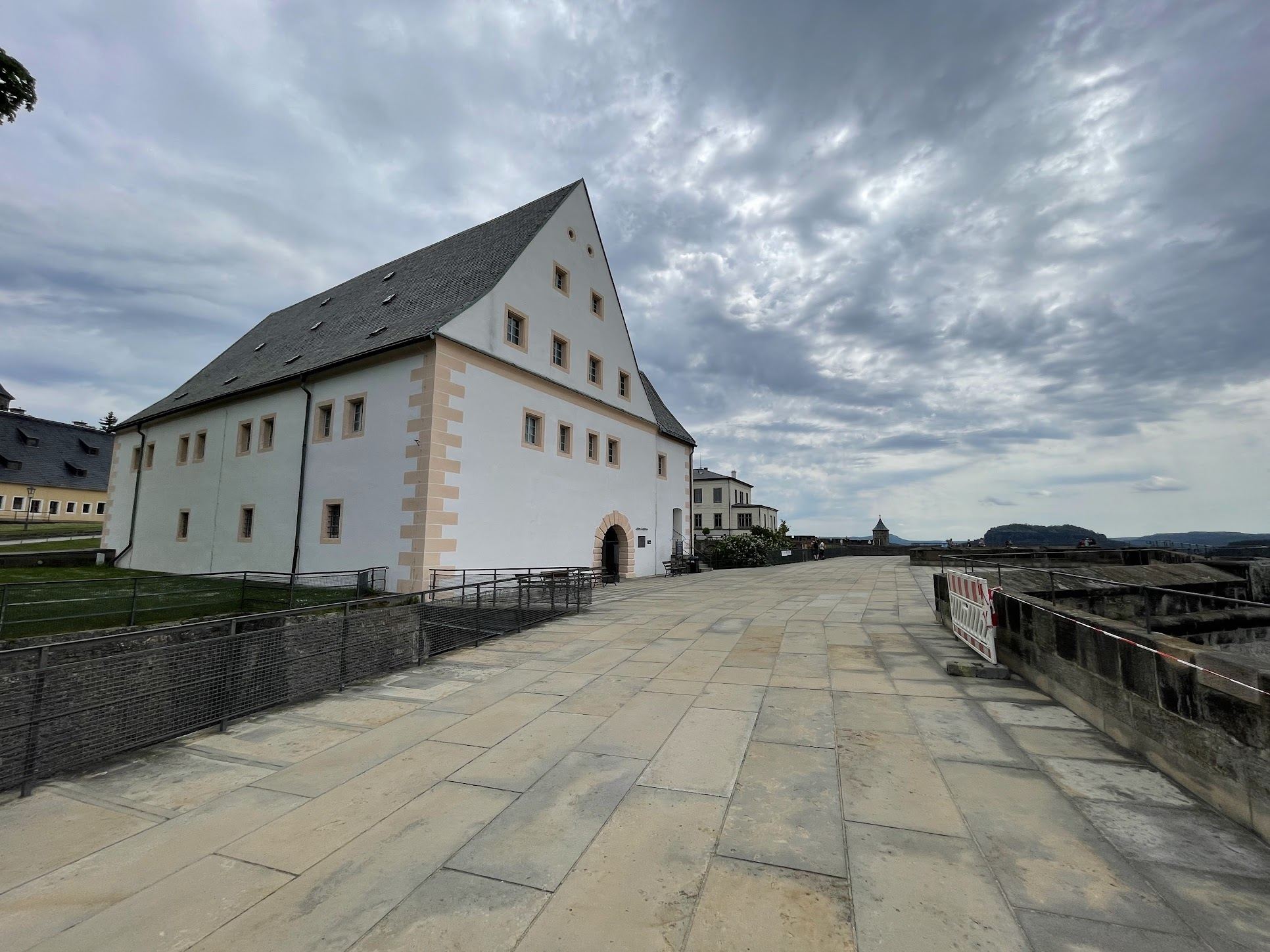
There are several buildings in the fortress one can visit. I visited the armory that exhibited several canons and canon balls, a description of how gunpowder is made, the first hand-held rifles etc. The canons mounted on the fortress walls never posed much of a challenge to any adversarial ships traveling on the Elbe or to troops near the base of the fortress because the canon barrels could not be pointed below the horizontal (otherwise the canon ball would simply roll out of the barrel).
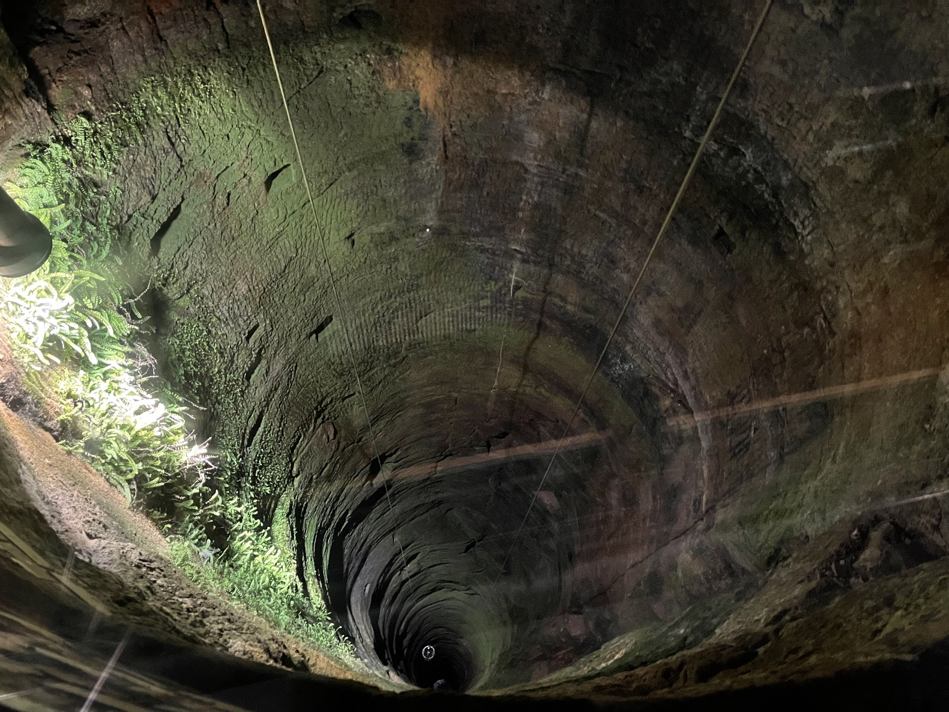
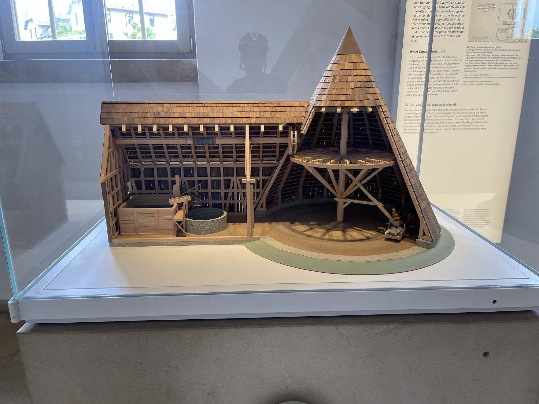
In 1563, by order the elector August, the deepest well in Saxony was sunk (152.5 m) under supervision of the master miner Martin Planer from Freiberg. This independent water source made it possible to support a permanent, large settlement in the fortress and fueled expansion of the fortress. According to an information display near the well, the miners arduously dug their way into the hard rock, equipped only with chisel and hammer. They received a certain pay for each 20 cubic-meter of rock removed, depending on its hardness. The miners climbed down into the well using a scaffolding. For this, they cut four square holes into the wall and fastened beams constructing intermediate floors which were then connected by ladders. In addition to the hard cutting work, the miners had to transport the cut rock and incoming water upwards. Astonishingly, the bulk of the work was completed within only two and half years (train connection to the Dulles airport – are you reading this?)
The well is still in operation, although the water is drawn from a motor operated pulley system, rather than using horse power (what a pity)..
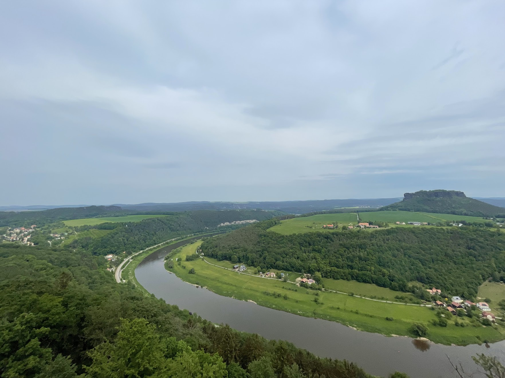
I also enjoyed walking along the walls of the fortress and the breathtaking views of the landscape, particularly the Elbe river.
I exited the castle from the main gates, which are largely unchanged from medieval times and are quite an imposing sight.
From Konigstein, I continued along the bike trail passing by some beautiful houses and well-maintained gardens. Near the town of Kurort, I saw a nice view of the Bastei bridge, which I had visited on a previous trip.
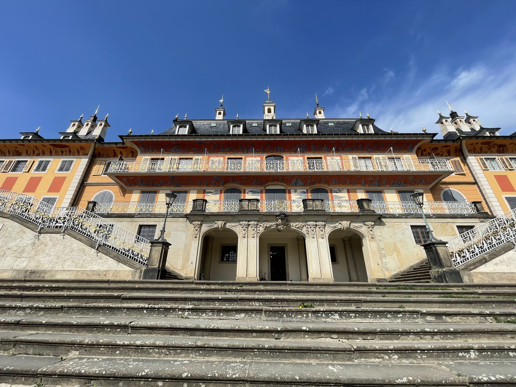
The next stop was the Pillnitz chateau. The activity guide recommended stopping by in the medieval town of Pirna for lunch. However I passed Pirna without realizing it. This was one of the many times during the trip I wished the map provided by the tour had the recommended activities of the day marked clearly on the map..
The day was pretty hot and I was getting a bit tired and hungry. I crossed the Elbe river to the town of Copitz to find a good place for lunch, but didn’t see anything compelling. Frustrated and a bit annoyed, I decided to continue along to Pillnitz hoping to find a good restaurant near the castle. I finally arrived at Pillnitz around 4:30 when the museums had already closed. I got myself a big lunch and a well-deserved glass of wine and contended myself with taking a picture of the Pillnitz palace with the Elbe river behind me.
From Pillnitz, it was only about 10 km to Dresden. I made a short video of the view as I got closer to Dresden.
Finally, upon arriving in Dresden, I crossed the Elbe for the last time (for the bike trip) and made my way to the hotel, concluding an incredible 5 day journey, sure to be the first of many such trips in the future!
That’s it! I hope you enjoyed reading this trip description and found it useful. Please leave a comment if you did! 🙂
Looking good Ankur! That castle on the mountain is amazing!
Thanks Yegor! 🙂
Thanks for this wonderful article!