
In this post I’ll describe biking the Alpe-Adria trail from Salzburg, Austria to Grado, Italy from May 25th – 31, 2025. The trail is so called because it starts in the Alps and ends by the Adriatic sea. I’ve done two multi-city rides in Europe now, from Prague to Dresden in 2022 and along the Loire valley in France in 2024 and greatly enjoyed both experiences. With its high population density, varied landscapes, old and rich history and amazing cuisines, Europe offers scores of fantastic multi-city biking options. I’ve decided to make biking in Europe an annual tradition :-).
Unlike the Loire valley trip that I booked a week before departure with only one tour company willing to accommodate me and a small number of routes available at such a short notice, I had more time to plan and more routes to consider for this trip. I spent a few days looking at self-guided tours on the Natural Adventure website. Previous tours were both along rivers and rated easy. This time I wanted to do a more strenuous tour with a more varied landscape. I also wanted to include Italy in the itinerary, as it had been almost two decades since I last visited Italy. Some tours I considered were the Habsburg trail from Vienna to Trieste, across the Alps from Munich to Venice, Cycling Via Francigena: Siena to Rome and a few others. Ultimately, I picked the Alpe-Adria trail because it was the right number of days (6 days of biking), covered a variety of landscapes (mountains, river valleys, rolling hills, urban/rural areas) and had the right level of difficulty. I considered booking through NaturalAdventure, but ultimately booked through Euro Bike, an Austrian company that specializes in tours around Austria. I did so because:
- They offered more bike options. I wanted a lighter, sportier bike and Natural Adventure didn’t properly respond to my inquiries about bike weight. EuroBike had a gravel bike option that was lighter and sportier
- They offered the ability to add nights at cities along the way.. this is useful if you want to have a day of rest during the bike trip and more time to explore the area
- They were about 10% cheaper than NaturalAdventure.
I already covered what to bring in my previous post about biking in the Loire valley. Pedals with toe cages/foot straps are important, because they let you generate power throughout your pedal stroke rather than only when you are pushing down. This also engages more of your leg muscles, thereby extending your range and delaying fatigue. I find toe cages particularly helpful while biking uphill.
I requested EuroBike for a bike with toe cages already installed on the pedals. They responded that I could bring my own pedals and swap the ones on the bike with mine. So I ordered these pedals from Amazon and carried them in my luggage. They are quite cheap and light and don’t take up much space. I also considered bringing a tool to replace the pedals myself, but a local bike shop in NYC recommended just asking a bike shop in Salzburg to do the swap. EuroBike also said that the bike delivery person could do the swap.
One thing I didn’t bring but wish I had is a phone charging battery pack or a high power phone charger. Because you are using a map application (which in turn uses GPS) continuously while biking, your phone will run out of battery in 5-6 hours and having a quick charging battery pack is helpful. I was able to get by stopping at cafes/bars to charge my phone, but wish I had carried along a battery pack.
Trip Summary
The table below shows the distances covered on each day (which can vary a bit depending on how many detours you take along the way), some points of interest along the way, difficulty level and things to do in the destination.
| Day | Source/Destination | Distance | Places of Interests | Difficulty | Things to do in destination |
|---|---|---|---|---|---|
| 0 | Arrival in Salzburg | 0 | - | - | Hohensalzburg fortress, old town, Sound of Music tour, Mozart concert, Mirabel palace |
| 1 | Salzburg to St. Johann | 70 Km | Golling waterfall, Hohenwerfen fortress Landgasthof Reitsamerhof restaurant for lunch | Moderate. Consistent but gradual incline. | Not much |
| 2 | St. Johann to Bad Gastein | 44 Km | Liechtensteinklamm waterfall, | Strenuous. Steep hills in the middle and then steep approach to Bad Gastein | Felsentherme spa, Bad Gasteiner waterfall, walk around town, dinner at Angelo restaurant |
| 3 | Spittal to Villach | 44 Km | None | Very easy | Parish Church of St. Jakob (panoramic city views from top), KärntenTherme spa, paddling on the Drava river, Landskron castle |
| 4 | Villach to Gemona | 110 Km | Pass by several tunnels, cross Italian border near Tarvisio | bit hilly to Tarvisio, easy downhill for the last 60 Km to Gemona | Gemona castle |
| 5 | Gemona to Udine | 64 Km | Forte di Osoppo | Moderate, gradual incline for the first half, then downhill | Piazza Libertà |
| 6 | Udine to Grado | 60 Km | Towns of Palmanova and Aquileia | Easy, gradual downhill all the way |
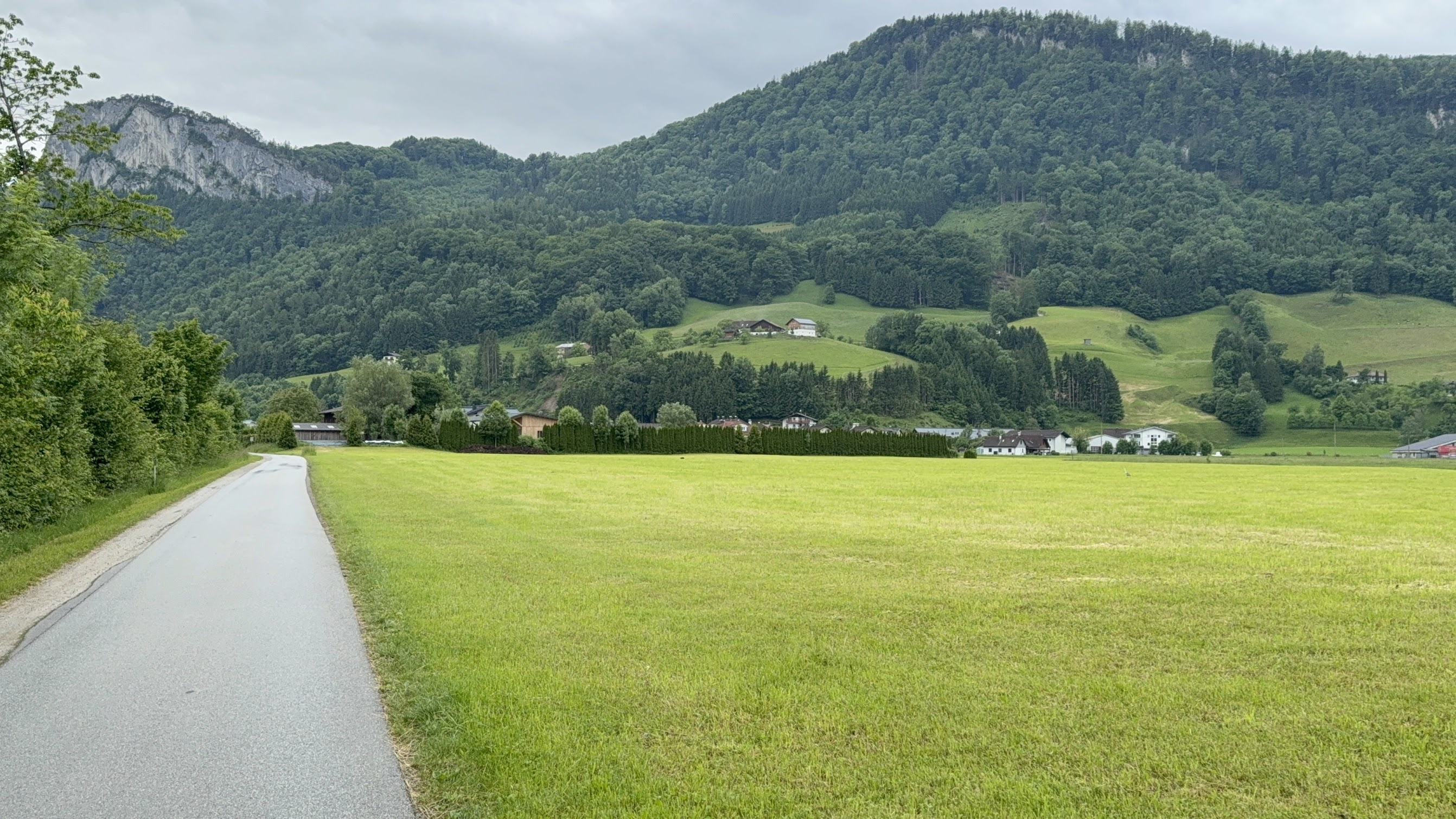
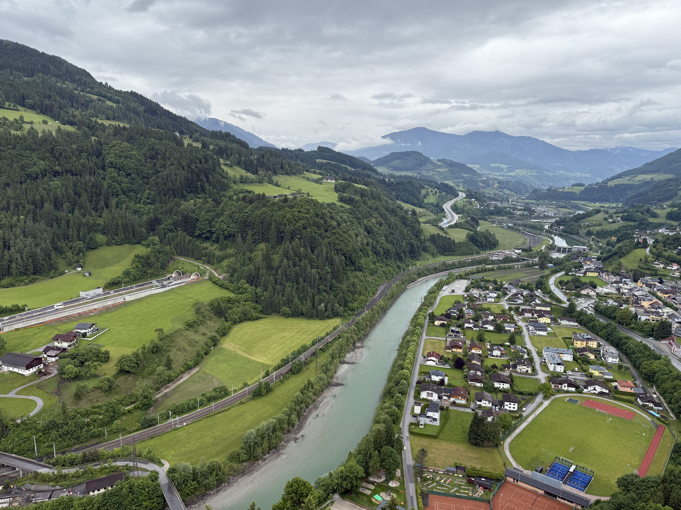
You are in an alpine environment from Salzburg to Villach, with sweeping views of the Alps. During my trip, the weather was cool and a bit wet in the Alps and I had a fleece on and had to put on my rain jacket part of the way. Once you cross the Italian border near Tarvisio, you leave the Alps behind and the weather gets drier and sunnier. I was in bike shorts and t-shirt from Tarvisio onward. The bike rides generally follow a mountain stream (river Salzach in Salzburg, river Drava near Villach..) and weave in and out through small towns and farms. There are cafes to stop, eat, use the bathroom, charge your phone etc., every 20 km or so. Along some popular stretches, I came across food stalls right by the bike path selling coffee, snacks, water refills etc. The overall difficulty level is moderate, with some steep sections, particularly in the St. Johann to Bad Gastein stretch. There are several long but gradual climbs, easily doable with a moderate level of fitness.
The tour company uploads turn by turn directions for the bike path for each day to an app called GUIBO. You follow directions on the app much like you’d on Google maps. The app also has places to see along the way, bike repair shops, cafes, accommodation and public transport stops marked on the map. It also provides a summary of each day–total distance, elevation change, description of the route and places to see along the way. It is a bit clunky, but works ok overall. The turn by turn directions try to avoid biking along highways and follow established bike paths meandering through dirt/gravel paths between farms and through small towns. While the bike paths are marked in some places, there is a lot of turning involved and it would be quite difficult to follow the bike path without following the map on the GUIBO app. An important point to remember is that directions on GUIBO are from the center of one town to the next, not specifically to the hotel you are staying. So once you reach your destination city, you must switch to Google maps to get directions to the hotel you are staying at (booked by the tour company in advance).
The stop over towns are small to medium size, with plenty of options to eat, sight see etc. The final destination Grado is a nice town with a beach, water sports (I saw several kitesurfers), boardwalk, and lots of food options. Spend a night there, if your schedule allows. I left for Venice the same day I arrived in Grado.. but wished I could spend a day there.
As usual for me, history podcasts and Pink Floyd kept me company along the way. I listened to the story of Hannibal crossing the Alps from Spain into Italy with his herd of elephants on the Rest is History podcast and the big three (Roosevelt, Stalin and Churchill) coming together to decide the fate of post war Europe at Yalta in Jan 1945 on the Empire podcast.
Day 0: Arrival in Salzburg
Summary: Hohensalzburg fortress, old town, Sound of Music tour, Mozart concert, Mirabel palace
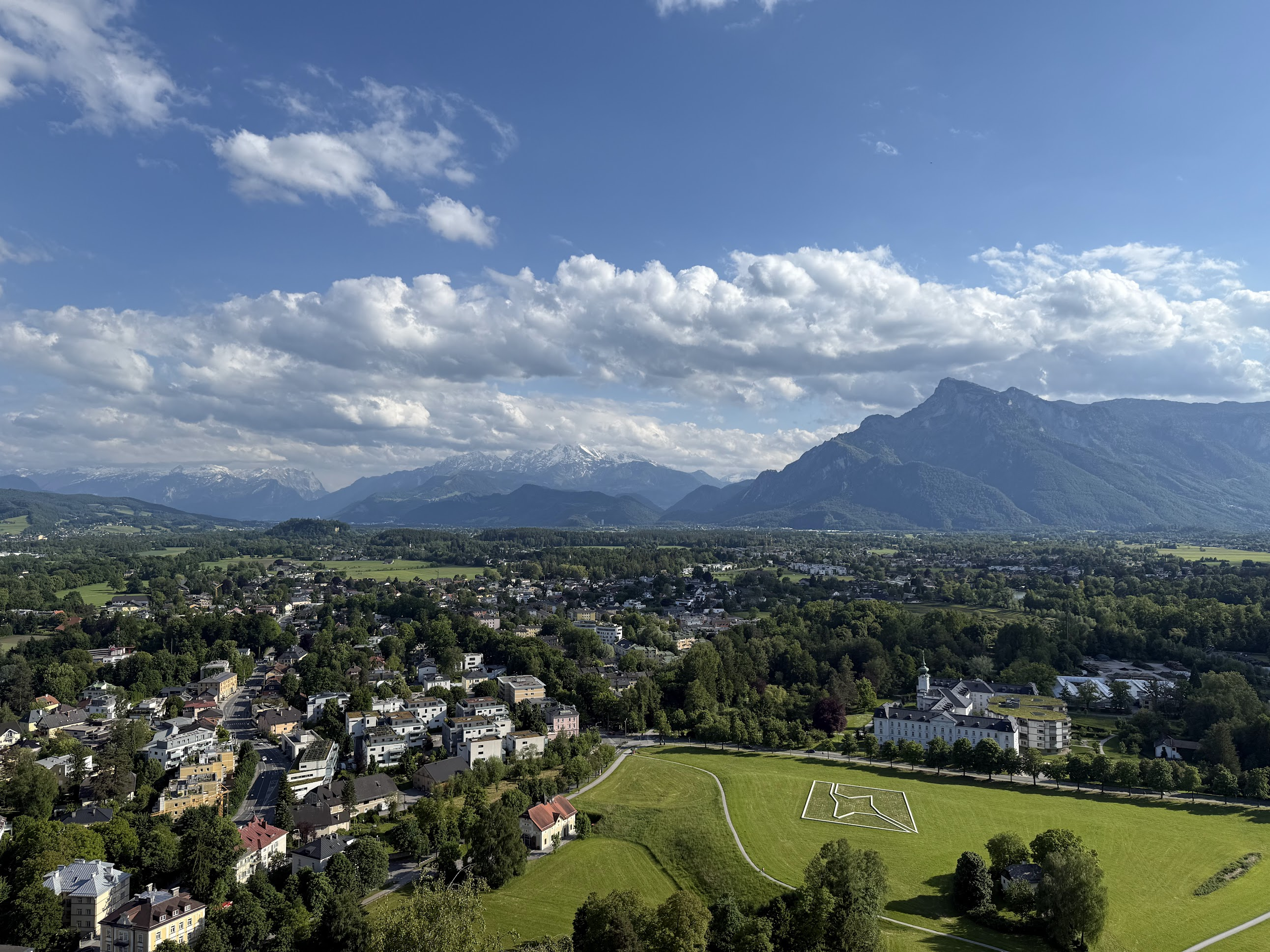
To arrive at Salzburg, I flew into Vienna and took the train to Salzburg. It takes about 3 hours to cover the 250 Km. Located near the German border, Salzburg (meaning “Salt Fortress”, because salt mining was an important industry in the city’s early history) is a city where art, history, and nature meet in perfect harmony. Salzburg is the birthplace of Wolfgang Amadeus Mozart (1756) and there are several Mozart concerts nearly every day. Many scenes from the 1965 movie Sound of Music were shot in Salzburg.
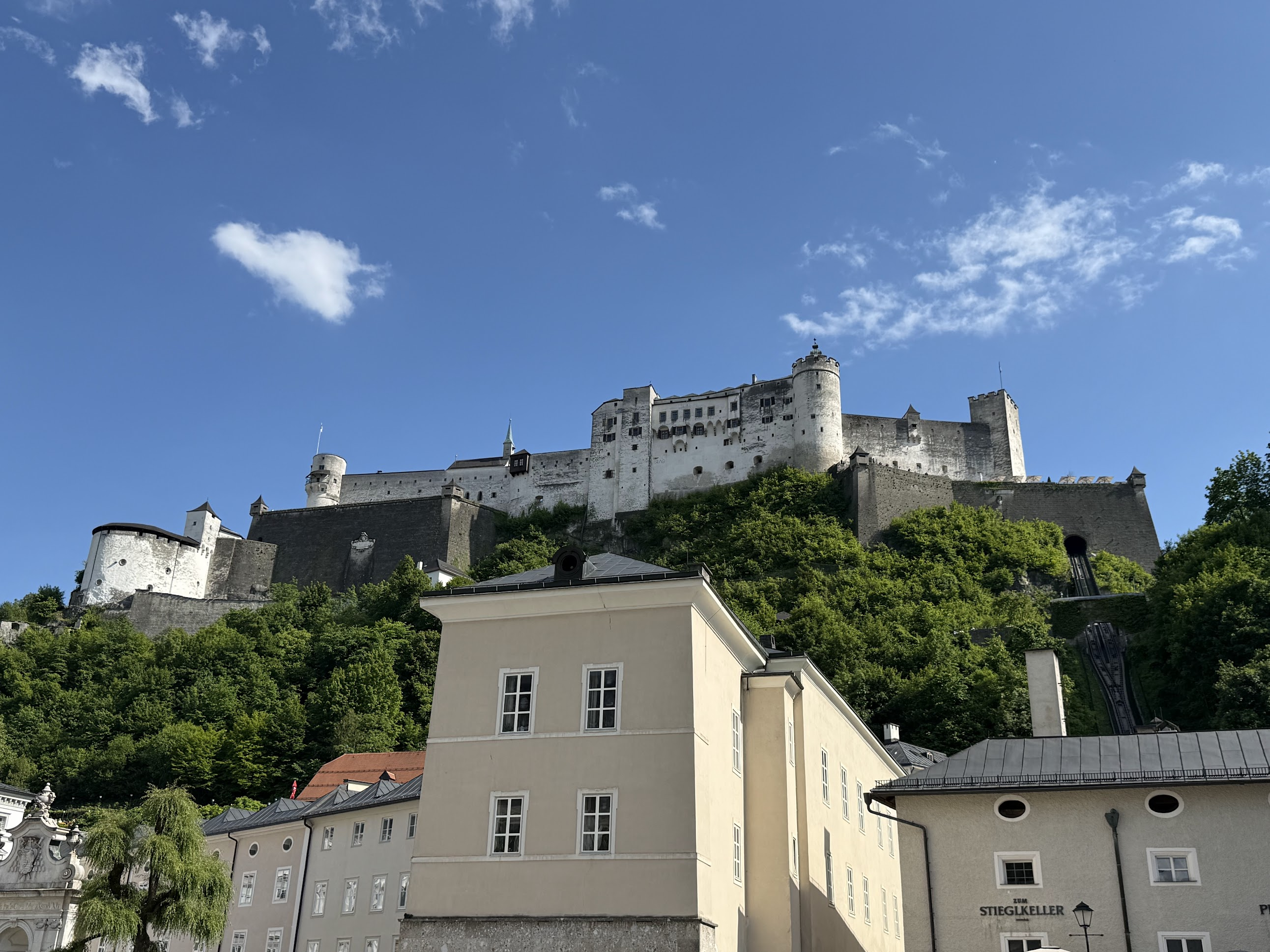
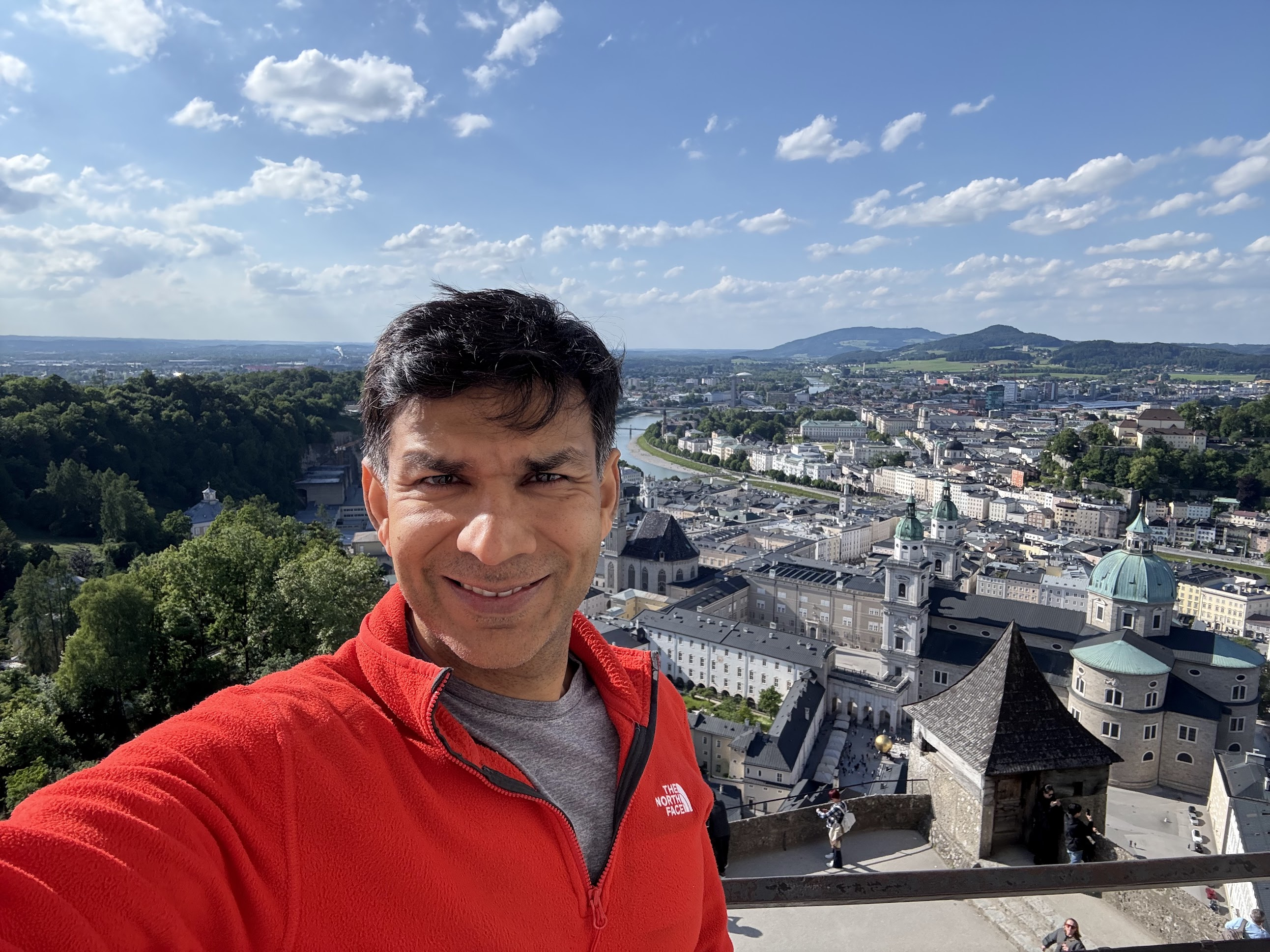
After checking in and catching some sleep, I walked over to the the Hohensalzburg Fortress, one of Europe’s largest and best-preserved medieval castles, towering over Salzburg’s skyline. The fortress offers panoramic views of the Alps, the Salzach river and the old town.
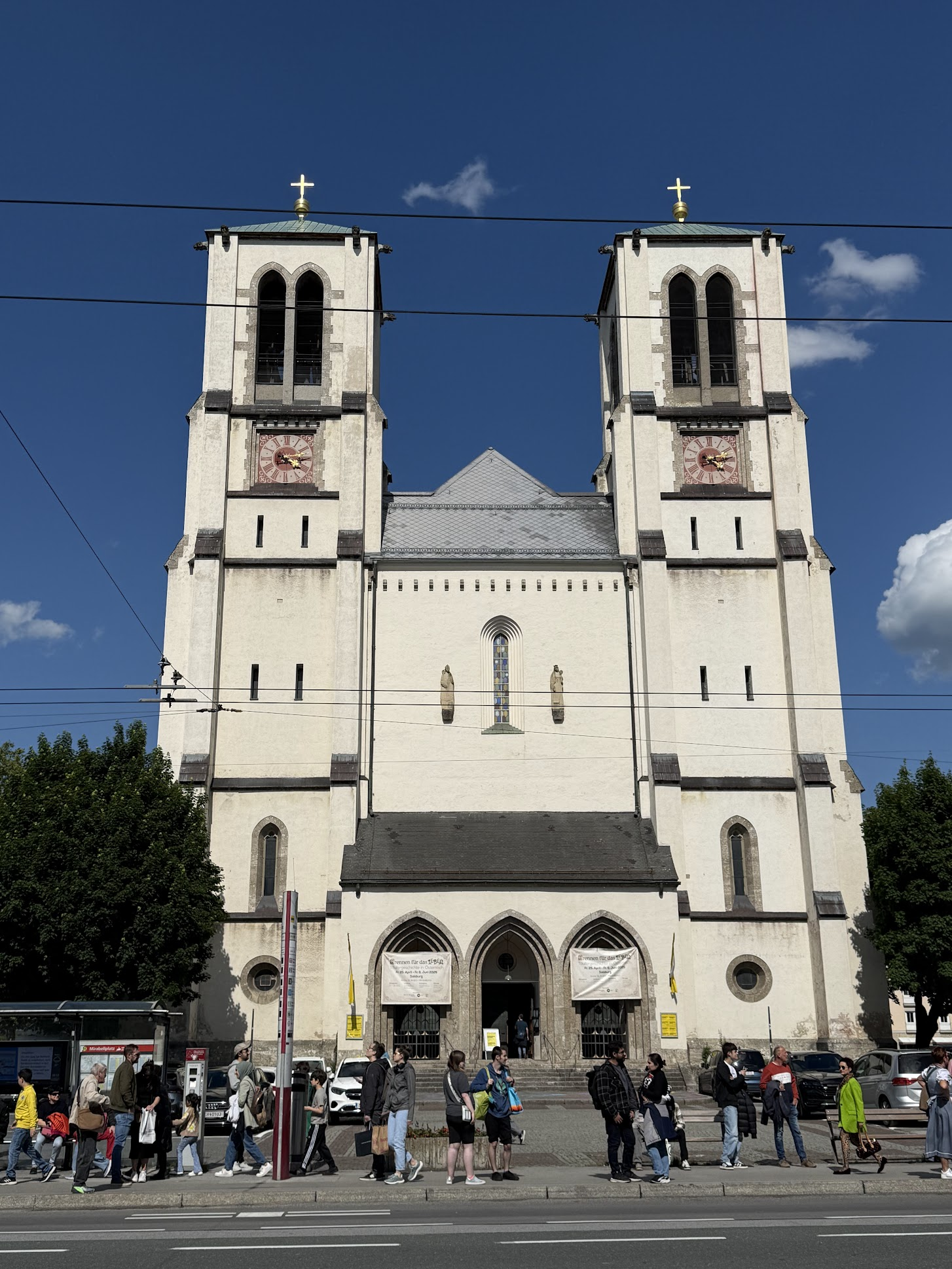
I was scheduled to meet the bike delivery person at 6PM, but it took me some time to finish the fortress tour and walk back to the hotel.. the delivery person was just about to leave when I arrived. We arranged for him to come back next morning to deliver the bike and tour briefing. I walked around some more and had dinner at Baerenwirt restaurant, which I recommend. On the way back, I walked by Mirabel palace. I also wanted to see a Mozart concert, but I finished dinner around 7:30 and most shows started at 7.. I was quite tired anyway and wanted to get a good night’s sleep before starting the bike ride next day.
Day 1: Salzburg to St Johann (~70 Km)
Summary: Gradual but steady climb towards St. Johann following the Salzach river, Goling waterfall, Hohenwerfen castle along the way. Not much to do in St. Johann
Because of the jet lag, I didn’t sleep too well, but still woke up energized and excited to start the trip.. I met with Marco, the bicycle delivery guy who gave a trip briefing, which covers things that are standard for such trips– tagging your luggage with company provided luggage tags and leaving them at the hotel reception before 9AM so the luggage transfer person can identify and transfer the luggage correctly, a package containing paper maps of the bike route and stop over cities etc. The package seems to date from the time before cell phones.. I didn’t even open it until the end of the trip. It would be far more useful if the tour company sent an email every day with a summary of what to expect.. distance covered, elevation change, places to see along the way and things to do in your destination. A bit like the table I provided in the summary above.
I had brought my own bike pedals with toe cages and asked Marco to switch the regular pedals on the bike with mine.. however the pedals were screwed on too tight and he was unable to do the switch with the tools he had on hand. Being a Sunday, no bike shops were open. So I had to bike to St. Johann with the regular pedals and stopped by a bike shop in St. Johann next morning. I got a nice breakfast at the hotel and started biking around 10 AM.
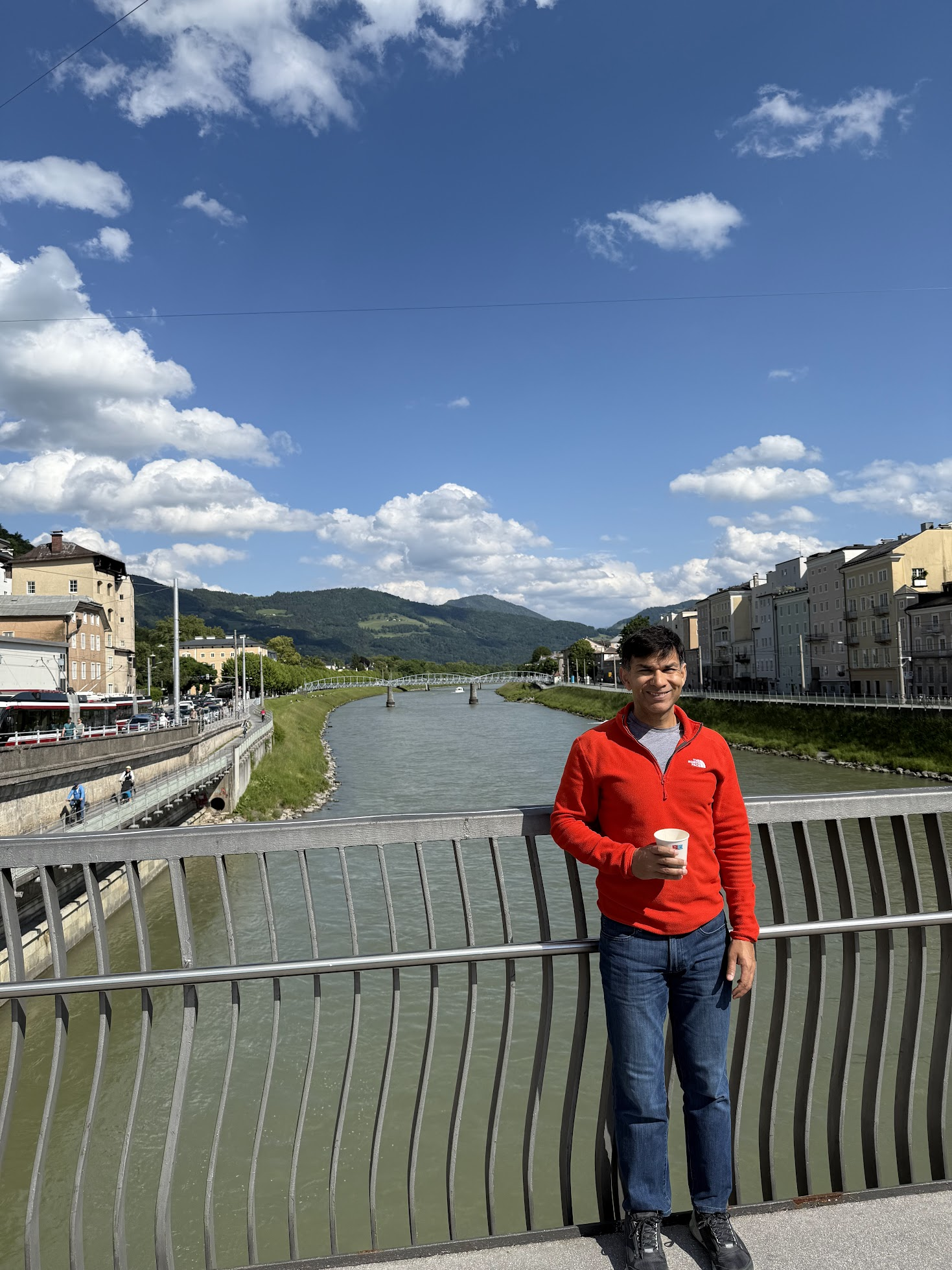
The route follows the Salzec river most of the way, with lovely views of the Alps. Passed by a couple of locks along the way.. temperature was cool, around 14 C. There was a light drizzle most of the way, but not enough to get soaked. I switched between a rain jacket and regular biking jacket. The bike path followed a mix of dedicated bike lane and a two-lane local road. The cars along the road were very respectful and steered well clear of me. It felt very safe.
I followed the Salzach river upstream most of the way–a steady, but very gradual climb up. There were a couple of steeper climbs along the way, but nothing too difficult..Lots of nice views of lovely country homes along the river, farmland with herds of cows and chicken..I passed by several bikers, some on regular bikes, some on e-bikes.
Austrian towns are very neat and clean. Houses are sturdy and well-built. I stopped at the Golling waterfall along the way with a short hike up to a nice picture taking spot. Also got a coffee and took a bathroom break
Next I stopped at the Hohenwerfen castle, a striking medieval fortress perched atop a 155-meter-high rock in the Salzach Valley, about 40 Km from Salzburg. Hohenwerfen was constructed between 1075 and 1078 under Archbishop Gebhard of Salzburg during the Investiture Controversy. Over the centuries, it served various roles: a military base, a hunting retreat for Salzburg’s archbishops, and a state prison. During WW2, it was utilized as a Nazi education camp. The castle offers stunning views of the Salzach river valley from the top and is famous for the site of the 1968 movie, “Where Eagles Dare”.
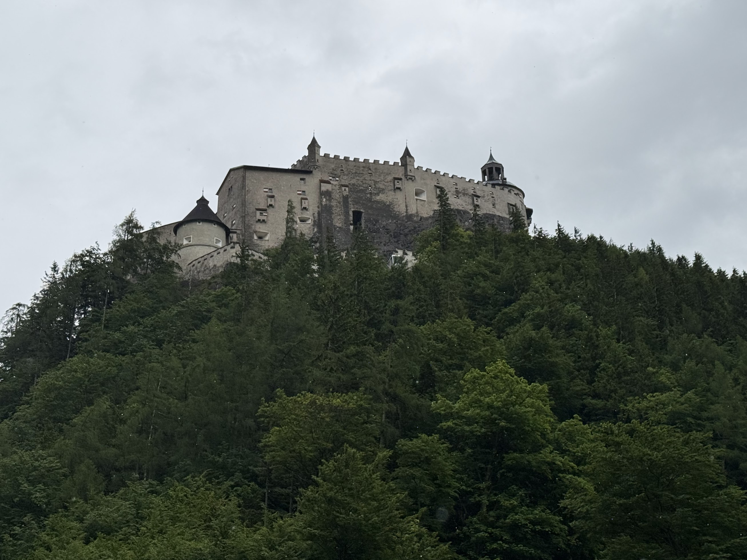
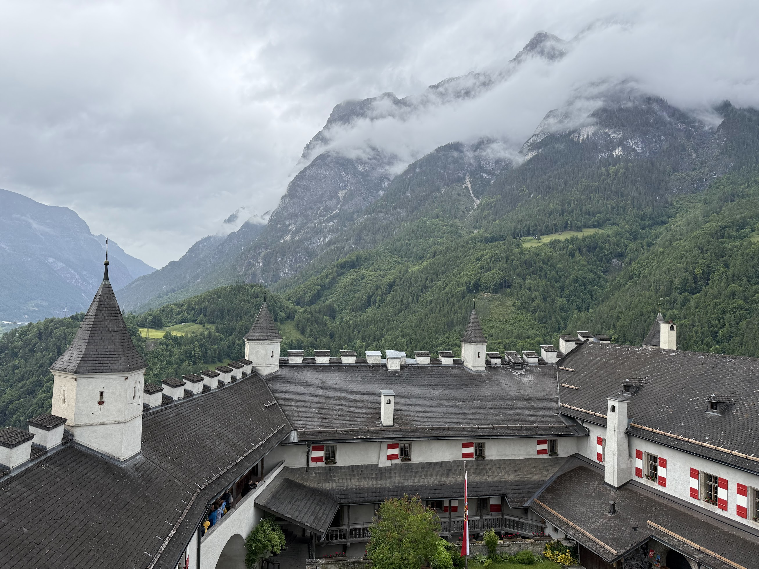
You can take a funicular to the fortress or hike up (which I what I did). There are several paths leading down from the fortress, and only one leads to the parking lot.. I got a bit lost coming down, so keep a mental note of which path you taking on your way up.
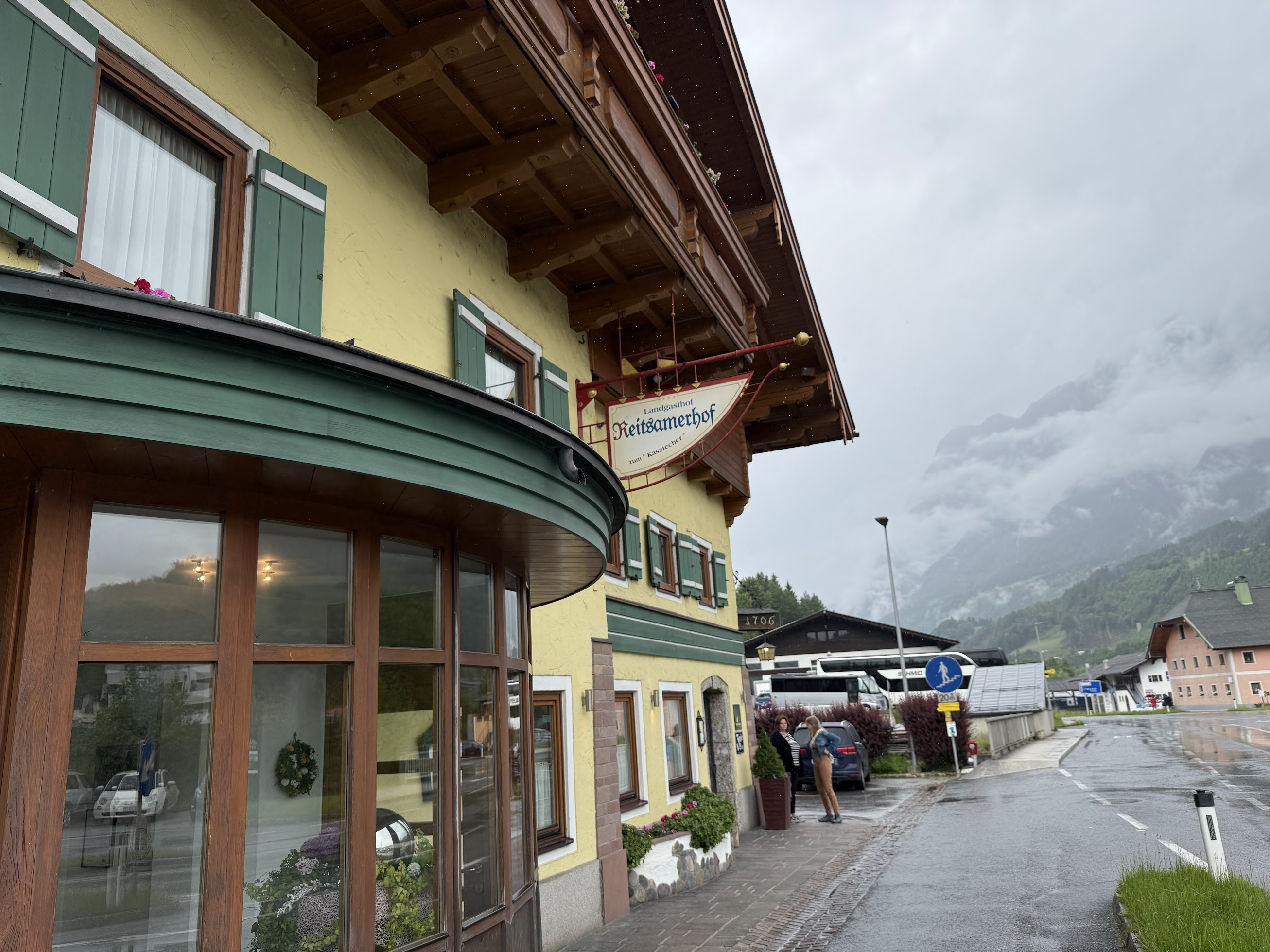
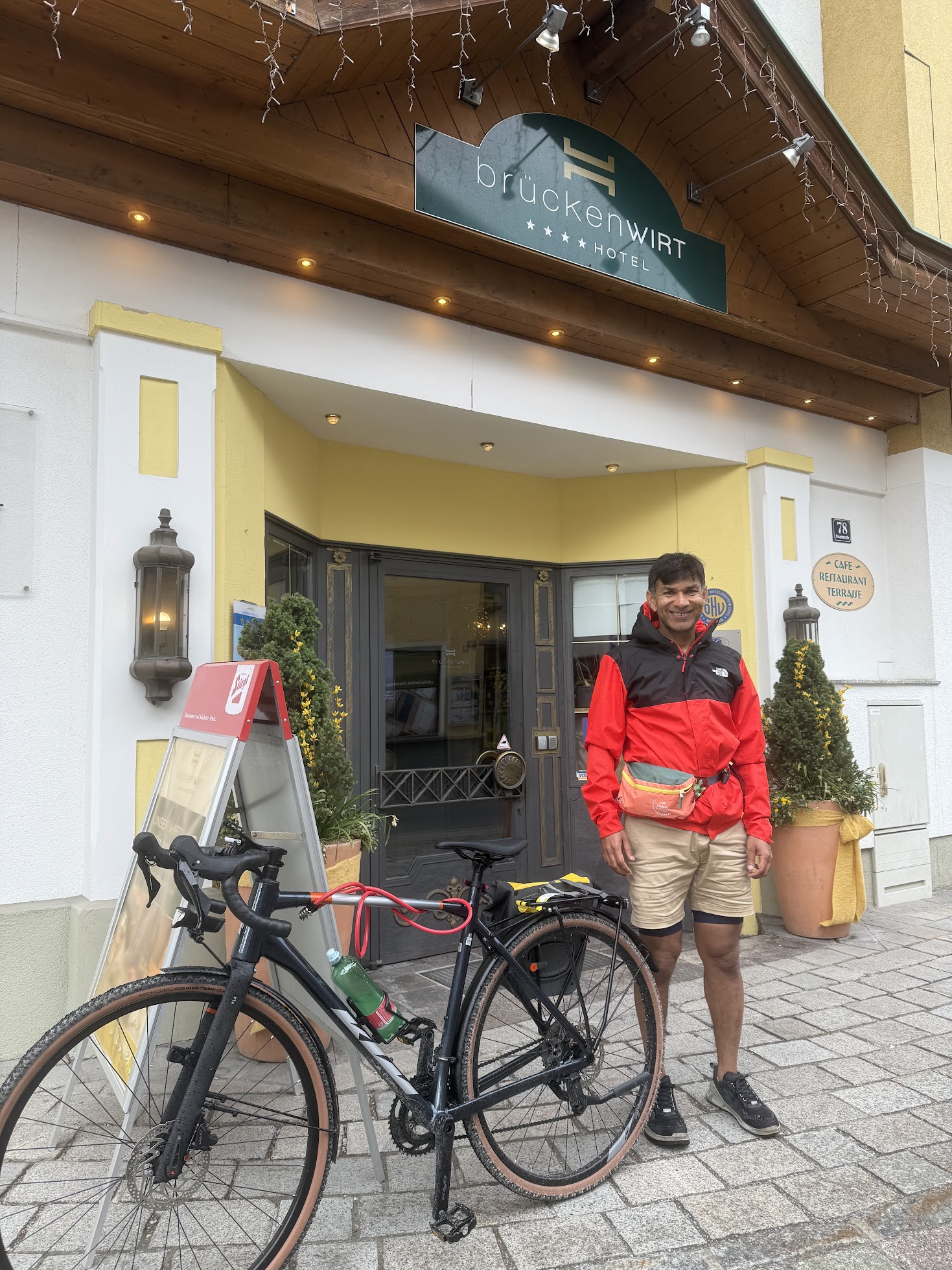
Couple of Km later, I got lunch consisting of potatoes and beef + coffee at Reitsamerhof restaurant, which I enjoyed and recommend.
I continued along the path to St. Johann, arriving around 4PM. Took a picture outside the hotel door 🙂 St. Johann is a small town, without much to do. I stayed at Hotel Bruckenwirt, a very nice hotel with a spa, sauna and heated pool in the lower level.. I lounged by the pool and read “Genome” by Matt Ridley, a great book about the evolution of the human genome, key genes on each of the 23 chromosomes in our cells, nature vs. nurture etc.
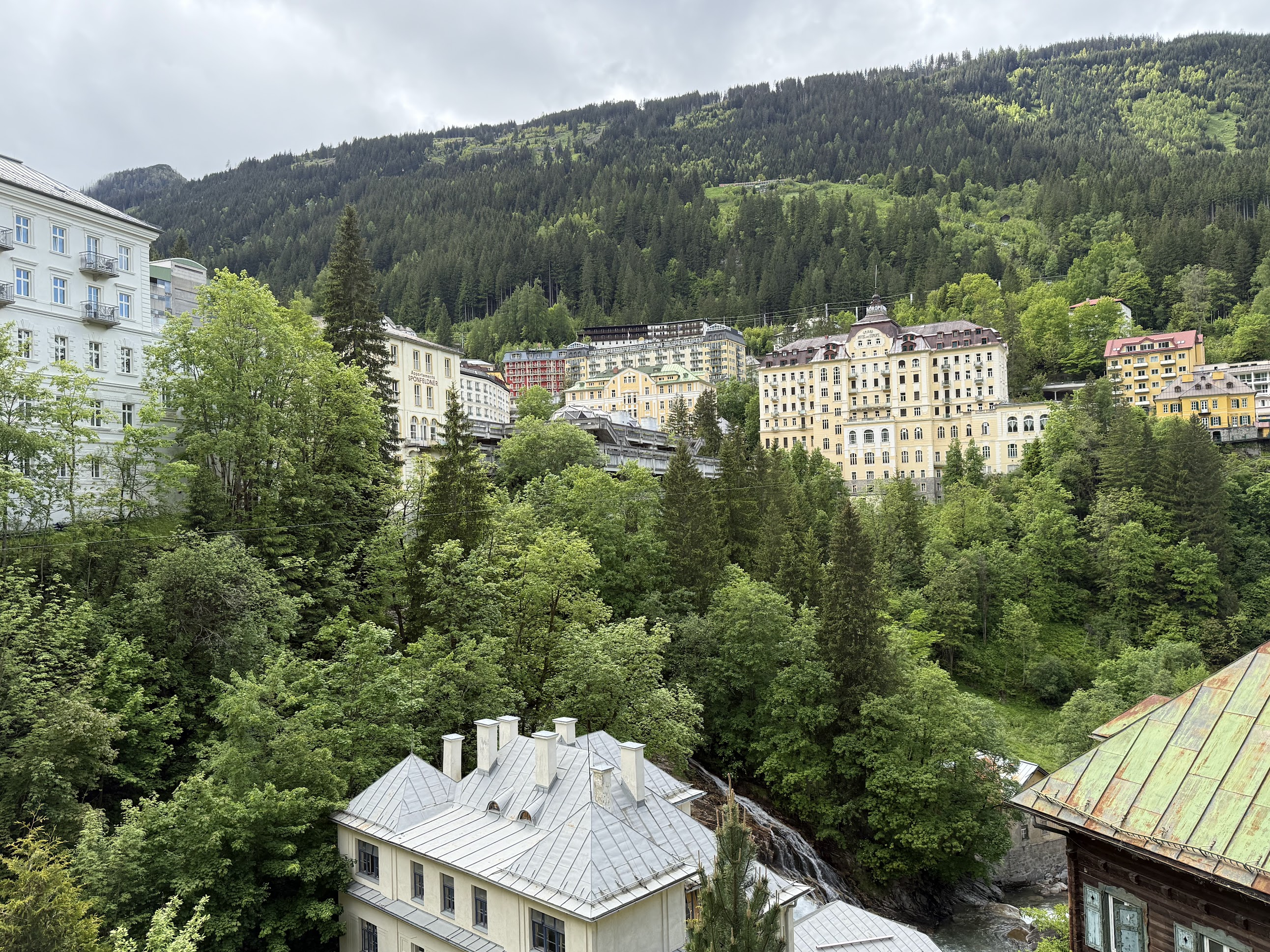
Day 2: St Johann to Bad Gastein (~44 Km)
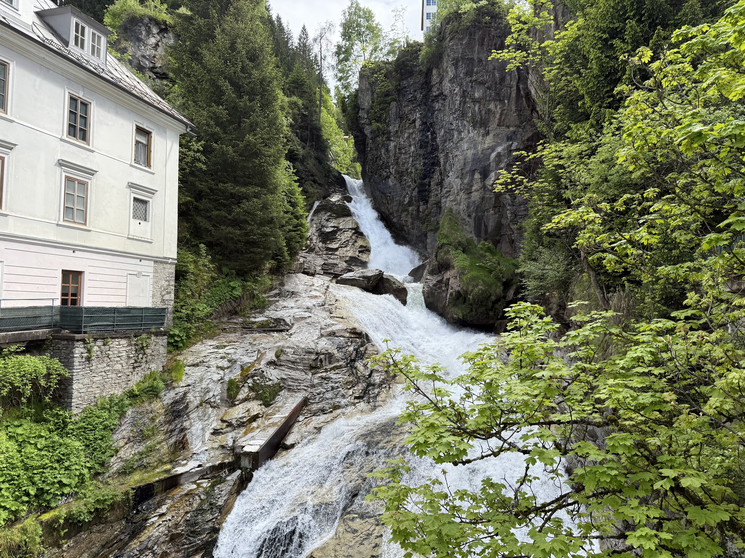
Summary: Short distance-wise, but several steep section, specially a ~3 Km climb into Bad Gastein. Liechtensteinklamm waterfall along the way. Felsentherme spa, Bad Gasteiner waterfall in Bad Gastein
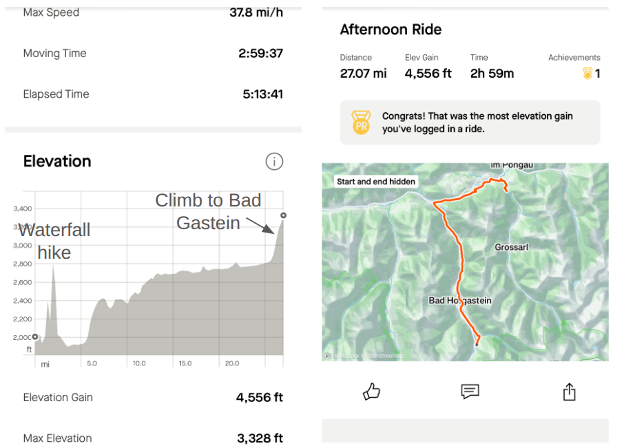
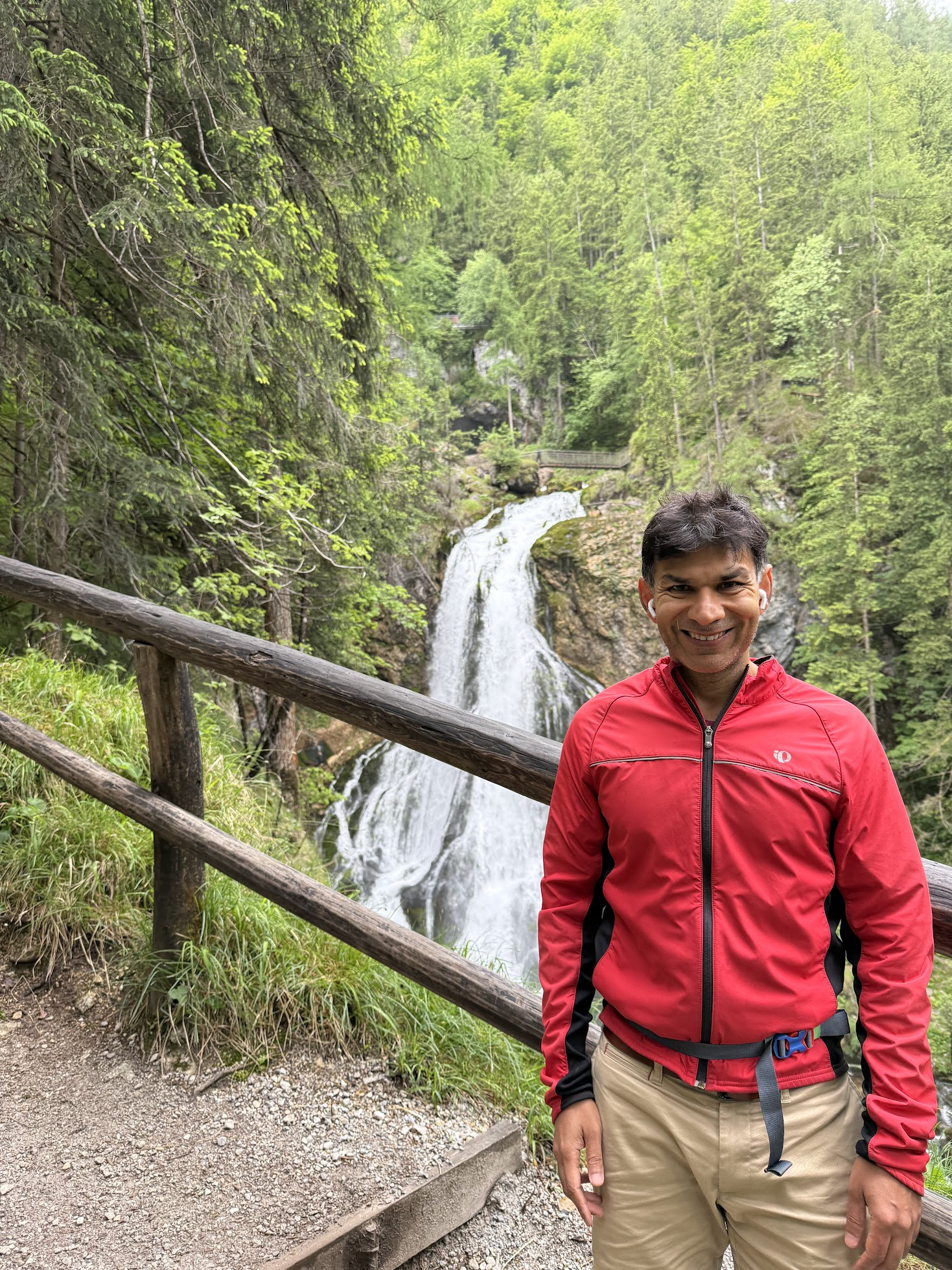
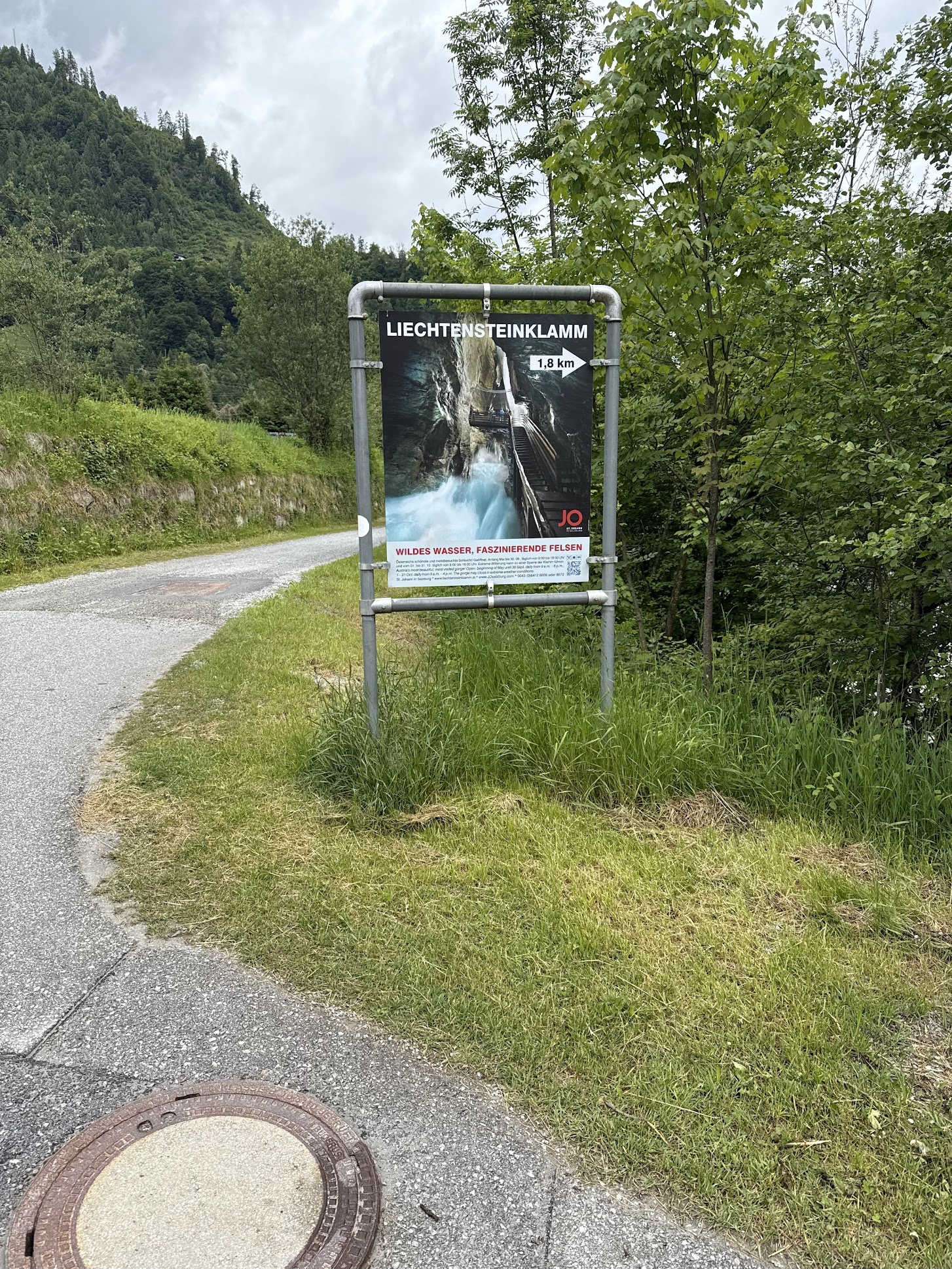
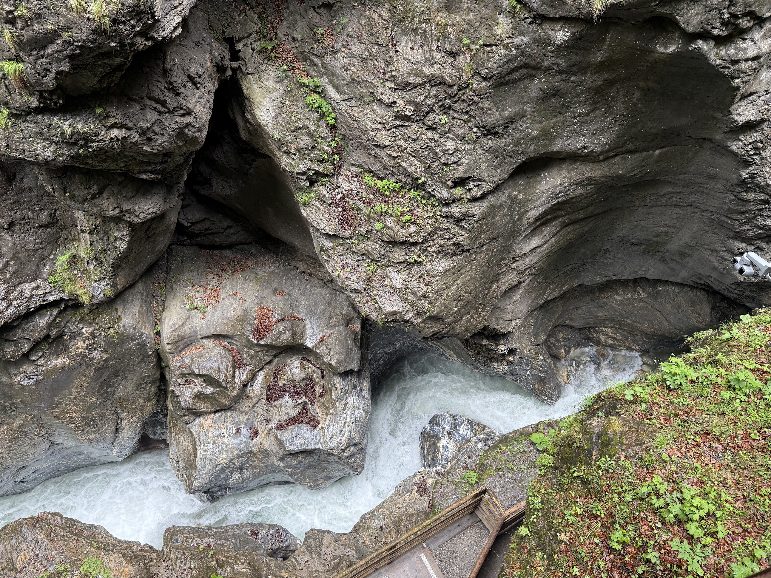
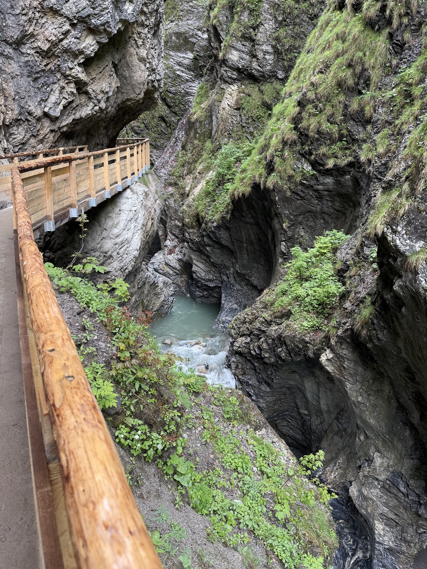
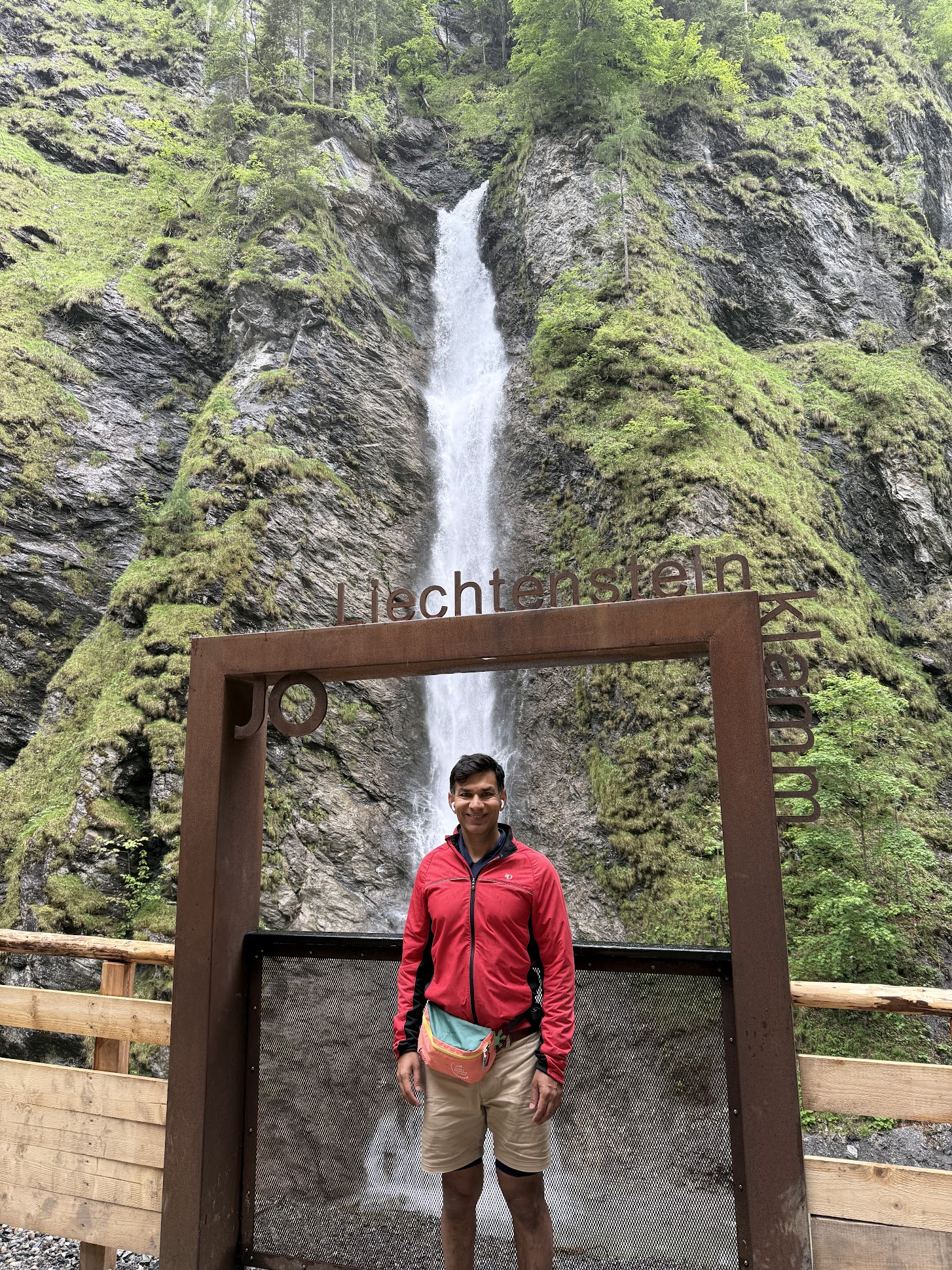
As before, I got a nice breakfast at the hotel and started the bike ride around 10AM. The weather was again cool with a light drizzle. I stopped at the Liechtensteinklamm waterfall along the way. A 1 Km walkway consisting of wooden pathways, tunnels, steel galleries, and steps built along the canyon walls leading up to the waterfall. The deep, vertical, sinuous walls reminded me of antelope canyon in Arizona I had visited earlier in May.
At 15 Euros, admission to the waterfall park seemed high, but the tunnels, stairs, and cantilevered walkways installed to access the waterfalls makes it well worth it.
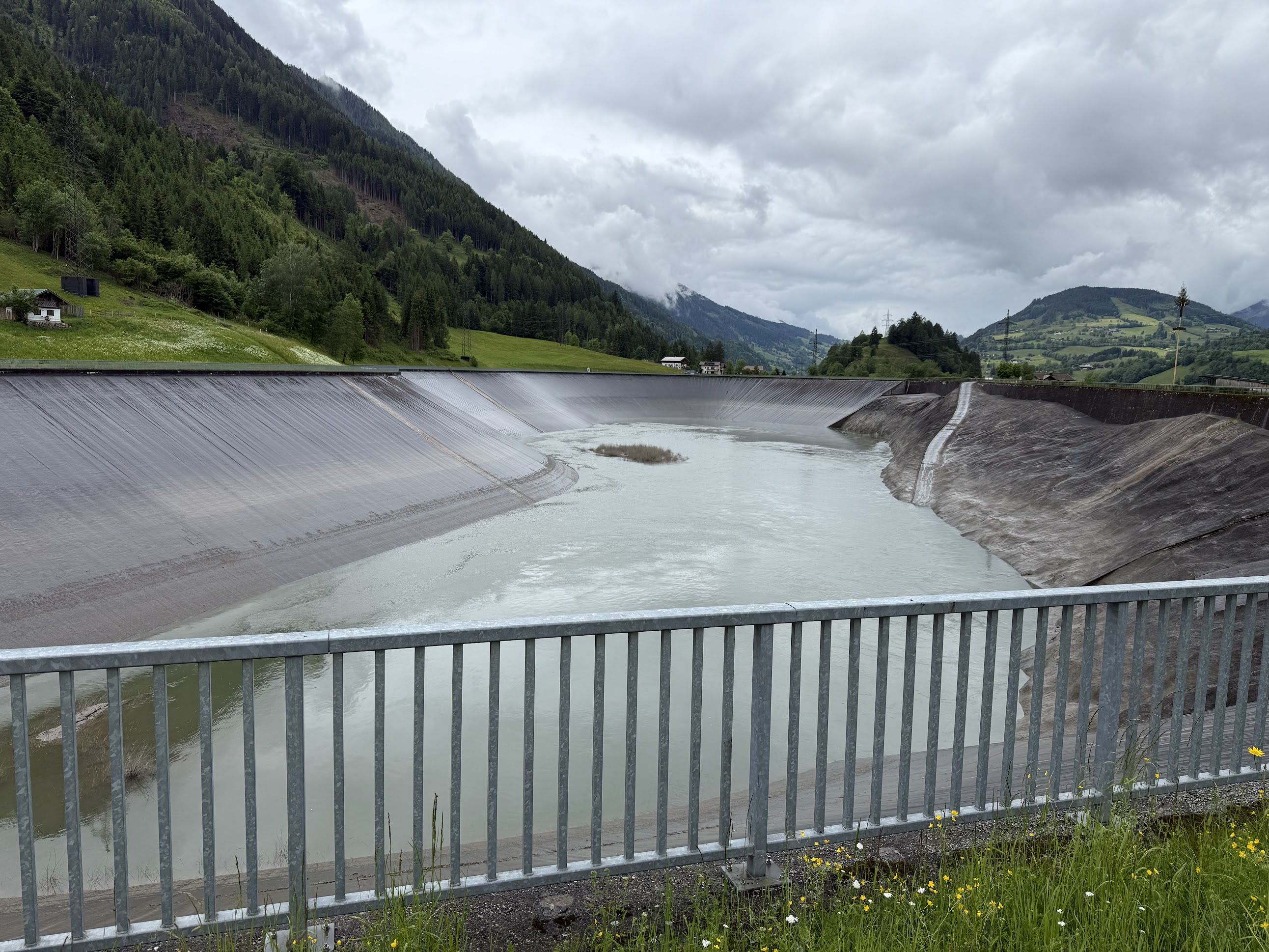
After the waterfall, the climb got steeper. I biked up and down several hills along a ridge overlooking the Salzach river. Passed by an “Ausgleichsbecken Brandstatt” or water balancing reservoir used to store water to generate hydroelectricity when water level in the Salzach river is low
The last 3 Km into Bad Gastein were quite steep and brutal. I had to stop couple of times along the way to give my legs a break..
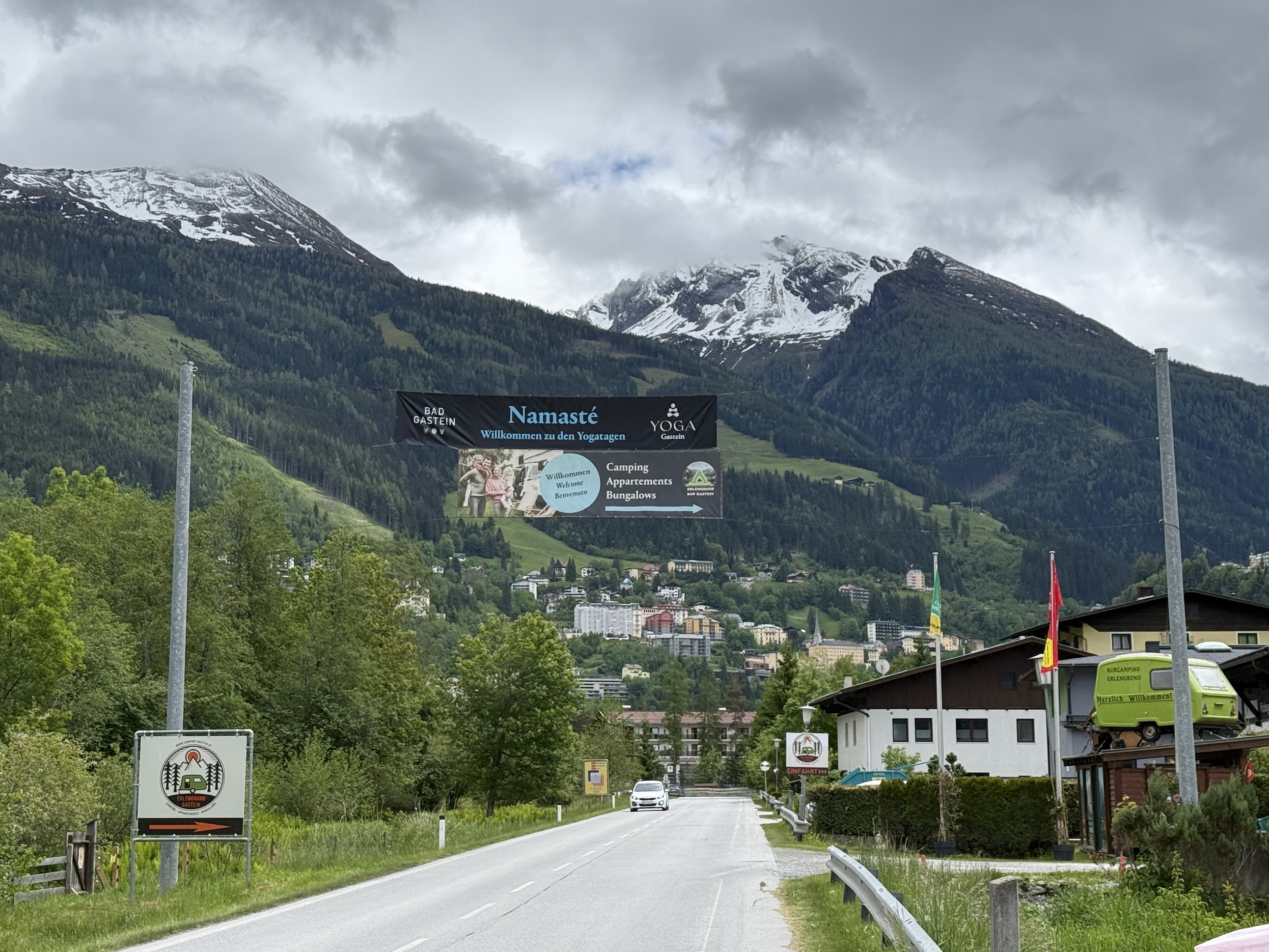
As per normal schedule on the Alpe-Adria tour, one would bike to Bockstein, a town few Km away from Bad Gastein, and take the train from there to Mallnitz. However the tunnel from Bockstein to Mallnitz was closed during this trip.. so I stayed in Bad Gastein, and was driven to Spittal, another town along the way the next day, from where I continued along the bike tour.
I stayed at Hotel Mozart. The room was ok, but offered great views of the surrounding alpine peaks from the balcony. There was a lovely dining room.
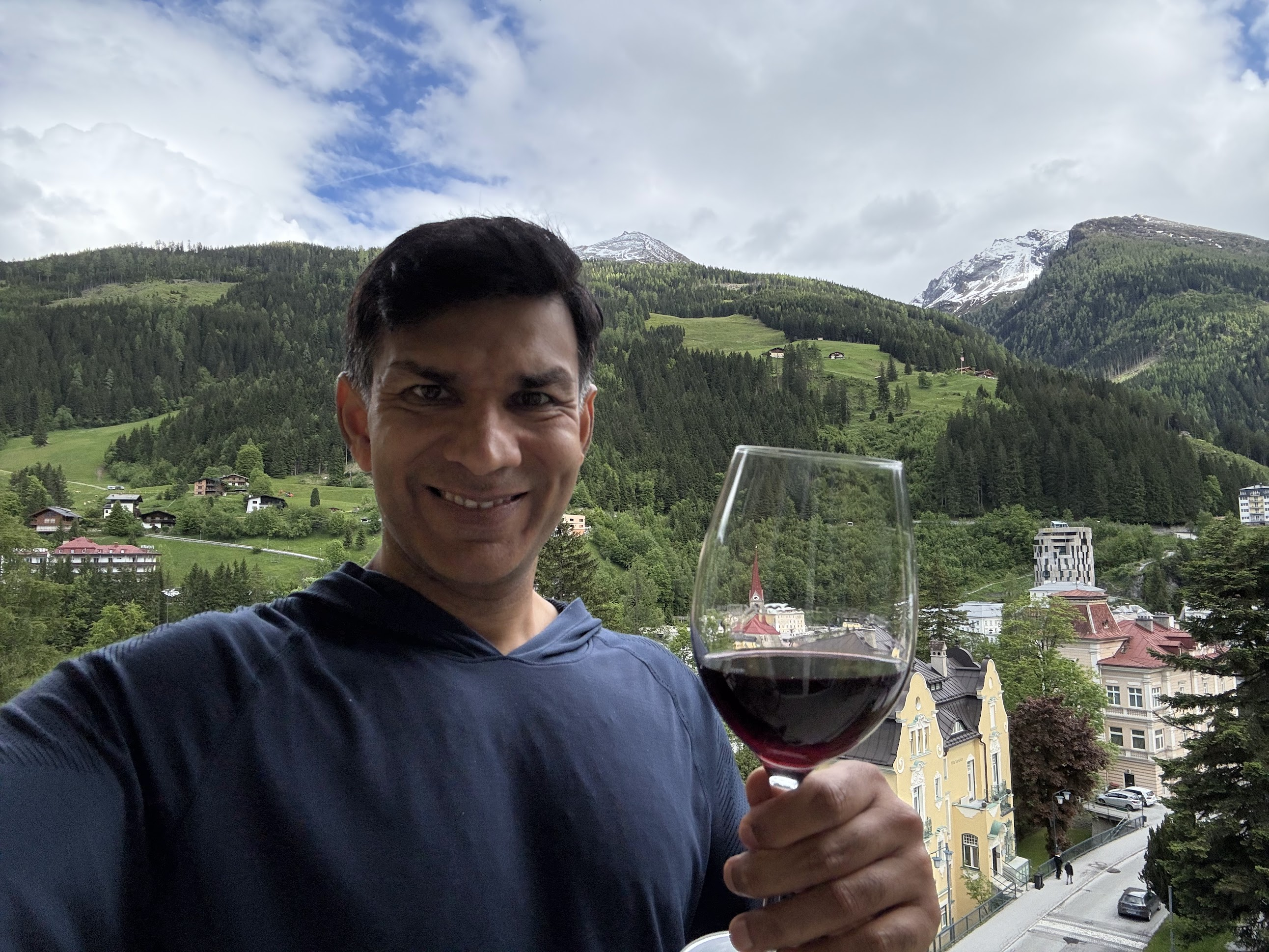
After enjoying a glass of wine on the balcony and reading for a bit, I went to the Felsentherme spa, a 10 min walk from the hotel.. The spa has an indoor and outdoor swimming pool, couple of smaller pools with warmer water, a waterfall area and a sauna, but no jacuzzis or hot tubs! The indoor pool area is surrounded by floor to ceiling windows with stunning views of the Alps. I kicked myself for not bringing a book.. would have been great to lay on a lounge chair and read for a bit.
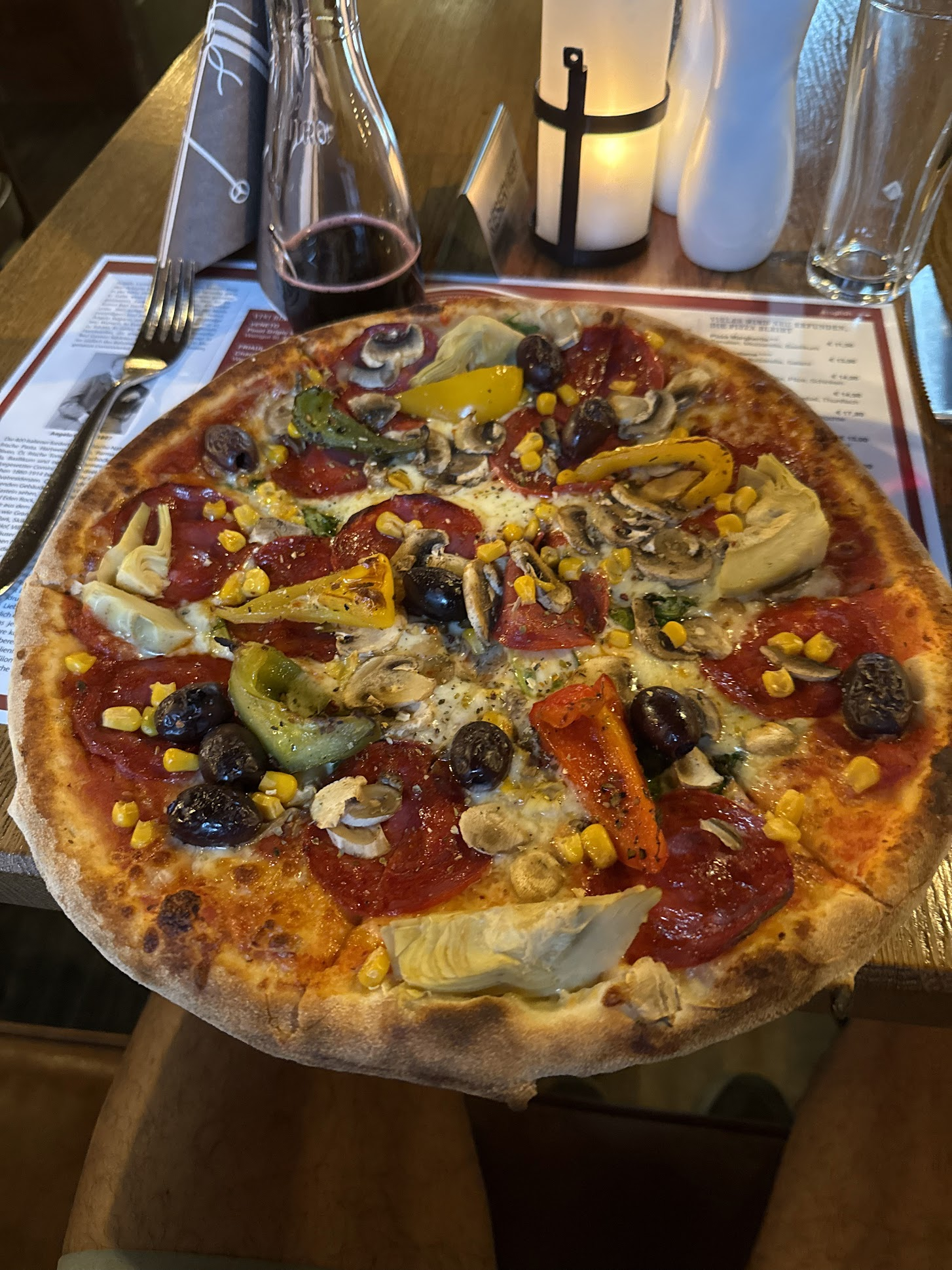
After spending about an hour at the spa, I had an amazing pizza at Angelo, a nice restaurant that normally is quite busy and hard to get a table at. I found Austrian food to be quite hearty, but missed my yogurt and blueberries, my normal post-dinner dessert..
Day 3: Van transfer from Bad Gastein to Spittal and biking to Villach (~44 km)
Summary: Easiest riding day. Downhill from Spittal to Villach. Not much to see along the way.. things to see in Villach: Parish Church of St. Jakob with its 94-meter bell tower (you can climb it!), Landskron castle (~ 8 km from Villach downtown), Villach Thermal Spa (near the train station),
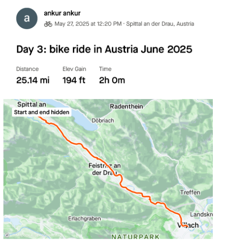
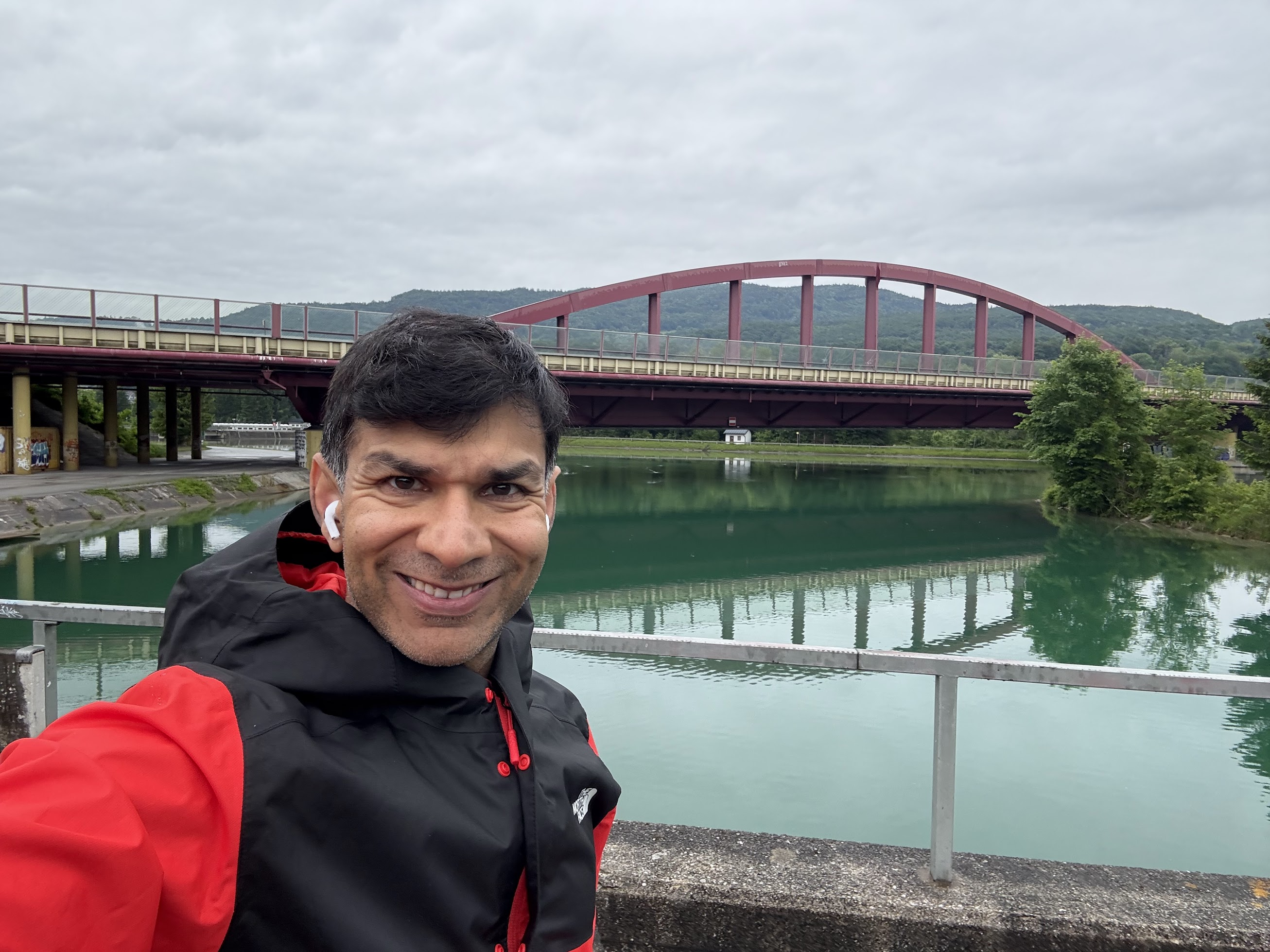
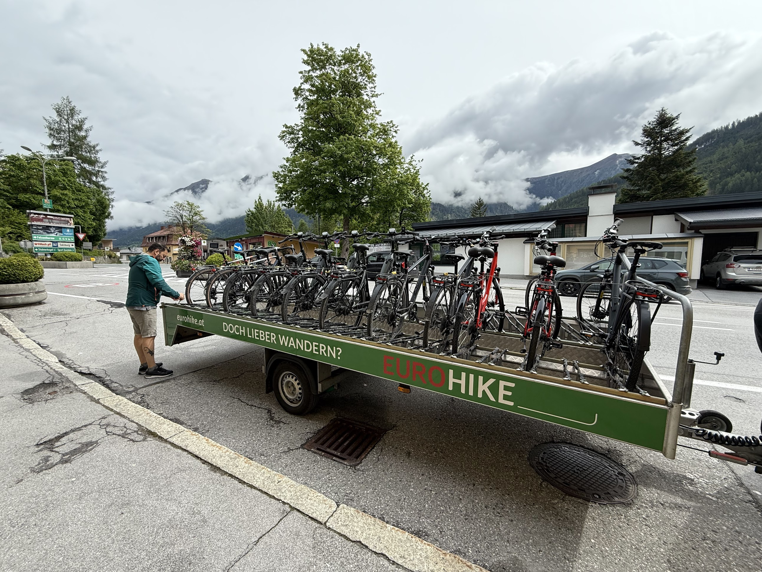
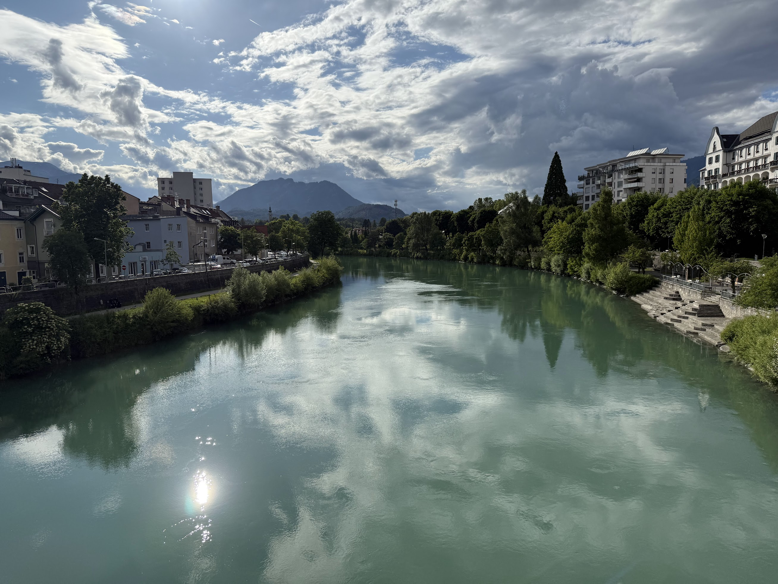
Normally, one would take train to Mallnitz the previous day and commence the bike ride from Mallnitz, passing by Spittal along the way. Because of tunnel closure, I ended up spending the night in Bad Gastein. Next morning, a driver from the tour company picked us (there were other people doing the same route staying in the hotel as well) up around 10AM, loaded up the bikes on a trailer and drove about 2 hrs to Spittal, a town we would have biked by on the original itinerary. Then I biked about 45 Km mostly downhill to Villach along river Drava. No points of interest along the way..
I stayed at hotel Palais 24, which was the worst so far.. The hotel quality seemed to be getting worse every day. My room was on the lowest level without any views..I got a soup and salad + fried chicken at the hotel restaurant, but the salad was smothered in dressing..The coffee was nice though.
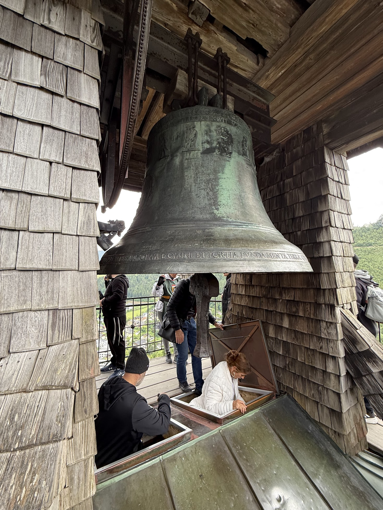
I arrived in Villach around 2 and worked for 2 hrs. Then I did a self-guided walking tour, following a map the hotel concierge gave me. Walked by the Parish Church of St. Jakob.. I wanted to climb up the bell tower for the views, but it was closed unfortunately. Saw statues of some obscure (to me) artists, writers and such. Nothing super interesting. In hindsight, I should have biked to Landskron castle, a medieval castle with panoramic views over Villach and nearby lake Ossiach. Another activity option is Lake Faak, around 15 Km away.
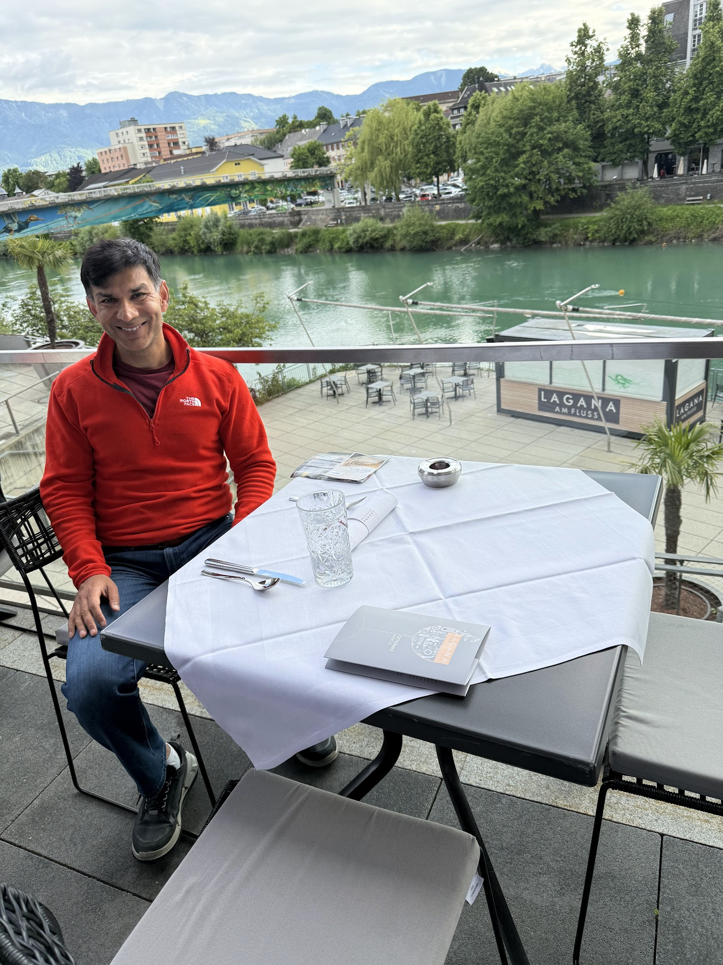
I had dinner at the Lagana restaurant and enjoyed ok’ish food with nice views of the river
Then I walked back to the hotel, worked a few more hours and called it a day.
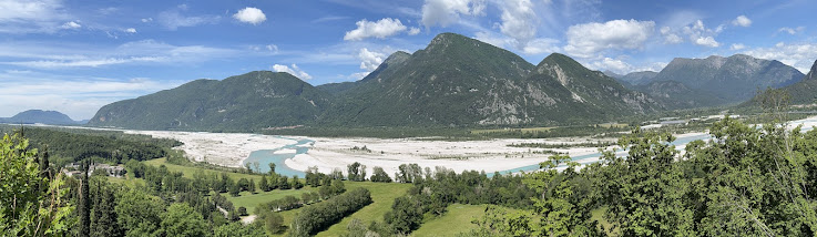
Day 4: Villach to Gemona (~110 Km)
Summary: Crossing the Austria-Italy border, gradual uphill to Tarvisio then downhill to Gemona. Not much to see along the way. Pass through several tunnels and abandoned railway stations converted into cafes.
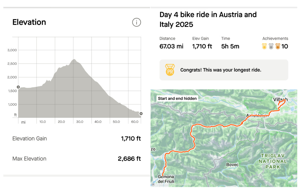
On Day 4, I had to travel from Villach, Austria to Gemona, Italy, about 105 Km apart. The first half from Villach to Tarvisio is moderately uphill and then straight downhill to Gemona. There are two ways to cover the distance.. take the train to Tarvisio and then bike the remaining 60 Km or so, or bike the entire distance. The tour company considers taking the train the default option, and the train tickets are already included in the tour. However, I decided to challenge myself and bike the entire way.
This was going to be the longest distance I ever biked in a day, and I wanted to track my fitness stats. So, I decided to get a fitness tracker. Upon doing some research, the Garmin Forerunner series seemed to strike the right balance between features that I needed and cost. So before starting the bike ride, I stopped by a few sporting goods stores in Villach. They had fitness trackers, but only the higher end Forerunners which are super bulky and packed with features I don’t really need. So I biked over to a mall, about 3 km from town and went to a supermarket that had a wider selection. There, I got a Forerunner 165 that tracks heart rate, distance travelled, sleep cycles and has a really good battery life (~6-7 days on one charge). I’m pretty happy with it so far!
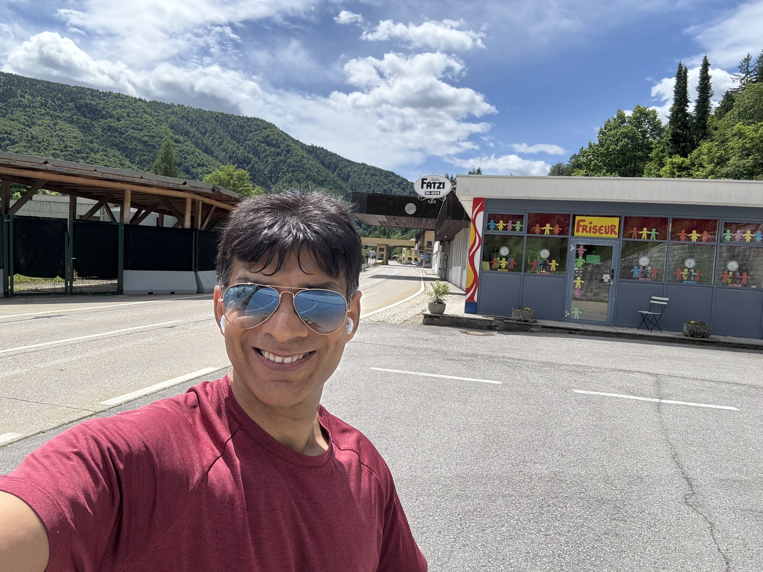
I passed the Austria-Italy border crossing about 30 km from Villach and got a coffee at a cafe at the border. The climb got a bit steeper about 10 km away from Tarvisio, but not too difficult.
Soon after crossing the border, a bit of bad luck struck. While making a sharp turn on a narrow path crossed by a shallow stream, the bike skidded and I scrapped my elbow and knee.. This was annoying, but I was glad there wasn’t any damage to my phone or to the bike.
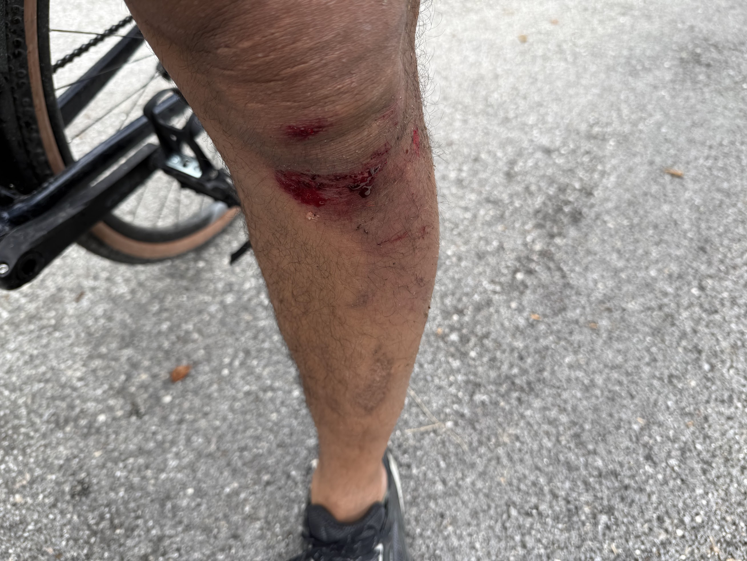
A bit rattled, I gingerly rolled into Tarvisio around 1:30 PM. I tried to find a pharmacy, but they were all closed (for siesta I assume) and reopened at 3. I asked around (noticing that the language had switched from German to Italian), and someone recommended a clothing store. A bit skeptical, I walked into the store and asked for a band aid. The girl at the counter didn’t understand me, so I pointed her to my knee and elbow. She led me to a small section with medical stuff. I bought what I thought was a band aid, but turned out to be just a gauze..I also bought a knee compression sleeve to keep the gauze in place.
I then had food and coffee at a nearby restaurant and charged my phone.
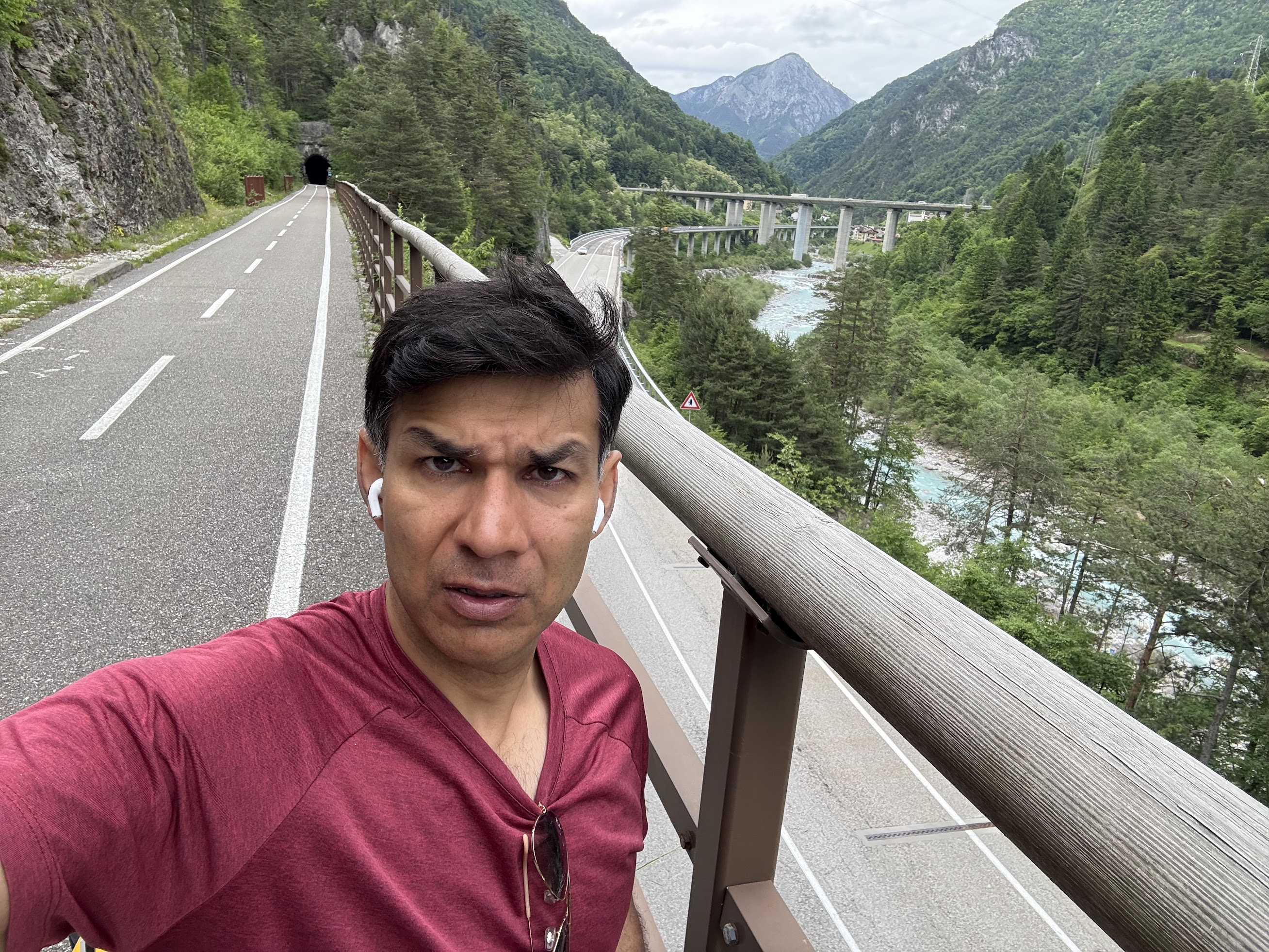
From Tarvisio, I biked uphill a few km more, and then almost a straight gentle downhill, following a beautiful stream with fast flowing, clear blue water. I went through several tunnels, most of which are old railway tunnels no longer in use.. It gets quite cool in the tunnels! I also passed by a few old railway stations that have been converted into cafes
https://youtu.be/v7162zth3iA
I arrived at hotel Willy (oddly named for an hotel in Italy) in Gemona around 6 PM, just before it started raining. I had never biked more than 100 Km in a single day and didn’t know how I’d feel after such a long ride. I was quite pleased that I felt just fine! My butt was a bit sore after sitting on a saddle for 6+ hrs, but legs felt completely fine.
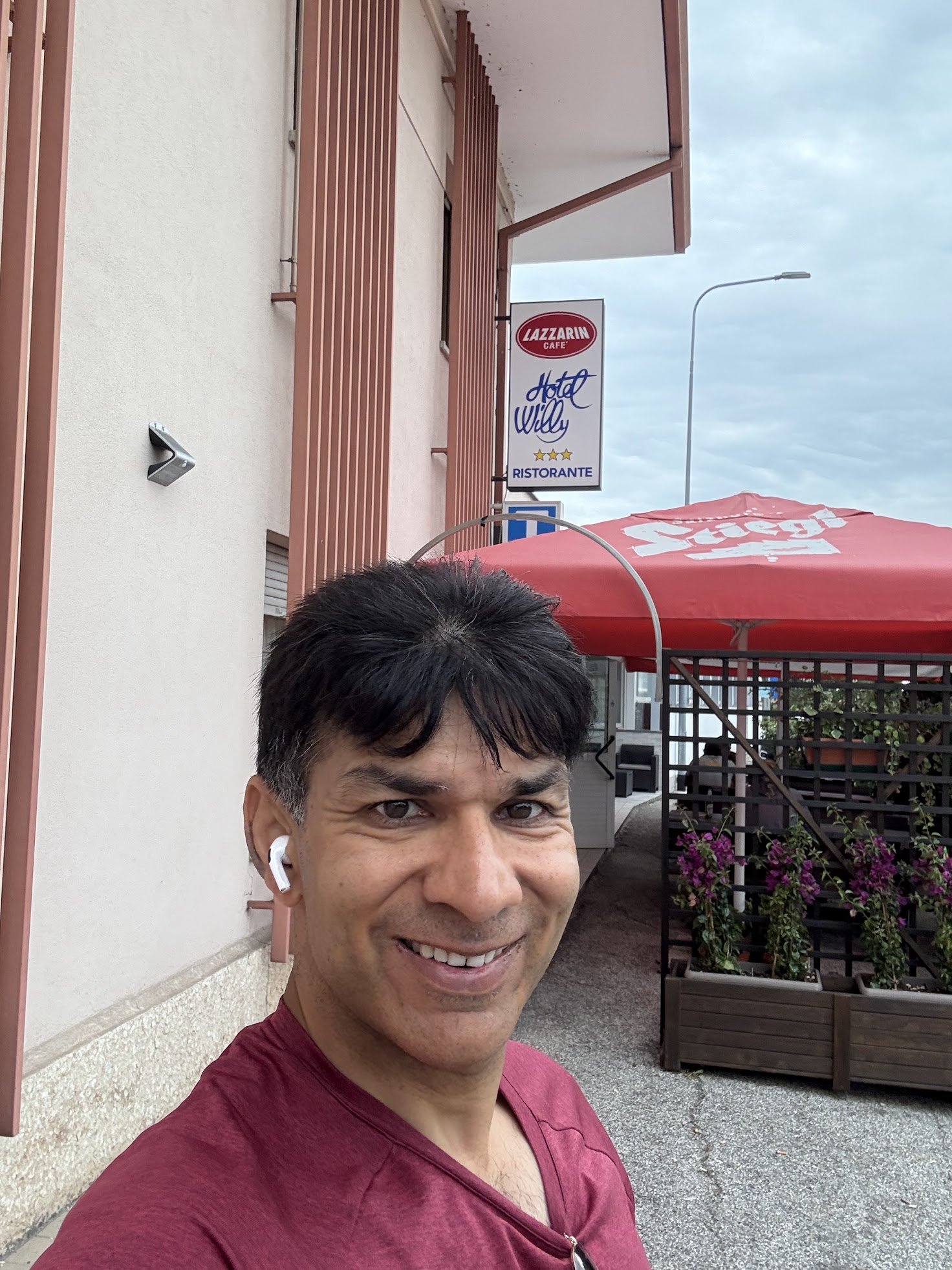
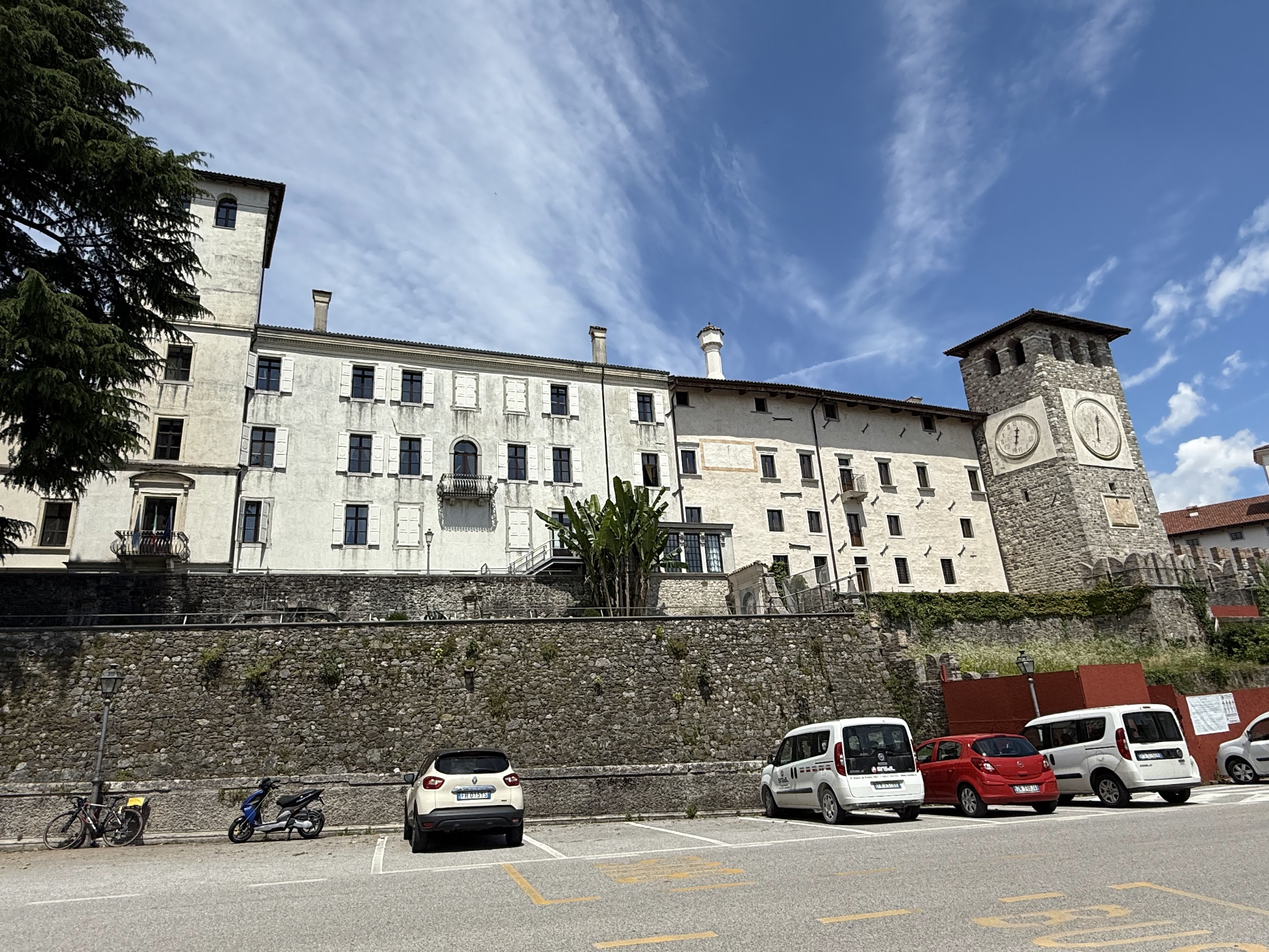
Gemona is a small town located in the Friuli Venezia Giulia region of northeastern Italy, near the border with Slovenia. The major points of attraction are Castle of Gemona, a medieval castle located up on a hill, offering nice views of the area, and a Romanesque-Gothic cathedral. I considered biking up to the castle after the rain, but decided to just take it easy for the day. I got dinner at the hotel restaurant, read a bit and went to bed.
Day 5: Gemona to Udine (~64 Km)
Summary: Mix of ups and downs. Short but steep climbs to Gemona castle and Fort di Ossopo. Castello di Colloredo di Monte Albano on the way, Piazza Liberta in Udine.
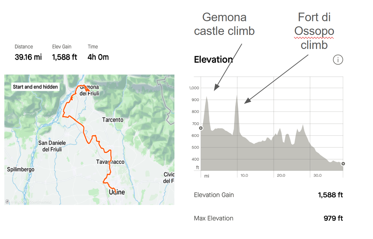
Next day, I got breakfast at the hotel and then biked up the hill to Gemona castle, dating from the 11th or 12th century, when Gemona was a strategic town along Alpine trade routes.. The castle was closed for construction.. I just walked around the outside and took some pics.
The cathedral was a short distance away and I considered stopping by, but there seemed nothing special about this cathedral, so I just continued on to Udine. About 8 km from Gemona, I biked up a steep hill to Forte di Osoppo. This fortress is part of a series of fortress built around WW1 along the border between Italy and Austria-Hungary. The fortress didn’t see much fighting because the Italian army quickly advanced beyond the Austria-Hungary border. The forts were either abandoned or used as warehouses after the war. You get to enjoy amazing views of the Tagliamento river and the town of Gemona. It is cool to see how the buildings in the town follow the alluvial fan of the stream above it.
After the fortress, I continued along a gravel path, between fields and through towns, dodging water-filled potholes (thanks to the evening downpour the day before) in some places. The weather was dry, warm and sunny, and the Alps were already far behind.
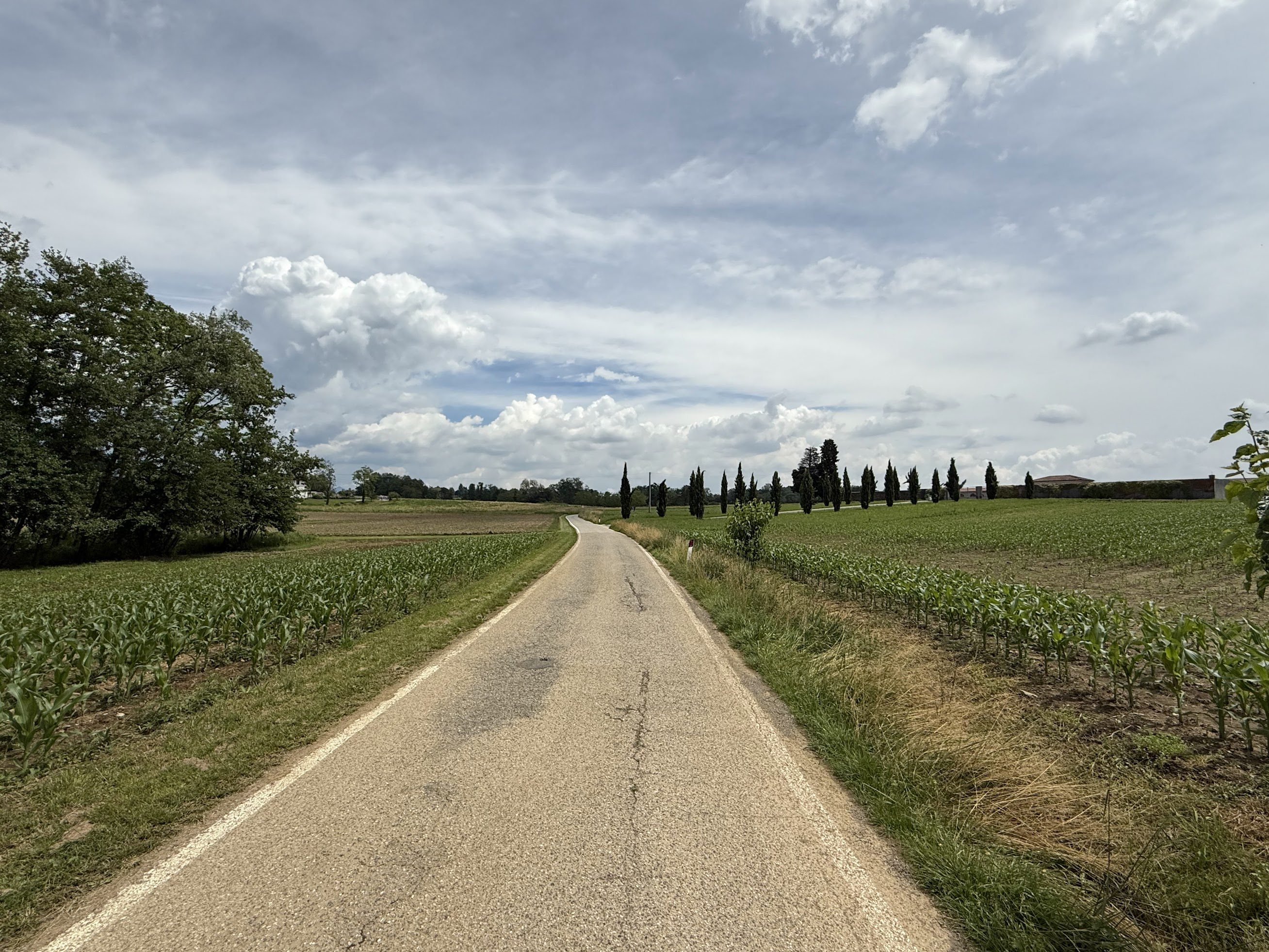
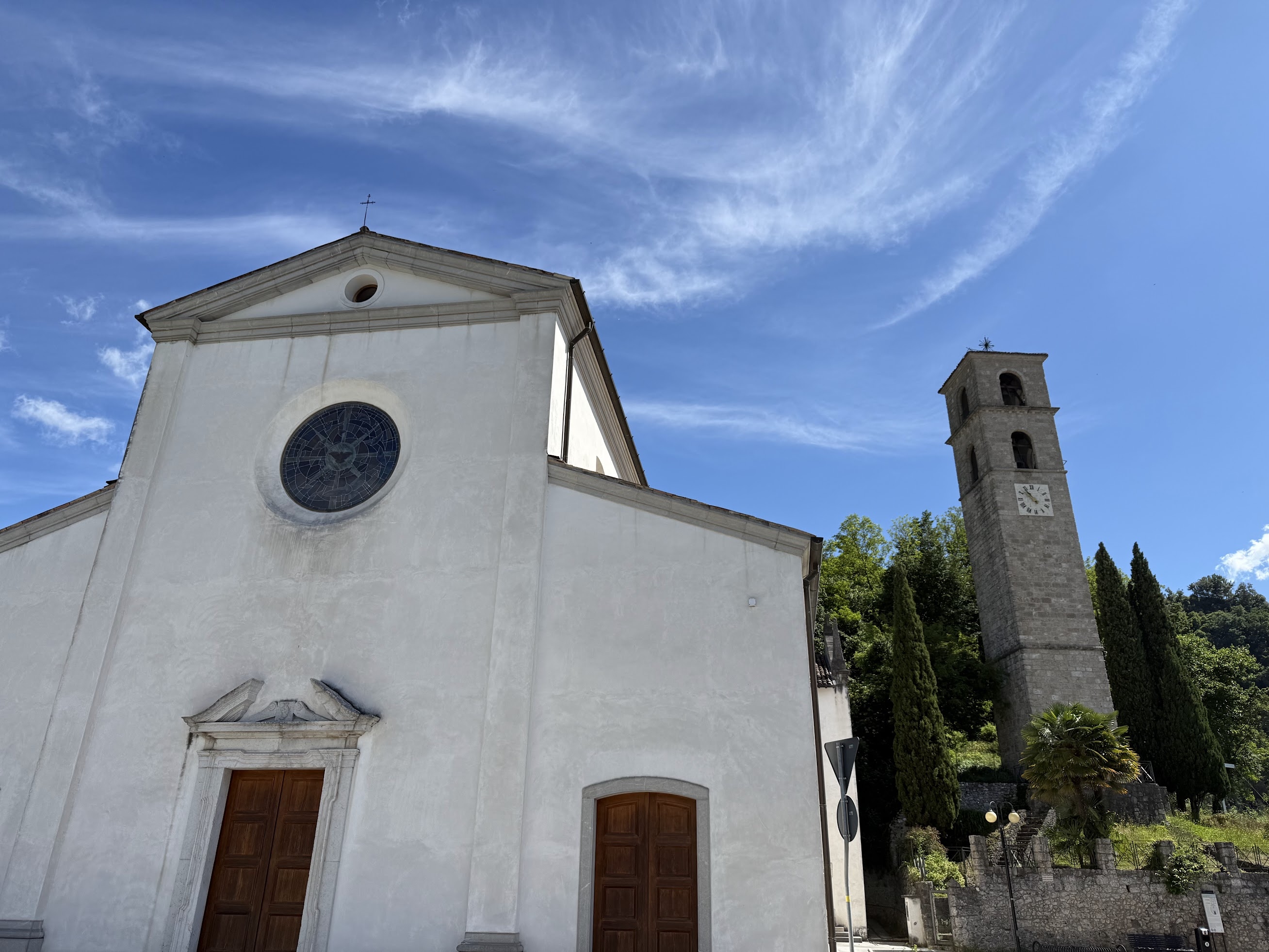
The water filled potholes got annoying after a while. To avoid them, I deviated from the GUIBO directions and just biked along a motorway, to the next stop along the way–Castello di Colloredo di Monte Albano, a 14th-century residential fortress. However the fortress was closed for construction. I just got lunch at an excellent Italian restaurant nearby and continued on to Udine. There really wasn’t much to see along the way on this day..
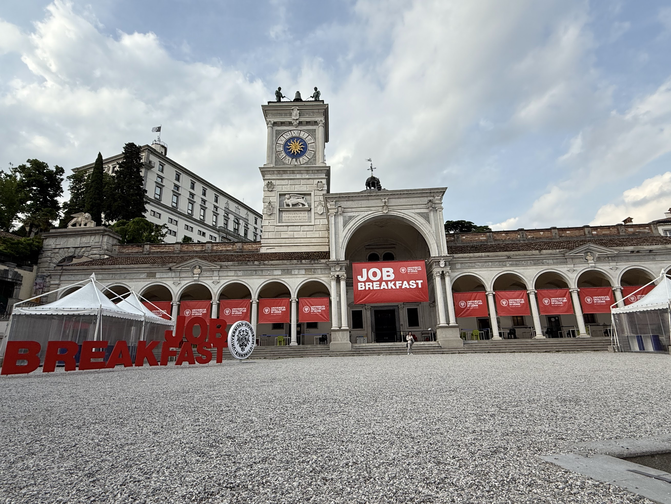
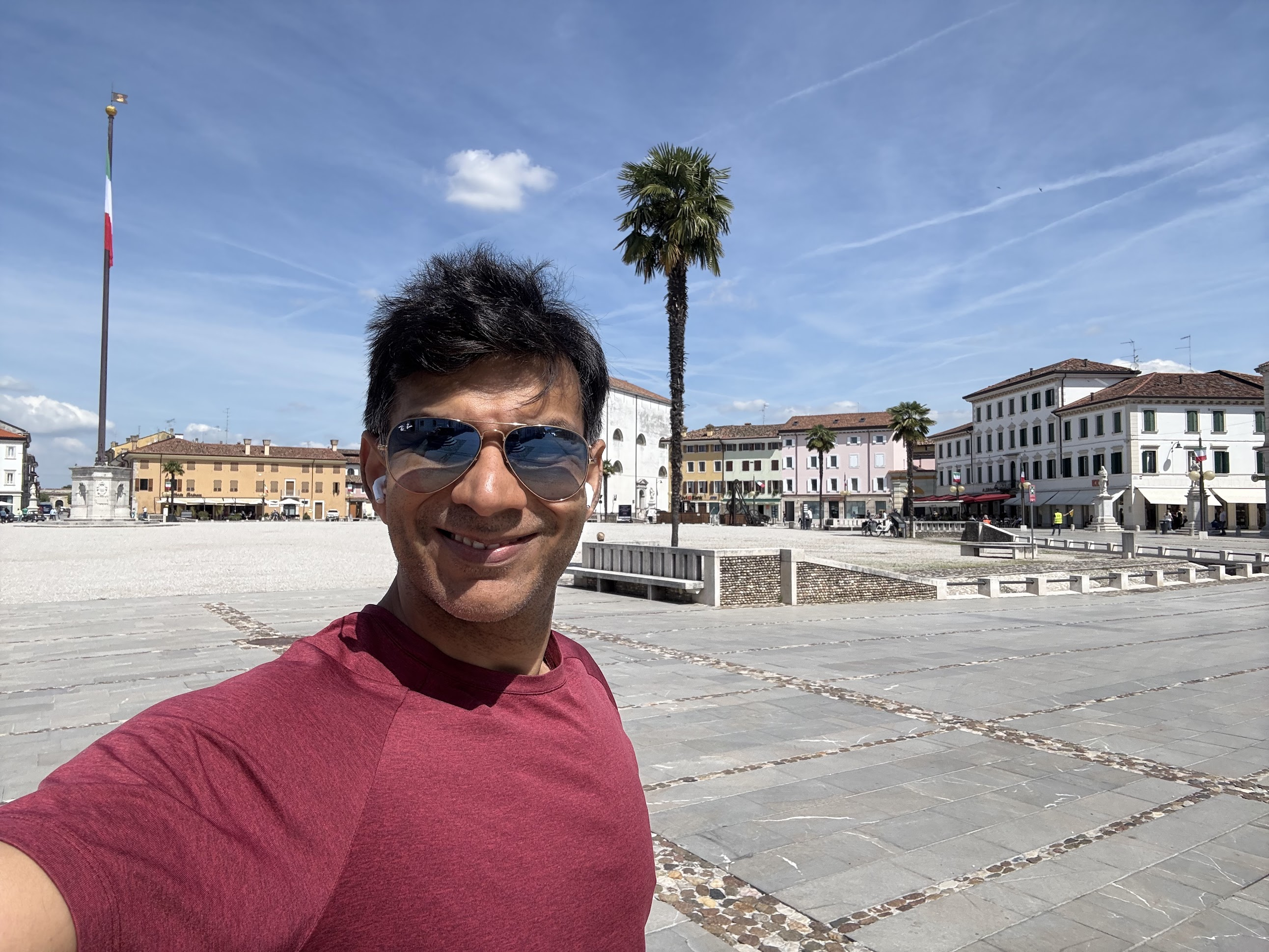
Udine is a cute town with several sites to see, such as Piazza Libertà known as “the most beautiful Venetian square on the mainland,” featuring a clocktower, modeled after Venice’s St. Mark’s tower; and Udine castle that offers nice views of the city.
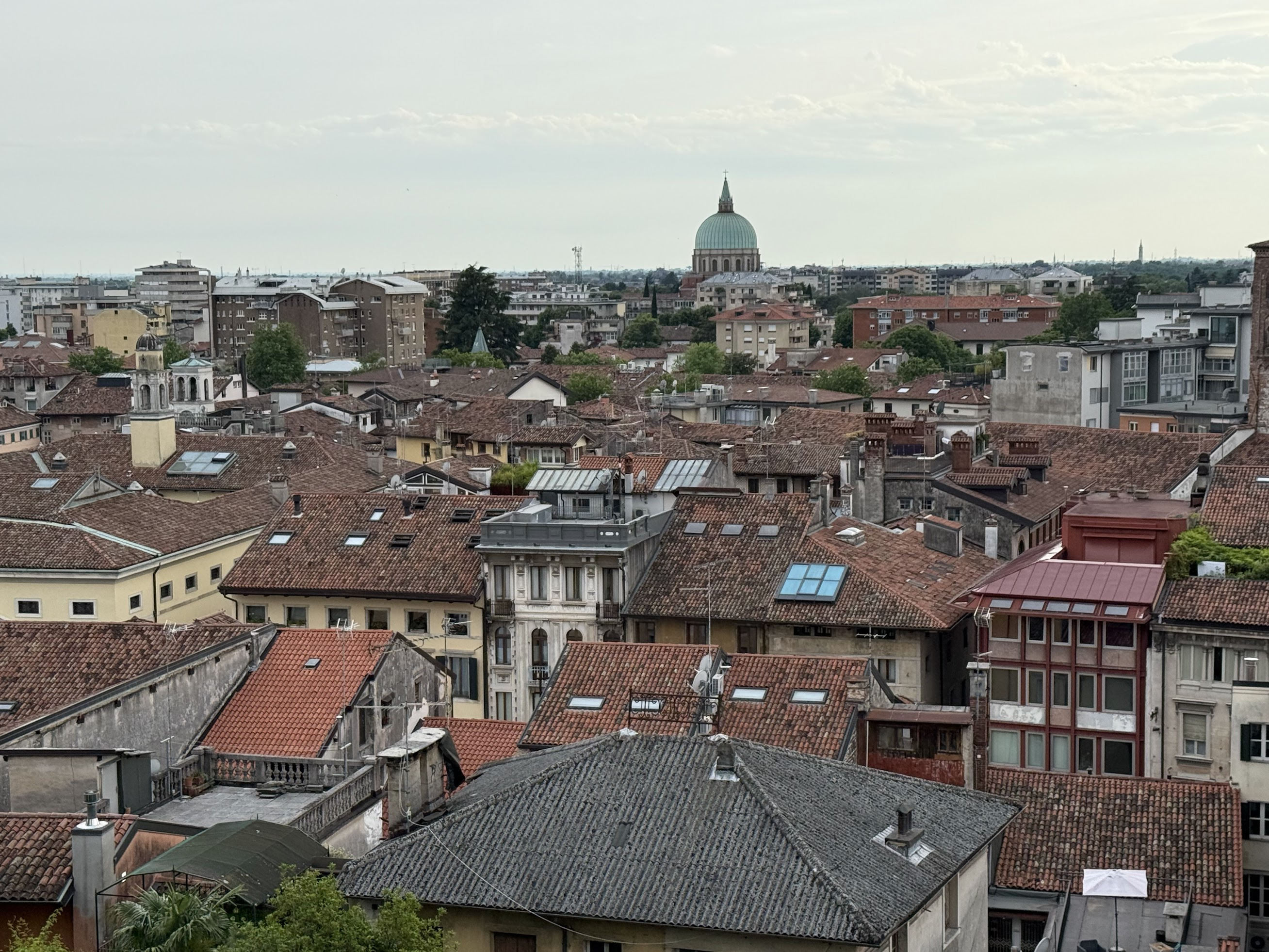
I also walked by several very medieval looking buildings, but which weren’t historical landmarks. I didn’t have much time for sightseeing, as I needed to work that day.
I had dinner at restaurant Carmagnola. Enjoyed Salmon and Red Wine surrounded by cool artwork.
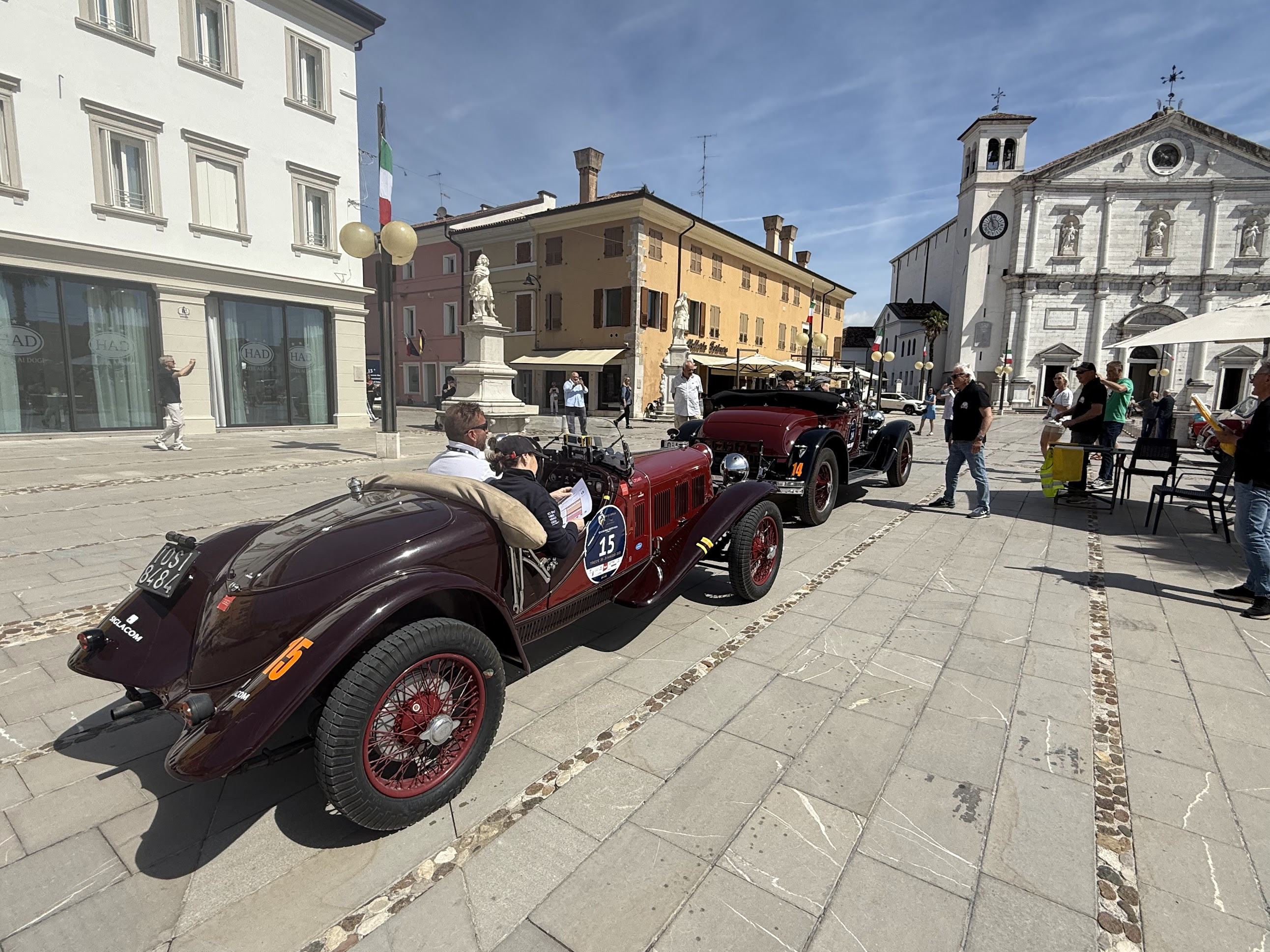
Day 6: Udine to Grado (~60 Km)
Summary: Gentle downhill all the way. Palmanova and Aquileia along the way.
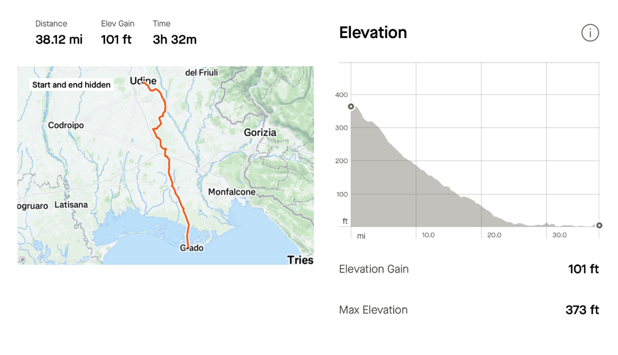
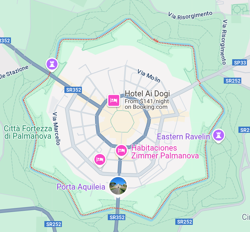
This was the final day of biking. I covered about 60 Km, mostly downhill. As on the last two days, biked through several small towns and farms along mostly paved and some gravel roads. I made two stops on the way. The first was at Palmanova, a Renaissance-era fortress town located approximately 20 kilometers southeast of Udine. Palmanova is renowned for its distinctive nine-pointed star-shaped layout, with a nine-sided city center and roads leading out towards the walls that surround the city. I took a short break to get a coffee and charge my phone.
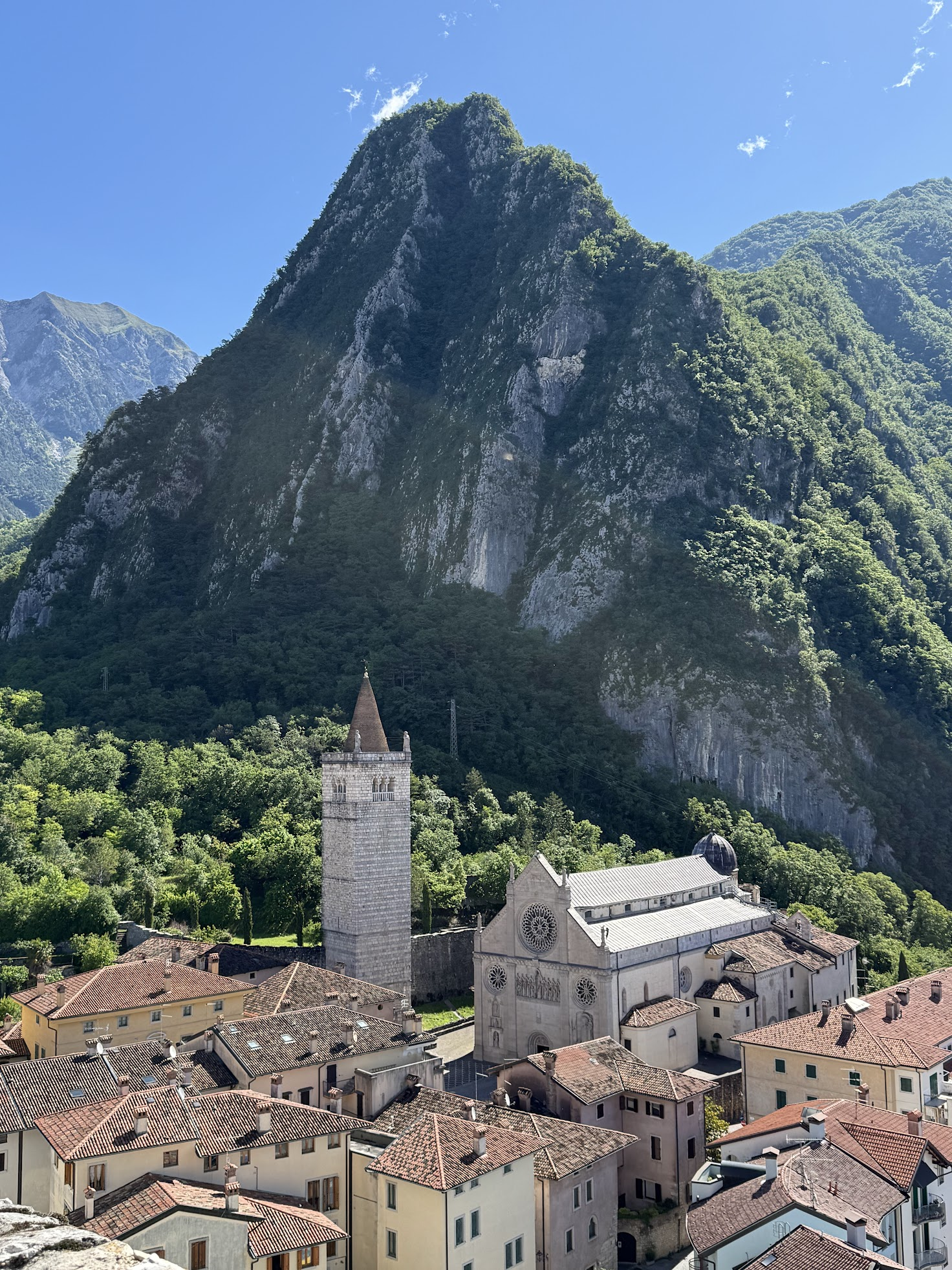
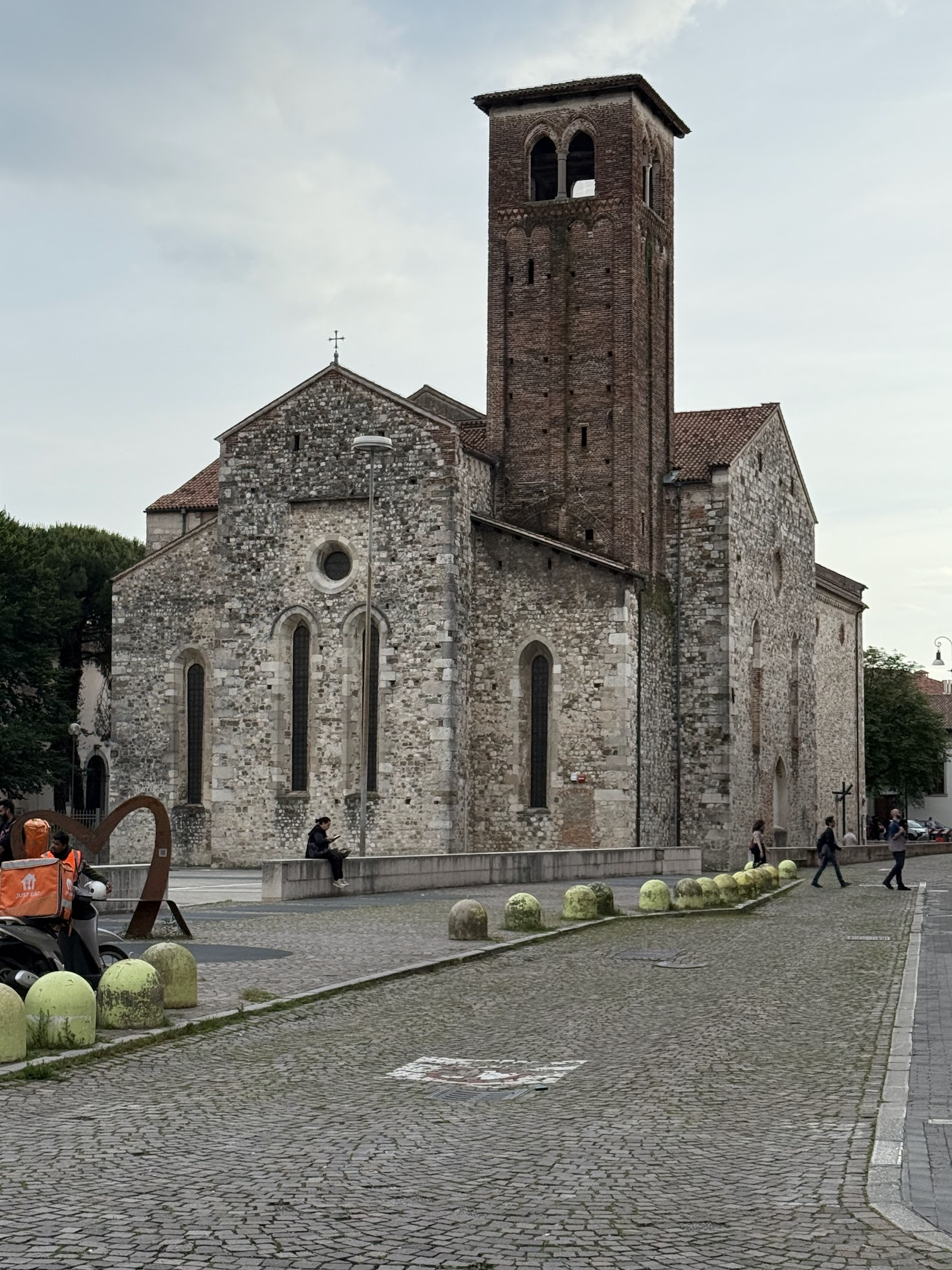
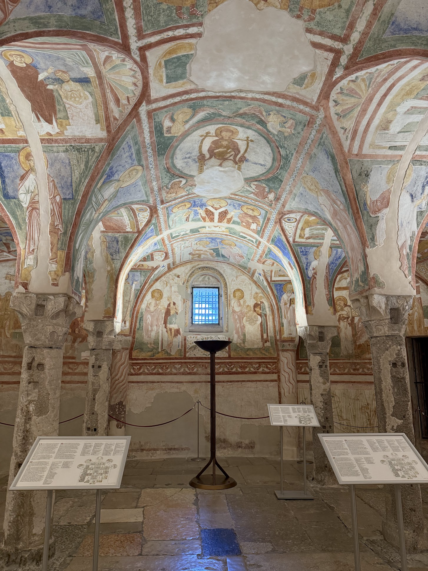
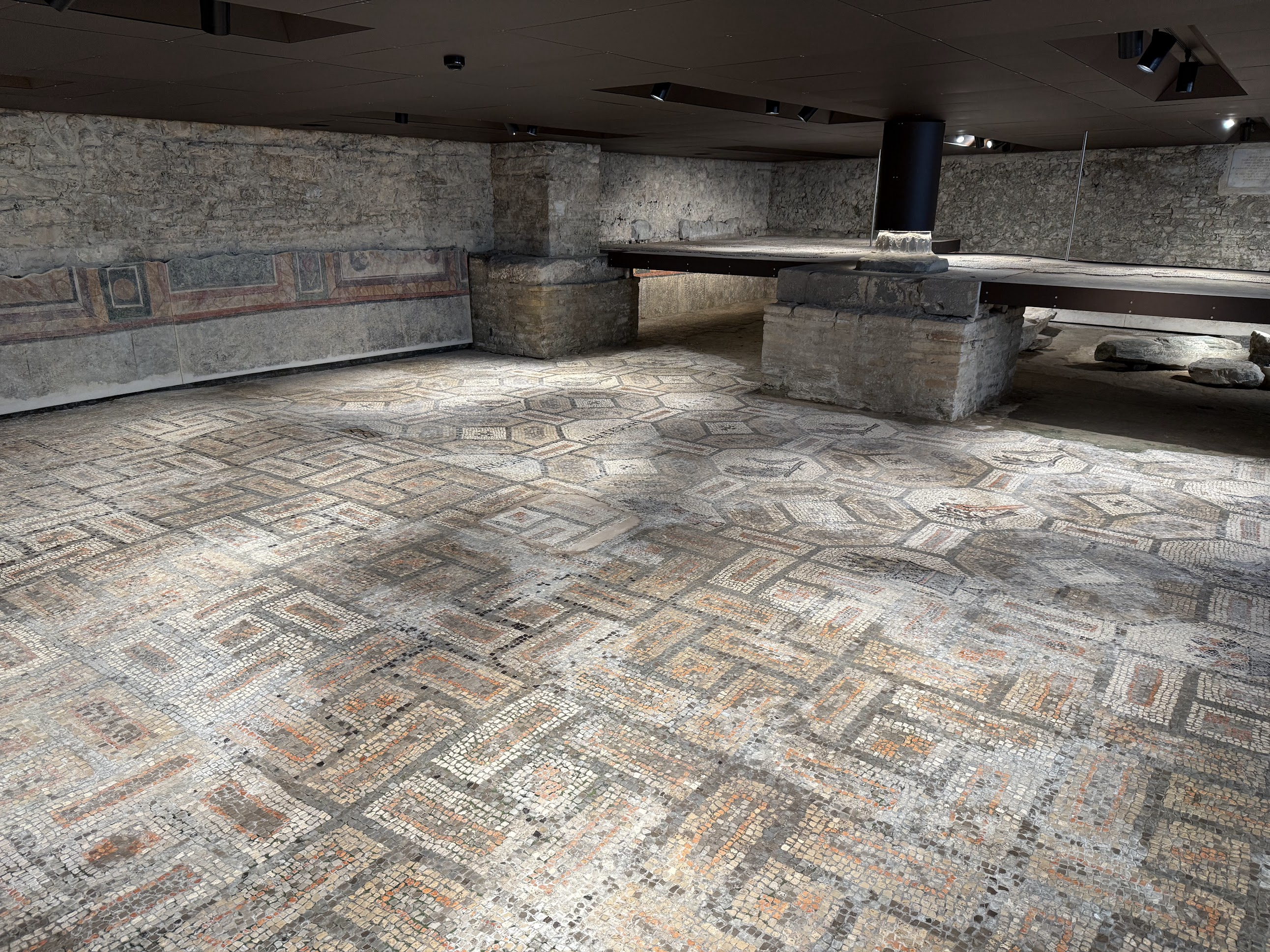
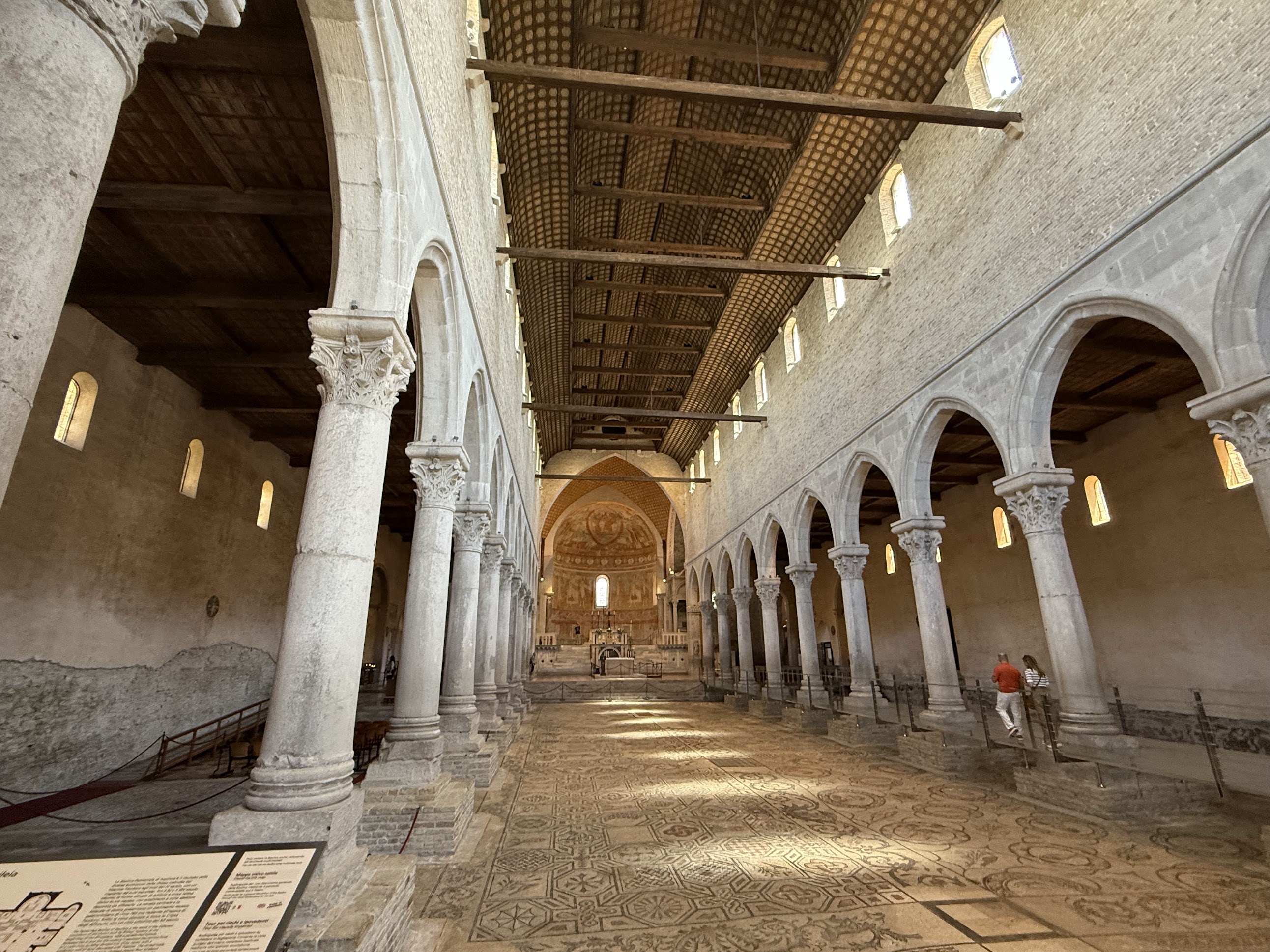
Second stop was at Aquileia, one of the largest and wealthiest cities of the Roman Empire, and early center of Christianity. In 452 AD, the infamous Attila the Hun sacked Aquileia, leading to its decline. Many of its inhabitants fled to the lagoons, contributing to the founding of Venice. Today, Aquileia is a popular spot on the tourist map of North Eastern Italy thanks to the Roman and early Cristian era buildings. I visited the Basilica of Santa Maria Assunta, famous for its stunning 4th-century mosaic floor featuring scenes from early Christianity. Excavations have revealed that this church itself was built on top of an preexisting Roman villa. The mosaic floor from that villa can still be seen in some places!
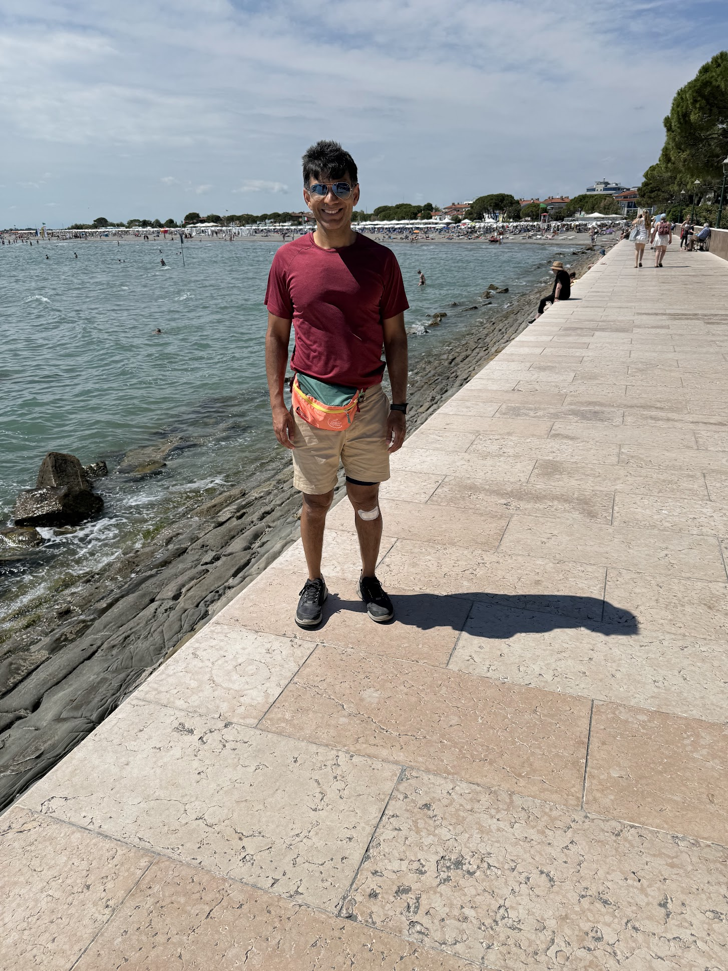
From Aquileia, I continued on towards Grado. I crossed a long stone bridge that connects the mainland to the town of Grado. I was expecting a sleepy, fishing village, but was a bit surprised to find a bustling town with bike paths, long beach-facing boardwalk and lots of cafes and restaurants by the beach. First I biked straight over to the beach facing the Adriatic sea and took a picture. I had made it from Salzburg, across the Alps to the Adriatic Sea!
After biking around a bit to explore the town, I found a bike shop to swap the pedals with the toe clips with the original pedals. With Grado being the last stop on the popular AlpeAdria circuit, there were several bike shops to pick from. Then I biked over to the hotel to drop the bike. The tour company had booked a night’s stay at the hotel, but I was not going to stay as I was leaving for Venice the same day. I had emailed the company if they could cancel my hotel reservation for the last night, but they couldn’t do so once the tour had already started.
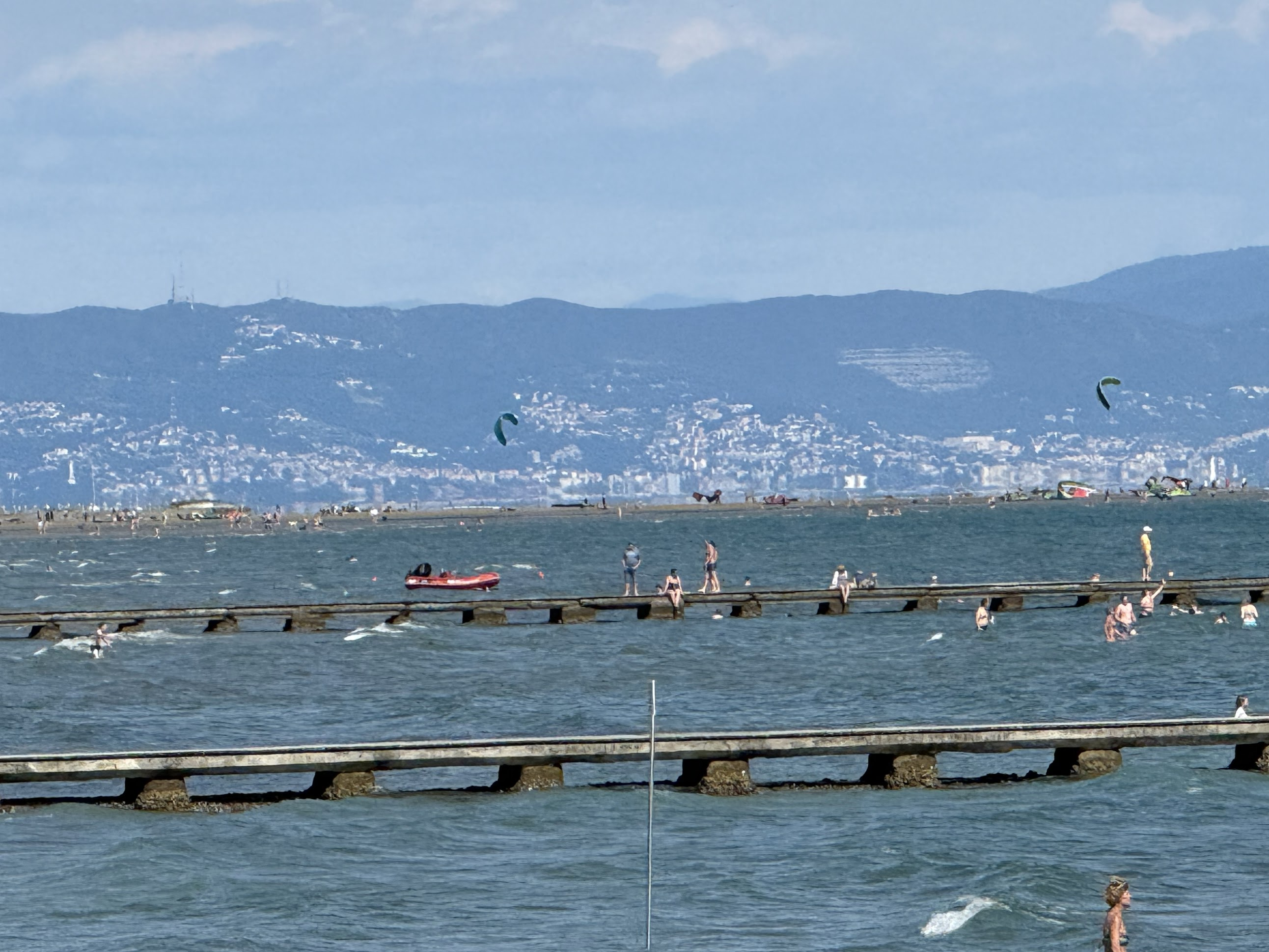
It was about 3 PM and my luggage still hadn’t arrived. So I just walked around and got some drinks..I even saw some kitesurfers! If I knew kitesurfing would be a possibility, I could have stayed the night in Grado! Would have been phenomenal to end this amazing bike trip with some kitesurfing!
Next up.. Venice and Rome. I’ll be writing about those trips in separate blogs.
Hope you enjoyed reading this one and found it useful! Post a comment if you did 🙂
Leave a Reply