Day 1: Quito historic district
Before I describe our experiences in Quito historic district, a few words about traveling to Quito from Washington DC. I flew Jet Blue with a connection in Fort Lauderdale. The flight to Fort Lauderdale was a bit bumpy but had a smooth ride to Quito. Saw a great Hitchcock movie – “Dial M for Murder” on the plane 🙂 The Quito airport isn’t the snazziest, but efficient and well-run. They checked the vaccination card and Covid PCR test carefully. I’m glad I got the PCR test done before leaving for Ecuador, because I don’t think the antigen test would have worked. I may have had to quarantine, which would have been fatal for my subsequent plans!
I breezed through immigration and customs and was greeted by our travel guide Daniel at the arrivals area. He drove me to the hotel and told me several interesting facts about Ecuador and Quito along the way. It was midnight by the time I arrived in my room. I was super tired and feel asleep right away.
The next day, I met up with Michael for breakfast (he had arrived earlier the previous day). The breakfast was a decent buffet style continental breakfast with eggs. To avoid people congregating near the breakfast buffer table, a server asked us what we wanted and then put those items on our plates.
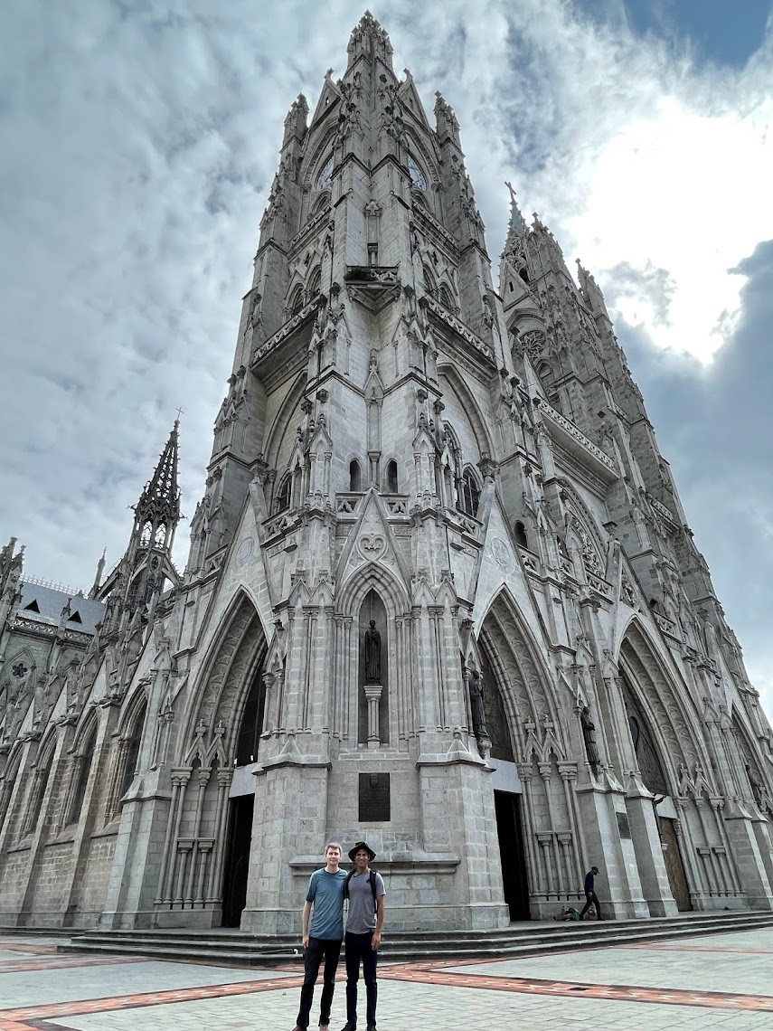
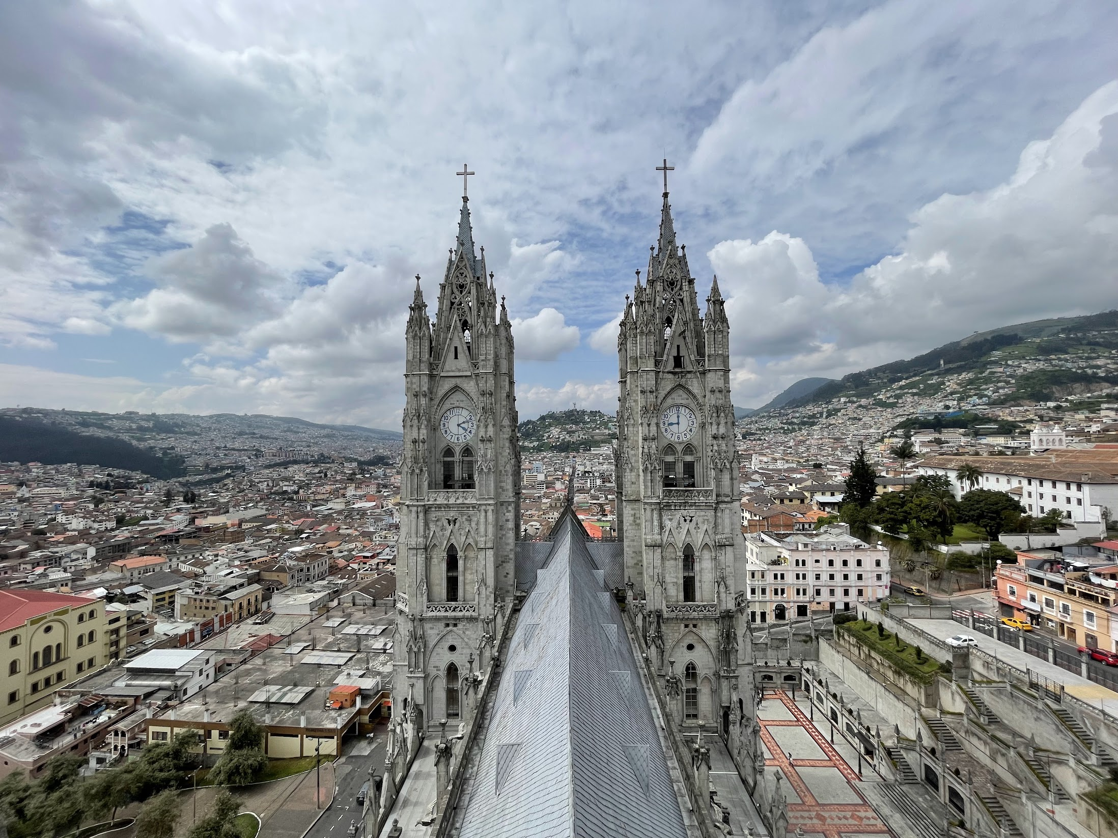
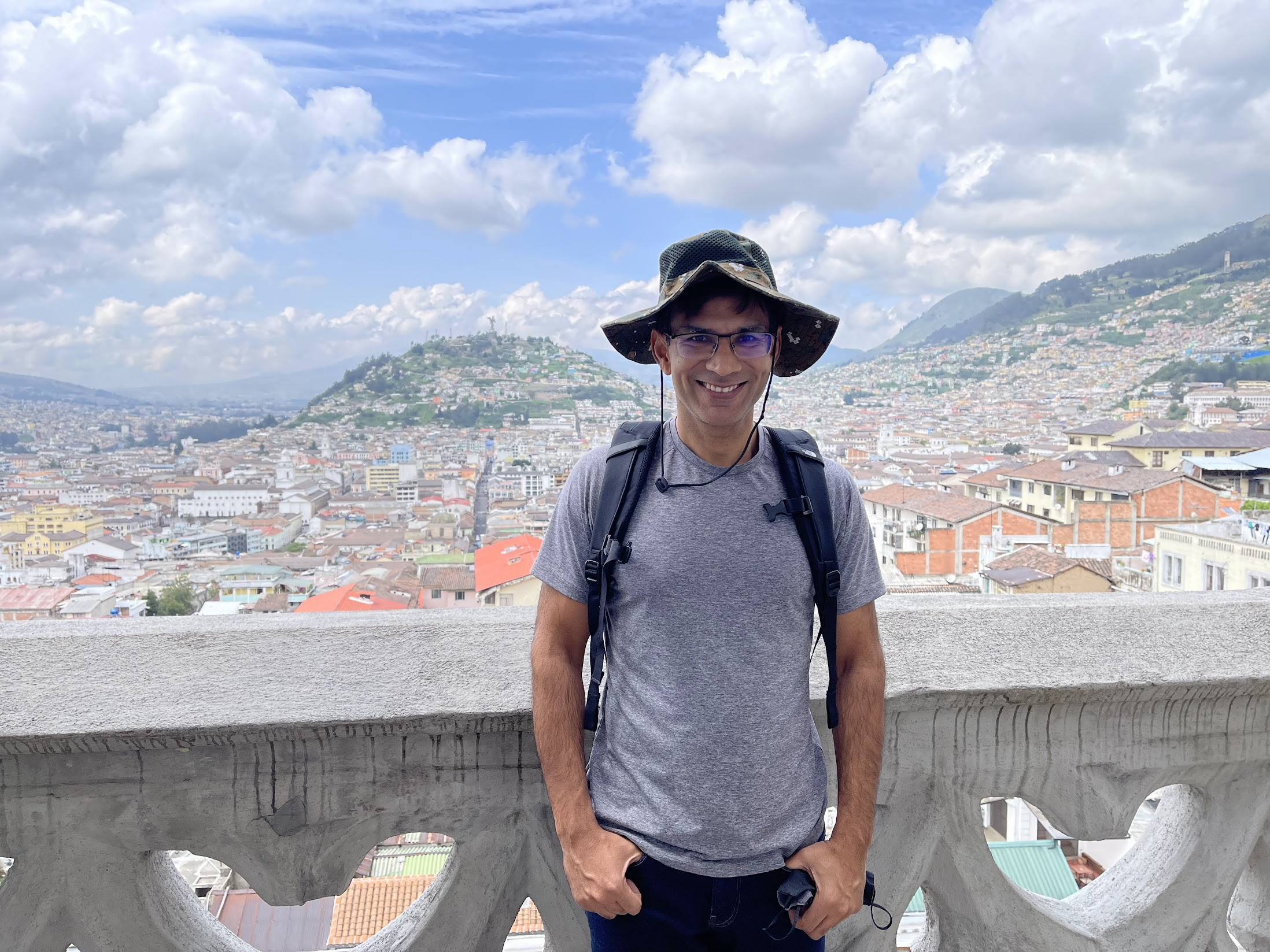
Daniel picked us up around 9AM and drove us to the first stop of the day – the Bascilica del Voto Nacional. Constructed in the early 20th century, this Roman catholic church is the largest neo-Gothic basilica in the Americas. Both Michael and I thought it looked a bit like the Notredame in Paris. We took the stairs to the top of the basilica towers and enjoyed some phenomenal views of the city. You can see how Quito has developed along a North-South axis, because it is hemmed in by mountains on the east and the west.
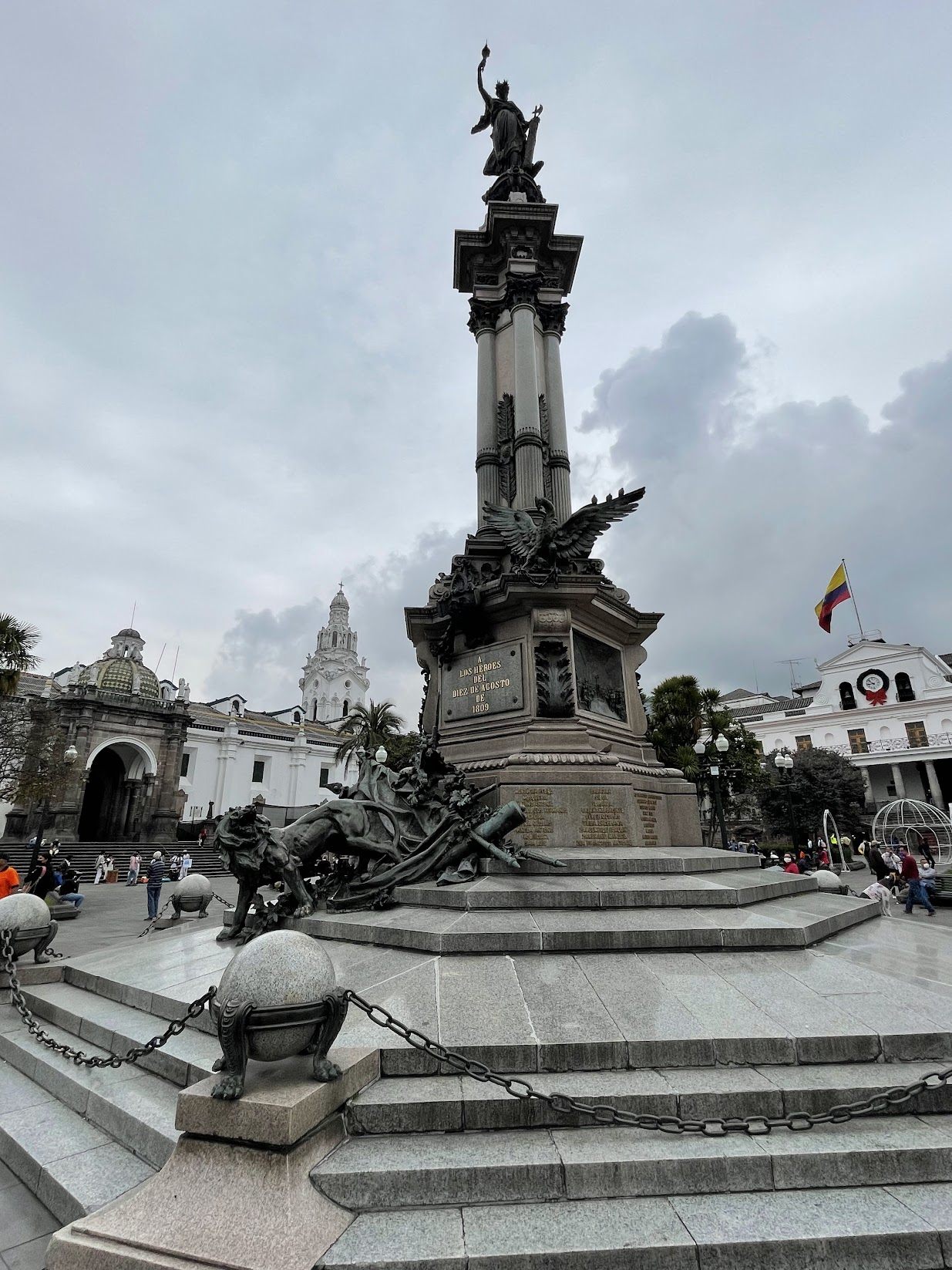
After the basilica, we drove to the historic center of Quito and walked over to the Plaza Grande, which is surrounded by Metropolitan Cathedral of Quito, Palacio Arzobispal, Municipio del Distrito de Quito and Palacio de Carondelet (presidential palace, where the president of Ecuador lives and the Spanish viceroy used to live in Colonial times). Together, these buildings symbolize God, the Vatican, modern democratic government and the king respectively. In the center of the plaza, there is a monument featuring a Condor (the national bird of Ecuador and Bolivia, Chile and Colombia) and a wounded lion, slinking away. According to our guide, these represent Ecuador’s flight to freedom from Spanish rule and the defeated Spaniards retreating. I found the symbolism quite touching.
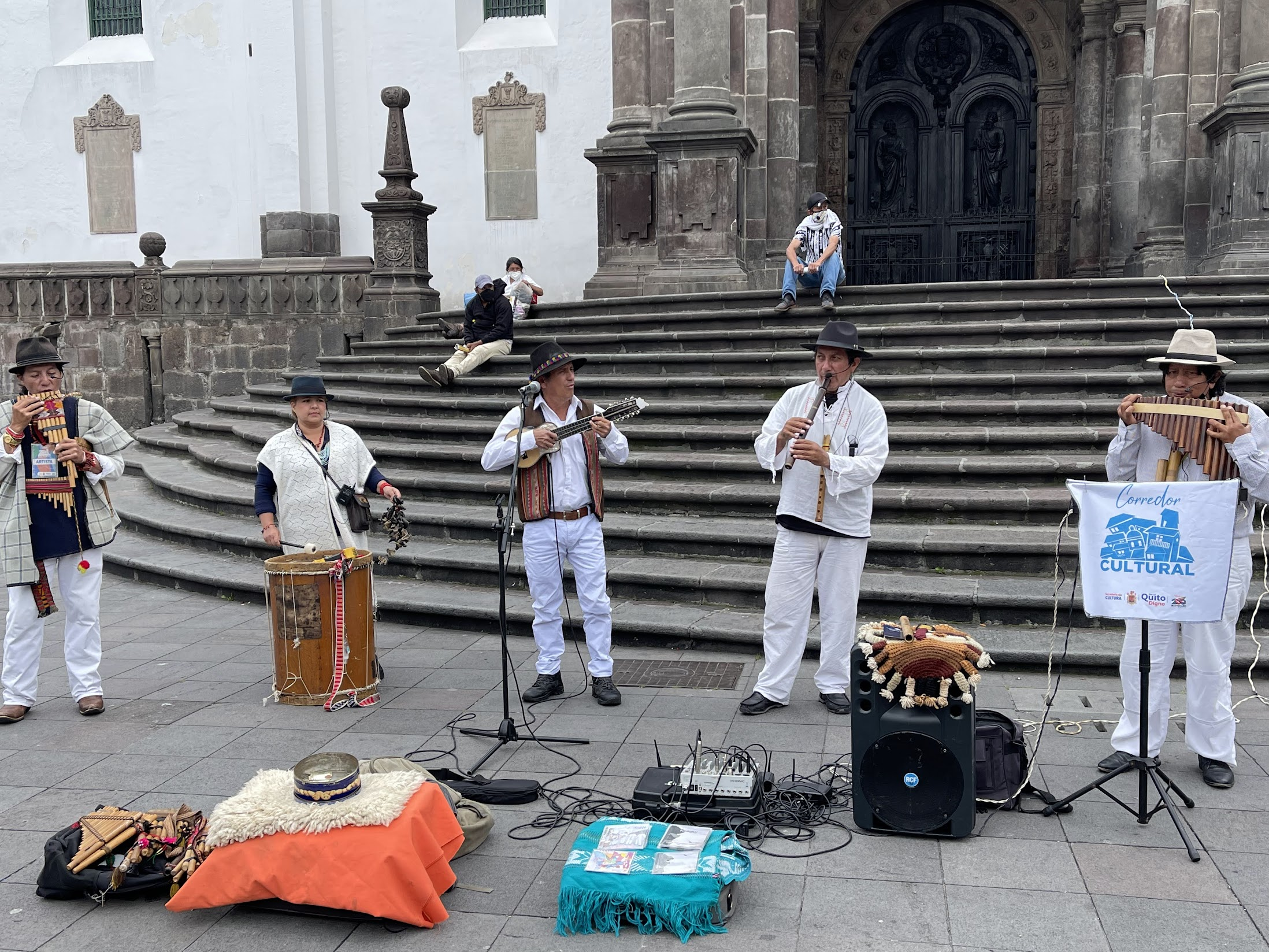
The plaza is a pleasant place with many trees, benches and people strolling around. A band was playing traditional Ecuadorian music.
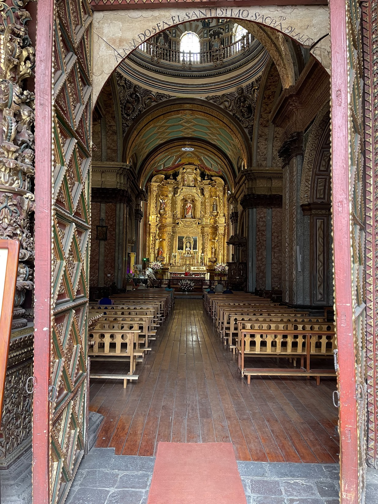
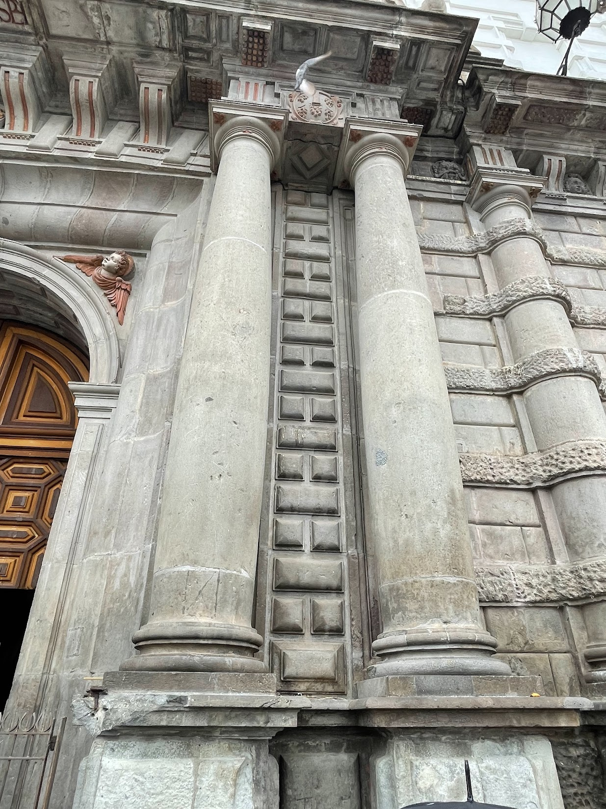
From the Plaza, we stopped by the Metropolitan Cathedral, one of the oldest churches in Quito. It was built in 1572 and reconstructed several times since because of damage due to volcanic eruptions and earthquakes.
The next stop was the Church and Convent of St. Francis. The Church and Convent encompass three hectares including 13 cloisters (six of them major), three churches, and a large courtyard. The building’s construction began around 1550, sixteen years after Quito was founded by Spanish conquistadors, and was finished in approximately 1680. The complex stands at the site of the palace of the Inca ruler Atahulpa. After the surprise capture of Inca emperor Atahulpa by Spanish troops led by Francisco Pizarro in 1532, the palace and the surrounding city were destroyed by the Inca general Rumiñahui to prevent it from being taken by the Spanish. Materials from the ruin were used as construction material for the Church. This is one of the reasons there is scarcely any trace of pre-Columbian architecture in Quito today.
I couldn’t help but marvel at the efficiency and industry of the Spaniards and how quickly they took over such large swathes of mountainous and densely forested terrain and built large public buildings with a relatively small workforce and 16th century technology, far away from their homeland! I fully understand of course that they brutally exploited the natives in constructing these buildings and co-opted/wiped out their culture and language, however purely from an architectural and engineering perspective, the achievement is still worth noting.
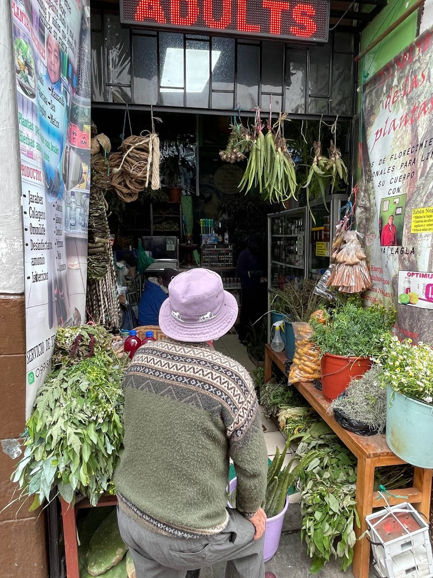
After the church, we walked around the historic center, saw several shops selling traditional Ecuadorian herbs with healing powers, street hawkers selling fruits in long plastic tubes for 1$, souvenirs and garments shops etc. Most buildings along the road were 2-3 storey apartments or commercial buildings with a main door leading to a courtyard, flanked by apartments.
I was a bit surprised by the poor air quality and the heavy traffic, even in the historic area. The biggest culprit appeared to be the public buses which were billowing clouds of black smoke. Most vehicles were small petrol or diesel cars. To help relieve congestion and pollution, private vehicle usage restrictions are imposed so that vehicles with license plates ending in certain digits can’t be used on certain days of the week. I didn’t see many scooters, mopeds or bicycles or any electric vehicles. Another reminder of the long road ahead before a significant portion of the world-wide road transport fleet is electrified!
The public transportation in Quito consists of buses and a “trolley system” which is an electric bus that travels along a designated lane along the main north-south road in Quito. According to our guide, a subway system is under construction and is scheduled to open in 6 months after repeated delays.
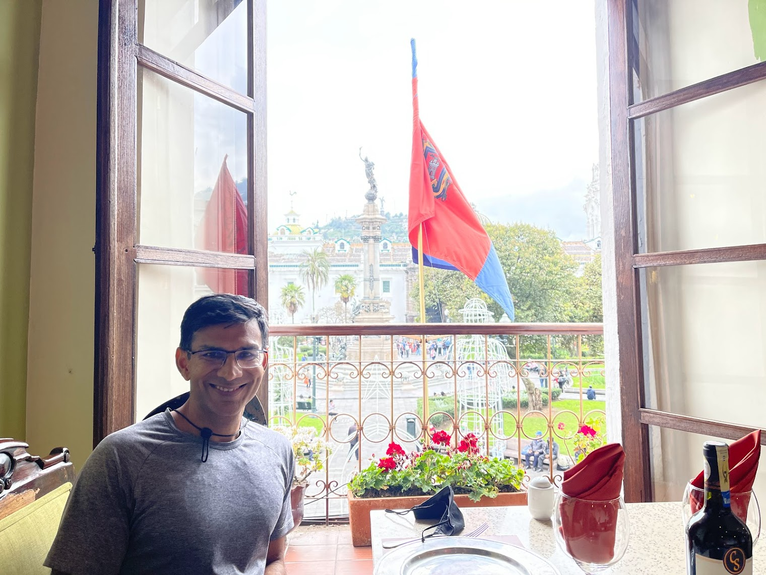
We had lunch at a lovely restaurant called Hasta la Vuelta in Plaza Grande. We were seated right by the window with good views of the plaza.
We tried an Ecuadorean drink called “Canelazo”, a traditional spiced hot drink from the highlands in Ecuador. The original canelazo recipe is made by boiling water with cinnamon and sugar and then mixed with a local sugarcane alcohol called punta or aguardiente.
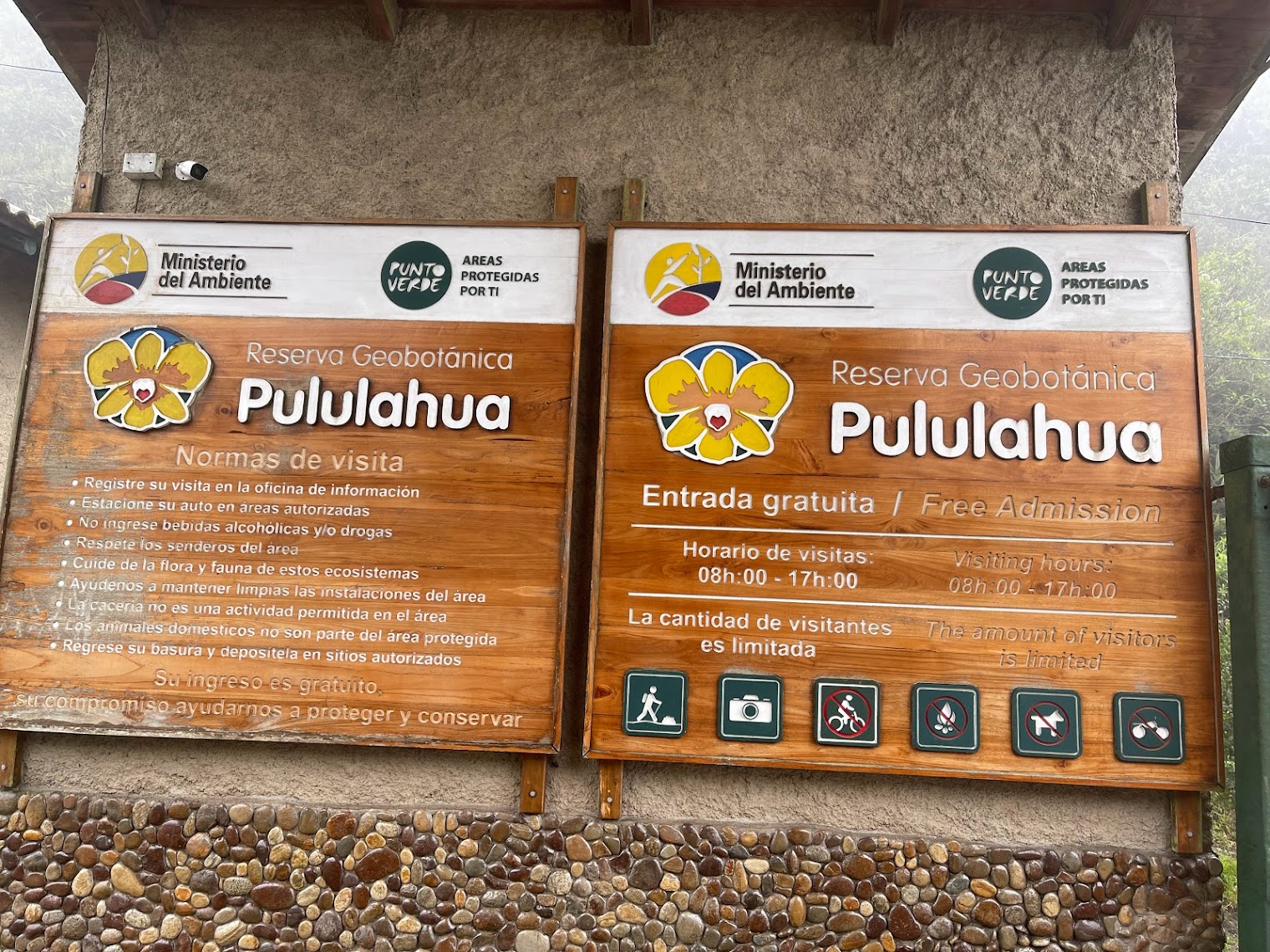
After lunch, we drove to Pululahua (meaning ‘cloud of water’) geobotanical reserve to see the Pululahua crater, one of only two inhabited craters in the world (the second being in Iceland, according to our guide). However the crater was covered by a dense cloud of mist and fog and we couldn’t see anything.
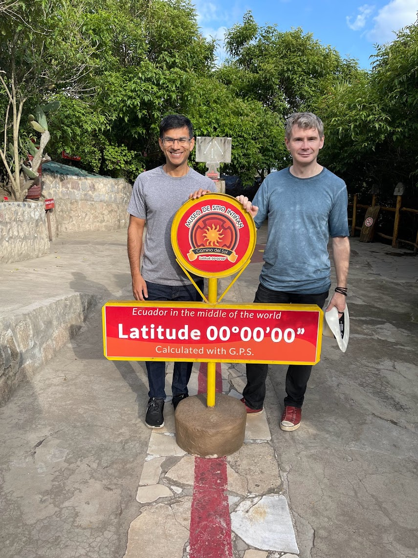
As I mentioned earlier, the name Ecuador is Spanish for Equator, the latitude that divides earth into Northern and Southern hemisphere. The equator runs just a few miles north of Quito and there are two sites dedicated to it – the Intenan museum which has a painted line that is very close to the equator and a monument called Mitad del Mundo (middle of the world), which is about 200m from the actual location of the equator. These being must do’s on the list of things to do in Quito, we drove to the Intenan museum from Pululahua. As I said, the museum is known for a painted line that runs very close to the actual equator. Visitors love to take a pic with feet on either side of the line, one in the northern and the other in the southern hemisphere.
The museum also has several guided tours. In one tour, people are led through several activities demonstrating events that supposedly occur only on the equator. These include the Coriolis Effect, effect whereby a mass moving in a rotating system experiences a fictitious force (the Coriolis force ) acting perpendicular to the direction of motion and to the axis of rotation. In the activity supposed to show the influence of the Coriolis force, the guide removes the plug from the bottom of a basin full of water and shows that the water drains out without swirling in any direction. Then the guide moves the basin a few feet away from the equator in the Southern hemisphere, fills up the basin again, removes the plug and claims that the swirling motion of the water draining out is because of Coriolis force that acts in one direction in the Southern hemisphere and in the opposite direction in the Northern hemisphere. This it totally bogus! Let me provide a brief and hopefully intuitive explanation of what Coriolis force is and the magnitude of the force on the equator to show that the force is so small that it is going to have no effect on a small basin of water. Geek alert – I’m done with the activities of the day, so feel free to skip over to the next page if you aren’t interested in the discourse about Coriolis force about to follow 🙂
The key to the Coriolis effect lies in Earth’s rotation. Specifically, Earth rotates faster at the Equator than it does at the poles. Earth is wider at the Equator, so to make a rotation in one 24-hour period, equatorial regions race nearly 1,600 kilometers (1,000 miles) per hour. Near the poles, Earth rotates at a sluggish 0.00008 kilometers (0.00005 miles) per hour. Let’s pretend you’re standing at the Equator and you want to throw a ball to your friend in the middle of North America. If you throw the ball in a straight line, it will appear to land to the right of your friend because he’s moving slower and has not caught up. To you, it would appear a mysterious force is causing the ball to deflect to the right. This apparent deflection is the Coriolis effect. Fluids traveling across large areas, such as air currents, are like the path of the ball. They appear to bend to the right in the Northern Hemisphere. The Coriolis effect behaves the opposite way in the Southern Hemisphere, where currents appear to bend to the left. See this article for more info.
The impact of the Coriolis effect is dependent on velocity—the velocity of Earth and the velocity of the object or fluid being deflected by the Coriolis effect. The impact of the Coriolis effect is most significant with high speeds or long distances. This means that the Coriolis force on a stationary object (such as a basin full of water) is zero, not matter where the basin is located! You may say that well the water in a basin is sloshing around, not completely still. So let’s consider the Coriolis force on a body of mass 10 Kg (roughly equivalent to a small basin of water) traveling at a velocity of 1 m/s perpendicular to the earth’s axis of rotation. Take my word for it that the magnitude of the force is 0.001454 Newtons. This is such a small force that there is no way it can affect the motion of the water as it is draining out!
There are other even more outlandish demonstrations of some mysterious force that only applies on the equator and vanishes a few feet from it. These involve balancing eggs on the head of a nail, and the loss of muscle strength experienced when standing precisely on the line of the equator. Bogus or not, the activities are still a good laugh if you don’t take them too seriously 🙂
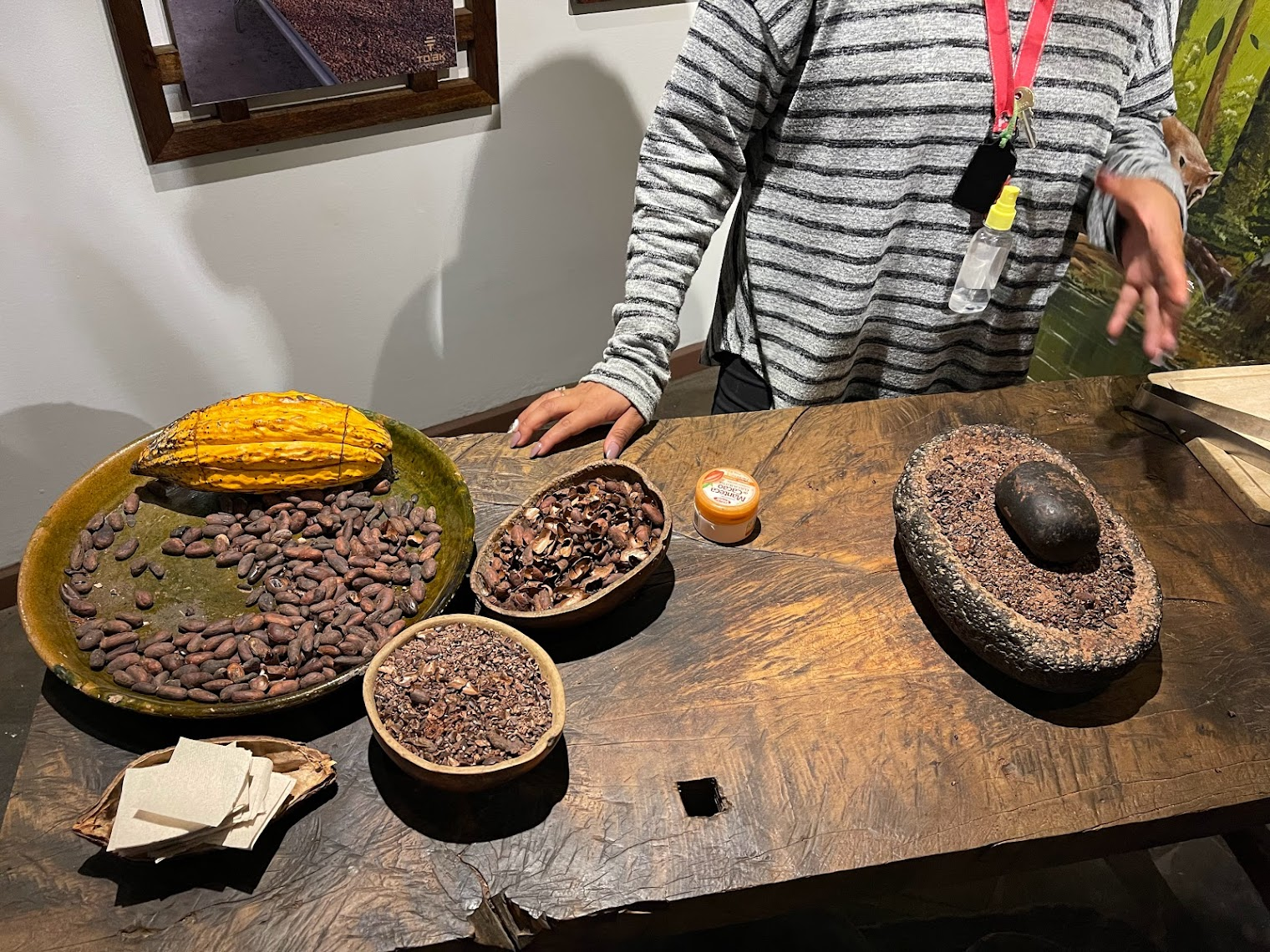
Another tour gave a demonstration of the chocolate making process, starting from a sample of raw cocoa seeds, the steps involved in making chocolate and finally a sample of the raw, finished product. This was a good tour. I was a bit surprised to learn that Chocolate is one of the major exports of Ecuador!
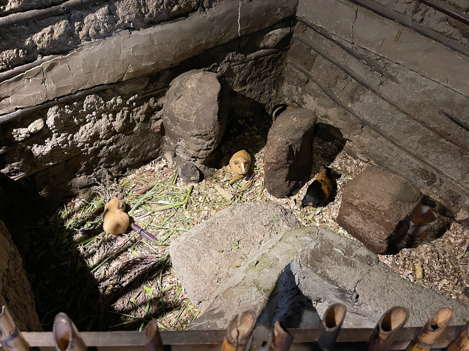
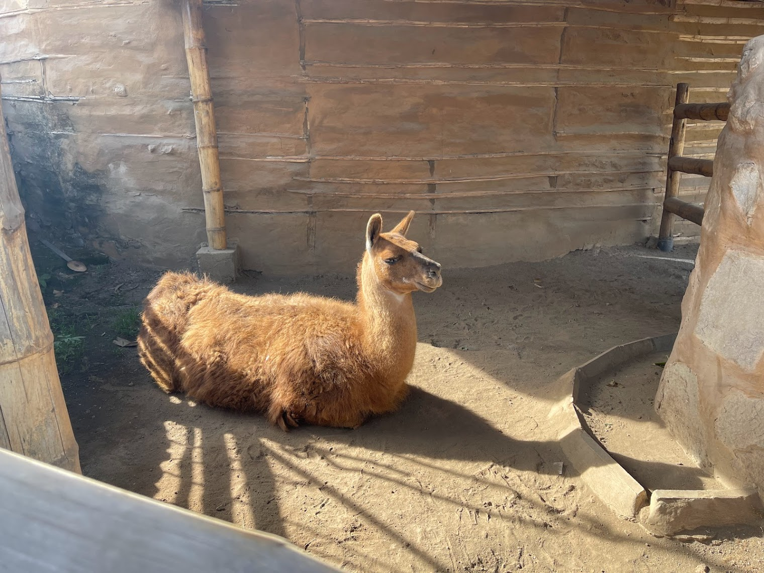
The most interesting tour walked us through a few tribal dwellings constructed in the same manner they have been for hundreds of years, and a variety of indigenous flora and fauna flourishes, such as indigenous medicinal plants, stuffed anacondas, tarantulas, a nasty fish found in the amazon that can squeeze its way into a man’s genitalia and once in, can only be removed surgically, guinea pigs, tortoises and llamas. The tour provided interesting insights into customs, rituals and traditions of rural life. Some traditional handicrafts, hunting and fishing equipment, as well as medicinal plants were also on display
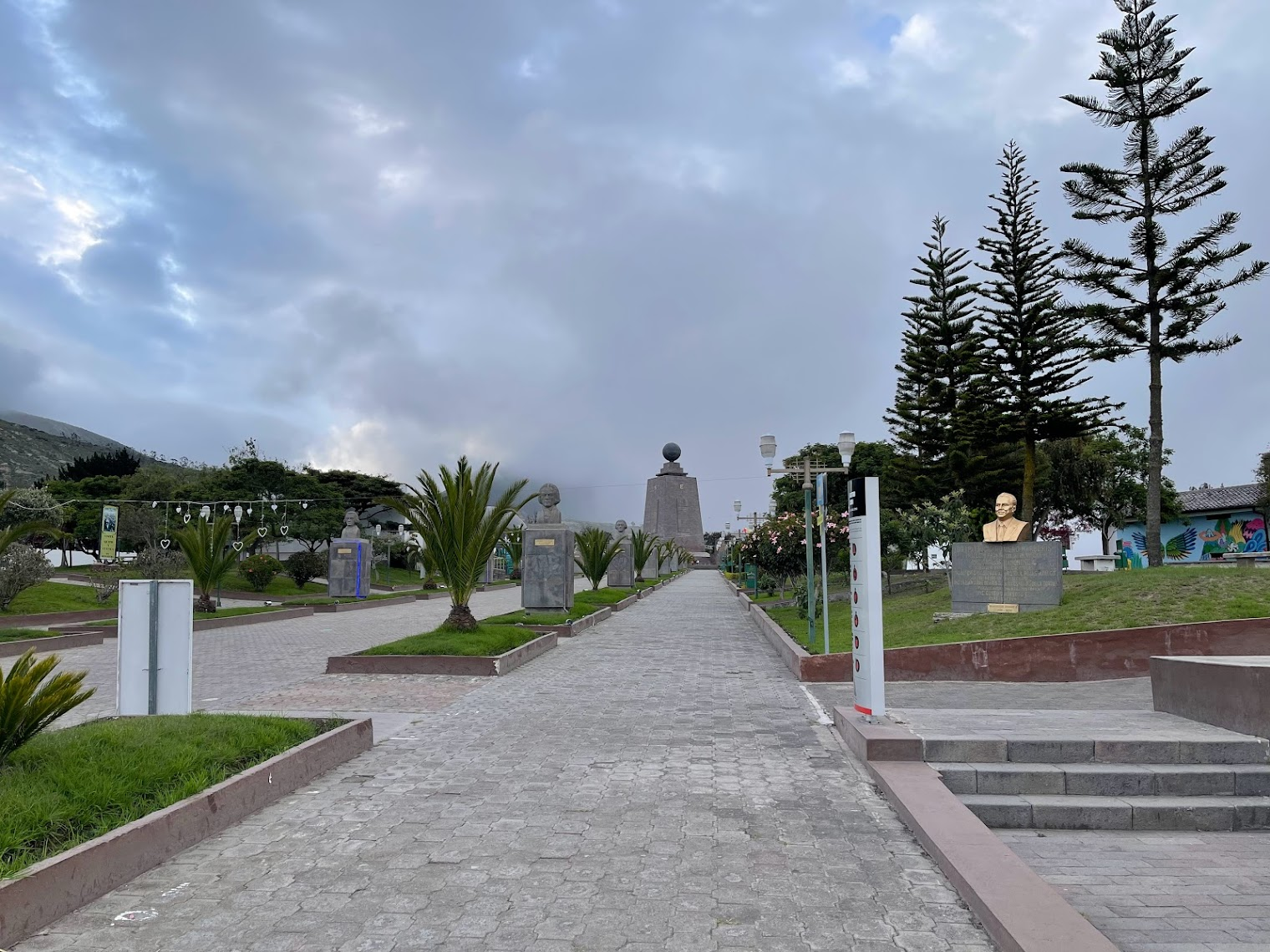
Located a few hundred meters from the museum is the “middle of the world” city that features the Monument to the Equator, a 30 meter tall monument to mark the location of the equator and commemorate the eighteenth century Franco-Spanish Geodesic Mission which fixed its approximate location. However the monument is located not on the equator but about 200m away. We had a brief stop at the monument to snap a picture. The park where the monument is located was closed already, so we just snapped a quick picture from afar
The park was the last stop of the day. Upon arriving at the hotel, we took another PCR test for the Galapagos islands. I ended up taking 2 Covid PCR tests over 3 days and spending more than $300! I went back to the hotel room, worked on the blog for a bit. Around 8, Michael and I walked over to a Japanese – Ecuadorean restaurant nearby called Osaka. The food was good but the place was pricey and the menu was a bit complicated to understand, so I can’t say I recommend it.
Leave a Reply